Tathwell & Haugham circular
Lincolnshire Walk
County/Area - Lincolnshire
Author - Hugh Marrows
Length - 5.5 miles / 8.9 km Ascent - 100 feet / 30 metres
Time - 2 hours 50 minutes Grade - easy
Maps 

| Ordnance Survey Explorer 282 | Sheet Map | 1:25k | BUY |
| Anquet OS Explorer 282 | Digital Map | 1:25k | BUY |
| Ordnance Survey Landranger 122 | Sheet Map | 1:50k | BUY |
| Anquet OS Landranger 122 | Digital Map | 1:50k | BUY |
Walk Route Description
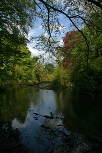
Click image to visit gallery of 5 images.
This short, easy walk (all the ascents are gentle) has far reaching views over dramatic Wolds countryside. There are no refreshments on route, though there's plenty of choice in nearby Louth, but both Haugham and Tathwell churchyards make good picnic spots. Because of difficulty in parking at Tathwell we start at the crossroads just outside Tathwell where grass areas provide ample space.
The first half of the walk is along virtually traffic-free country lanes whilst the return is over remote, elevated countryside. It is a walk that is best done on a fine, clear day to fully enjoy it. Curiously the route crosses Greenwich Meridian twice - at grid ref. TF332822 and grid ref. TF332807.
Tathwell nestles - there's no other word for it - in a lake-filled hollow in the Wolds southwest of Louth. The area has long been settled and the nearby Bully Hills tumuli stand testimony to this and we see them silhouetted against the sky as we head for Haugham. These seven prehistoric burial barrows date from the Bronze Age (i.e. 2,200 to 1,500 years BC) and their heights vary up to ten feet and diameters between fifty and eighty feet.
Even more remote than Tathwell is Haugham (pronounced "Haff-um") on the open hilltop. All Saints church is initially glimpsed from a distance before disappearing only to re-appear suddenly in close-up across the fields. It was designed, intentionally, to appear as a miniature version of Louth's St James's. Approached down a grassy lane it stands on the site of an earlier church and, built in 1840, was paid for by the vicar at the time the Rev George Chaplin, a member of the local squarson family whose huge estate included the whole of Haugham parish. Inside you will find a children's activity pack enabling youngsters to explore the churchyard's flora and fauna. A seat meanwhile offers a resting place for parents!
On our return towards Tathwell the path crosses Orgarth Hill, reputedly the site of a Danish encampment though all traces have now been ploughed away.
Back in Tathwell St Vedast's church is mainly of mellowed Georgian brick. The church mostly dates from 1778 although the tower base is Norman. The dedication to St Vedast is unusual for it is one of only two named after him in England and the dedication here is known to have been in existence by 1182AD. St Vedast was a monk from northern France, born (about) 450AD who became Bishop of Arras around 499ADThere is another activity pack here and more welcoming seats.
Route Guide
From the crossroads take the lane signed to Haugham. As height is gained good views open up behind you as well as in front, so do look back from time to time! The road passes close to the Bully Hills tumuli on the left and on reaching Haugham, at a left-hand bend, a green lane departs to the right for the church. Do visit it!
After visiting the church bear right, still following the road through the hamlet. At the bottom of the hill turn right at a "T" junction (note the sign is hidden in hedge even when there are no leaves!). Go right for half a mile and then join the undulating bridleway signed on the right. After a mile you will come to a bridleway junction where you must turn right again, uphill on a continuing grass track. At a waymark where another track joins from the right keep ahead to the next track junction. Now keep ahead over an arable field, bearing slightly right aiming at a group of trees on the horizon - there is a hedge gap halfway - and at the trees keep to the right of them. You are now on Orgarth Hill and there are far-reaching views and Louth church prominent ahead. When the trees end go straight ahead towards the farm below.
Once through the farmyard walk forward down a lane into Tathwell. Go left at the first junction (by the "Old Post Office") but only for 10 yards, then bear right on a grass path that leads straight into the churchyard. Pass to the left of the church and then down steps to a lane. Cross into the drive opposite and at once turn right on a path round the lake. At a road turn right, walk through the village and return to the start.
Other walks nearby
| Walk 1914 | Louth, South Elkington, Hallington & Raithby | easy/mod | 7.5 miles |
| Walk 1792 | Somersby and Tetford Circular | easy/mod | 6.0 miles |
| Walk 2809 | Aby & Belleau | easy | 3.0 miles |
| Walk 2722 | Covenham St. Bartholomew & the Reservoir | easy | 4.8 miles |
| Walk 2712 | Hagworthingham to Horncastle | moderate | 12.5 miles |
| Walk 1325 | Horncastle, Langton & Thimbleby circular | easy/mod | 6.0 miles |
| Walk 3224 | Tealby, Walesby, Claxby & Normanby-le-Wold | moderate | 10.5 miles |
| Walk 1712 | Tealby & Risby circular | easy | 3.5 miles |
| Walk 1817 | Walesby from Tealby circular | easy | 5.0 miles |
| Walk 1611 | Tealby and Kirmond le Mire | easy/mod | 7.5 miles |
Recommended Books & eBooks
No suggestions for this area.Messaging & Social Media
Message Walking Britain and follow the latest news.

Mountain Weather
Stay safe on the mountains with detailed weather forecasts - for iOS devices or for Android devices.