Wild Boar Fell & Swarth Fell from Cotegill Bridge
Yorkshire Dales Walk
Nat Park - Yorkshire Dales - Howgill Fells
County/Area - Cumbria
Author - Lou Johnson
Length - 7.0 miles / 11.4 km Ascent - 1500 feet / 455 metres
Time - 5 hours 0 minutes Grade - moderate
Maps 

| Ordnance Survey Explorer OL19 | Sheet Map | 1:25k | BUY |
| Anquet OS Explorer OL19 | Digital Map | 1:25k | BUY |
| Ordnance Survey Landranger 98 | Sheet Map | 1:50k | BUY |
| Anquet OS Landranger 98 | Digital Map | 1:50k | BUY |
Walk Route Description
Click image to visit gallery of 5 images.
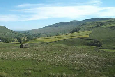
Strangely most of this walk to the summit of Wild Boar Fell stays outside the boundaries of the Yorkshire Dales National Park even though it feels and looks as though it should not have been excluded by the legislators. The walk starts alongside the Settle and Carlisle Railway Line which threads its way through the wide valley of Mallerstang. Just to the south of the starting point is Aisgill Summit, the summit of the railway and the watershed between the River Eden and the easterly flowing River Ure. Limited off-road parking is available near to Cotegill Bridge (grid ref. SD774968) from where there is an excellent view of almost the whole of the walk.
The original route was to cross the railway bridge and head north along the road as far as the railway viaduct opposite Aisgill Farm where a gated track leads under the railway and onto the open fell. However this route is now adorned with a "private" notice on the gate after a new owner has taken control. The route recommended by Neil Spencer reads as follows. "At Cotegill Bridge join the fell through the gate between the quarry and the bridge. I then made my way northwards to join the walk as described at the intake wall. This first part is quite boggy in places but the only real obstacle is Aisgill - very steep sided and too wide to jump at the lower reaches. A detour upstream to just above the magnificent waterfall revealed a reasonably easy crossing place."
Follow the west side of the intake wall north maintaining this direction through the area containing Angerholme Pots even though the wall has veered away to your right. To your left rises Wild Boar Fell. Besides the Pots there are also some fine examples of limestone pavements in this area which may surprise newcomers to the district. Height is gained quite painlessly and you soon reach the main bridle-path crossing east to west across the fell which is followed as far as the broad col on the main ridge of Wild Boar Fell.
After taking in the new view that has opened up across the northern Howgills, turn south following the gritstone edge to the prominent outcrop of the Nab. In view for the full duration of the climb, you can be forgiven to be surprised to learn this is not the summit of Wild Boar Fell but it still provides an excellent place to enjoy the view across Mallerstang to the Fells of Archy Styrigg and Hugh Seat. Heading south-west the true summit lies some distance away across a broad plateau. The summit trig point of Wild Boar Fell is protected by a stone windbreak and provides a wide ranging view across the Howgills and much of Cumbria. Not seen from the summit is Sand Tarn which nestles under the western slopes of Wild Boar Fell and worth a diversion if you have time and energy to spare.
Turn south-east and return to the Mallerstang edge to inspect the small gathering of tall cairns that stand like sentinels guarding the fell. From here a clear path takes you in a large sweeping arc, first west along the band and then south to the col that lies between Wild Boar and Swarth Fells. A short steady climb takes you to the summit cairn, although the best views are to be had further east on the craggy face that overlooks Mallerstang.
Follow the main path over Swarth Fell Pike. Ahead and slightly to your right is Grisedale. Once a busy farming community it now has an air of desolation even though some people still live there. Thankfully the dale featured in an excellent TV programme "The Dale that Died" which I think was produced by Yorkshire TV. As you descend from this minor top you need to chose a route roughly north-east descending across rough grass (and occasional bog!) to reach the north bank of Far Cote Gill which is followed back to where you parked your car.
Despite the occasional boggy patch and the need for some navigational skills in poor visibility, this is an ideal walk for those wishing to see what Fell walking is all about. Care is needed when near Angerholme Pots and along the edge but otherwise provided normal precautions are taken then no problems should be encountered. However do chose a good day with the cloud off the fells and take along a copy of the 1:25,000 OS Map.
Other walks nearby
| Walk 1384 | Mallerstang Edge | moderate | 8.8 miles |
| Walk 1383 | Pendragon Castle | easy | 2.3 miles |
| Walk 3573 | Wild Boar Fell from Pendragon Castle | moderate | 8.3 miles |
| Walk 2409 | The Upper Eden valley without a car | moderate | 12.0 miles |
| Walk 1389 | Fell End Clouds | easy | 3.0 miles |
| Walk 2253 | Uldale Falls & Wandale | moderate | 8.5 miles |
| Walk 3006 | Cautley Spout & The Calf | moderate | 5.5 miles |
| Walk 1393 | Yarlside | moderate | 4.0 miles |
| Walk 1387 | Cautley Spout | easy | 2.0 miles |
| Walk 1341 | Nine Standards Rigg | moderate | 6.0 miles |
Recommended Books & eBooks
Walking the Lake District Fells - Buttermere
 Part of the Walking the Lake District Fells series, this guidebook covers a wide range of routes to 32 Lakeland summits that can be climbed from the Buttermere, Lorton and Newlands valleys, with highlights including Haystacks, High Stile, Grasmoor and the fells of the Coledale Round. Suggestions for longer ridge routes are also included.
More information
Walking the Lake District Fells - Langdale
 Part of the Walking the Lake District Fells series, this guidebook covers a wide range of routes to 25 Lakeland summits that can be climbed from the Great Langdale valley, Ambleside and Grasmere, with highlights including Scafell Pike, Bowfell, the Langdale Pikes and Helm Crag (the Lion and the Lamb). Includes suggestions for longer ridge routes.
More information
Messaging & Social Media
Message Walking Britain and follow the latest news.

Mountain Weather
Stay safe on the mountains with detailed weather forecasts - for iOS devices or for Android devices.