Chelmorton & Flagg from Taddington
Peak District Walk
Nat Park - Peak District - Lathkill Dale High Peak
County/Area - Derbyshire
Author - Lou Johnson
Length - 6.0 miles / 9.8 km Ascent - 840 feet / 255 metres
Time - 3 hours 50 minutes Grade - easy/mod
Maps 

| Ordnance Survey Explorer OL24 | Sheet Map | 1:25k | BUY |
| Anquet OS Explorer OL24 | Digital Map | 1:25k | BUY |
| Ordnance Survey Landranger 119 | Sheet Map | 1:50k | BUY |
| Anquet OS Landranger 119 | Digital Map | 1:50k | BUY |
Walk Route Description
Click image to visit gallery of 3 images.
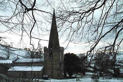
The White Peak is well known for its dales but the upland plateau into which these valleys were cut is less walked. This Peak District walk starts in the village of Taddington just off the main A6. The village offers plenty of on-street parking although do be considerate to residents and keep all accesses clear of obstruction. The most suitable point to park is close to the cross roads in the centre of the village (grid ref. SK141710) quite close to the church.
From here a narrow signed path climbs towards Sough Top crossing Slipperlow Lane shortly after leaving the village. The route to Chelmorton is straightforward and you cross numerous stiles in the many dry stone walls. Stay with the path to cross Sough Lane and Pillwell lane before following a wide rough track between stone walls that was once a mineral rake.
Crossing the southern flanks of Chelmorton Low you descend steeply into the village of Chelmorton. Joining a road go past the church and pub to a cross roads. Turn left here and take particular note of the narrow enclosures on your right with each plot of land carefully delineated by a stone wall. Evidence of former strip farming, this area is registered as of Historic importance by the National Park. The lane climbs a little to reach a junction. Turn left and stay on this lane going straight across at the next junction before taking the signed footpath on the right.
Crossing pastures you descend towards Town Head farm. Exit into a lane and almost opposite pick up another path that runs parallel to the main village road to exit close to the centre of Flagg. Continue southwards along the lane as far as the old school. Turn left at the footpath sign, over the stile in the wall following the waymarked route round the farm until the fields at the back are reached. The route is clear and you reach Flagg Lane. Turn right and then almost immediately left onto a path that leads past Rockfield House. Not far past the house look out for a stile on your right - there is no footpath sign. Cross this and the onward path is fairly clear as you climb steadily through the remains of mining activity to reach a lane. Follow this north down into Taddington to the starting point.
Other walks nearby
| Walk 1859 | Chee Dale & Monk's Dale from Miller's Dale | moderate | 7.3 miles |
| Walk 1043 | Chelmorton & the Monsal Trail | easy/mod | 8.1 miles |
| Walk 1651 | Monsal Trail & Ashford-in-the-Water from Lees Bottom | easy/mod | 8.8 miles |
| Walk 3341 | Brushfield, Miller's Dale & Monsal Head from Lees Bottom | easy/mod | 6.5 miles |
| Walk 1650 | Miller's Dale & Cressbrook Dale from Tideswell Dale | easy/mod | 5.5 miles |
| Walk 1146 | Bradford & Lathkill Dales | moderate | 11.3 miles |
| Walk 3046 | Lathkill Dale & Monyash | easy | 4.0 miles |
| Walk 2573 | Tideswell, Miller's & Cressbrook Dales from Litton | easy | 7.0 miles |
| Walk 3709 | Sparklow, Crowdicote & Pilsbury Circular | easy/mod | 9.0 miles |
| Walk 1827 | Ashford-in-the Water,Magpie Mine & Over Haddon | easy/mod | 7.1 miles |
Recommended Books & eBooks
Dark Peak Walks
 Guidebook to 40 walks in the Dark Peak area of the Peak District National Park. 35 circular routes for most abilities, from 8km to 19km, around Edale, Marsden, Fairholmes, Baslow and Castleton, including Kinder Scout and Mam Tor, and 5 longer (25km to 45km) routes highlighting the best of the Gritstone Edges, High Moorland and Deep Valleys.
More information
Walking in Derbyshire
 Walking guidebook to 60 circular day walks in Derbyshire and the Peak District. Includes the Derwent, Wye and Trent river valleys, near Derby, Matlock, Glossop, Bakewell and Ripley. Routes range from easy to moderate and are between 4 and 14km (2 to 10 miles). Walks focus on places of interest, from Stone Age forts to castles to grand estates.
More information
Messaging & Social Media
Message Walking Britain and follow the latest news.

Mountain Weather
Stay safe on the mountains with detailed weather forecasts - for iOS devices or for Android devices.