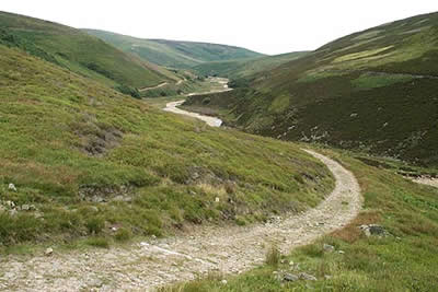
Fiensdale Head & Bleasdale Water from near Sykes Farm
Forest of Bowland Walk
Region - Forest of Bowland
County/Area - Lancashire
Author - Lou Johnson
Length - 10.0 miles / 16.3 km Ascent - 1265 feet / 383 metres
Time - 6 hours 20 minutes Grade - moderate
Maps 

| Ordnance Survey Explorer OL41 | Sheet Map | 1:25k | BUY |
| Anquet OS Explorer OL41 | Digital Map | 1:25k | BUY |
| Ordnance Survey Landranger 102 | Sheet Map | 1:50k | BUY |
| Anquet OS Landranger 102 | Digital Map | 1:50k | BUY |
Walk Route Description
Click image to visit gallery of 6 images.
This route takes in some wild moorland so it is important that you are competent using a map and compass especially if poor weather is likely to be encountered. Like many areas of the Forest of Bowland the moors visited during this walk are quiet and unspoilt with little chance of other walkers being met for much of the route. It is also worth noting that two river crossings may be impossible after heavy rain so it is best to choose a day after a dry spell. Note - since this route was walked additional fences have appeared and these are not shown on the Ordnance Survey map. It is therefore important that you are confident of your navigational skills especially if low cloud is likely.
The start is near to Sykes Farm on the Trough of Bolwand road a couple of miles west of Dunsop Bridge. It is worth noting that through traffic can now use this road after a series washout has been repaired. Ample parking is available on the grassy verge (Grid ref. SD632512) by the access road to the Langden Brook water Works.
After parking head west through the trees to reach the Water Works continuing on the track that follows the north bank of Langden Brook. Within minutes you will have left civilisation behind and your progress up the valley will be remarkably swift on the undulating route. The first notable landmark is a ruined hut.
Langden castle is in fact not the ruined hut! Approaching from the east it can be found about 100m before the hut where a track joins the path from the right at the top of a small rise just before the descent to the hut. Careful examination of the immediate area will reveal many examples of dressed stone, carved stone and so on that appear to have come from the original.Climbing above the site will give a better idea of layout. (Information supplied by Graham Brown)
Stay on track for a hundred metres past the hut to bear left along a waymarked path. This crosses a boardwalk before descending to the stream. Pick your crossing point with care as the stream is quite deep in places.
The path ahead is clear and climbs steeply across the eastern face of Fiensdale Nab with Fiensdale Wateron your left. This is a very pleasant section of the walk with the path climbing up the side of a deep valley or clough onto the open moorland. It does not look very far on the map but the section alongside Fiensdale Water takes much longer than you think. The path reaches open moorland and crosses a wet and boggy section to reach a fence. this is Fiensdale Head.
Turn left along the fence. The path is clear but is quite wet in places and leads without problem to the summit of Fair Snape Fell which is coincident with a fence junction (grid ref. 597473). The view is disappointing so make the short walk south west along the fence to reach the cairn and trig point (neither of which mark the highest point). From here there are extensive views to the south and west including the distinctive summit of Parlick.
Return to the fence junction and shadow it eastwards for just over one kilometre. You pass a fence junction and shortly afterwards a boundary stone. Ahead lies a shallow col with the crest of Totridge beyond. You now need to turn north to pick up Bleasdale Water and there is a very feint path (grid ref. 613474). However it is feint and extreme care needs to be exercised to ensure you follow the correct route and the only sure way is to find one of the many small stream draining north and follow it downstream as it forms Bleasdale Water. (Note - If you are not confident of finding this path and watercourse then it is safer to follow the route in reverse as navigation is much easier when you head south over this section.)
The path soon becomes clear and follows the east bank of Bleasdale Water, which it accompanies for approximately three kilometres as it descents to Langden Castle. here you need to cross Langden Brook, which can be tricky after rain, to rejoin the track that you used on the outward part of the route. All that remains is to retrace you steps back to the Water Works and the road.
Other walks nearby
| Walk 2594 | Totridge Fell & Fiendsdale Head, Forest of Bowland | moderate | 11.0 miles |
| Walk 3505 | Whitewell via Crag Stones from Dunsop Bridge | easy/mod | 8.5 miles |
| Walk 2508 | Dunsop Fell & the Forest of Bowland | moderate | 10.0 miles |
| Walk 2510 | Totridge Fell via Langden & Bleadale Water | mod/hard | 10.0 miles |
| Walk 2555 | Whitendale from Dunsop Bridge | moderate | 8.0 miles |
| Walk 2556 | Whitendale & Dunsop Fell from Dunsop Bridge | mod/hard | 15.0 miles |
| Walk 2331 | Whin Fell & Ouster Rake from Dunsop Bridge | moderate | 8.3 miles |
| Walk 3038 | Wolfhole Crag from Tower Lodge | moderate | 9.0 miles |
| Walk 2384 | Hodder Valley from Whitewell | easy/mod | 6.8 miles |
| Walk 2278 | Ward's Stone from Stoops Bridge | mod/hard | 13.0 miles |
Recommended Books & eBooks
Walking in the Forest of Bowland and Pendle
 A guidebook to 40 diverse circular day walks suitable for walkers with navigational skills. The Forest of Bowland and Pendle are two of north west England's upland AONBs, perfect for walkers who enjoy exploring rough hilly, sometimes pathless terrain. The routes include Ward's Stone, Pendle Hill, Longridge Fell and Fair Snape Fell.
More information
Walking on the West Pennine Moors
 This guidebook describes 30 walks on the West Pennine Moors, around Blackburn, Darwen, Chorley and Bolton, home to some of the most inspiring and exhilarating walking country. The walks range from short, easy rambles to more challenging hikes covering a variety of terrain, all of it easily accessible for day walking.
More information
Messaging & Social Media
Message Walking Britain and follow the latest news.

Mountain Weather
Stay safe on the mountains with detailed weather forecasts - for iOS devices or for Android devices.