Bannerdale, Boredale & Beda Head from Martindale
Lake District Walk
Nat Park - Lake District - Lake District Far Eastern Fells
Wainwrights - Beda Fell
County/Area - Cumbria
Author - Lou Johnson
Length - 9.0 miles / 14.6 km Ascent - 2345 feet / 711 metres
Time - 6 hours 50 minutes Grade - moderate
Maps 

| Ordnance Survey Explorer OL5 | Sheet Map | 1:25k | BUY |
| Anquet OS Explorer OL5 | Digital Map | 1:25k | BUY |
| Ordnance Survey Landranger 90 | Sheet Map | 1:50k | BUY |
| Anquet OS Landranger 90 | Digital Map | 1:50k | BUY |
Walk Route Description
Click image to visit gallery of 10 images.
This Lake District walk was put together after detecting potential worsening of the weather. In retrospect it proved to be a great route and provided an interesting insight into two Lakeland valleys. The worries about the weather were proved but with a slight but temporary improvement towards the end of the walk, the decision was made to include an ascent of Beda Head. If the weather is fine it is probably better to head onto Bead Head and continue along the ridge to Boredale Hause and returning as described but omitting a second ascent to Beda Head …. Although this walk does use lanes there is little traffic and it is a delight to be able to walk undisturbed in such pleasant countryside.
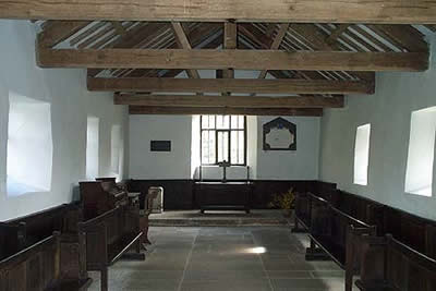
The start is the small car park by the new chapel in Martindale (Grid ref. 436191). After parking return to the lane and turn left and follow the road down and past the old chapel of Martindale. This is worth a visit and you are recommended to buy a copy of the history as it contains some amusing and interesting stories. The road crosses Howegrain Beck and continues on the other side of the valley with excellent views of the Nab to reach Dale Head Farm.
Take the signed footpath on your right and climb steadily across the flank of Beda Fell to reach Beda Knott where the ridge path is crossed. Stay on the main path and descend to cross Freeze Beck before climbing a little to reach Boredale Hause. In good visibility navigation should not be problematical. However in low cloud it can be difficult and care is needed to ensure you locate the correct path.
Assuming you have made the right choice the path descends slightly before dropping down very steeply into Boredale. Note - should this sudden change of gradient not be experienced then you are probably on the wrong path. Continue to descend more gently across the flank of Place Fell to reach the lonely habitation at Boredale Head.
Follow the metalled road north to cross Boredale Beck. At Garth Heads (Grid ref. 427186) turn right and climb steeply over grass to reach a convenient sat beneath Winter Crag. Turn right here and follow the ridge path climbing steadily to reach the summit of Beda Head. There are grand views and the ascent is worthwhile. Descend to the seat following the ridge path and turn right to descend to the lane in Martindale. Turn left and go past the old chapel to reach the start.
Other walks nearby
| Walk 2039 | Gowbarrow Fell circular | moderate | 3.5 miles |
| Walk 1230 | Birks & Arnison Crag | moderate | 5.5 miles |
| Walk 1520 | Helvellyn & Fairfield Horseshoe from Patterdale | very hard | 13.0 miles |
| Walk 2047 | Place Fell from Patterdale | moderate | 7.5 miles |
| Walk 2425 | Boredale Circular from Patterdale | mod/hard | 11.5 miles |
| Walk 3670 | Angle Tarn and Hayeswater | moderate | 8.3 miles |
| Walk 1156 | Helvellyn via Striding Edge | hard | 9.5 miles |
| Walk 1235 | Red Tarn & Grisedale | moderate | 7.0 miles |
| Walk 1710 | Glenridding, St. Sunday Crag & Helvellyn | hard | 11.5 miles |
| Walk 3232 | Glenridding Dodd & Sheffield Pike | easy/mod | 4.5 miles |
Recommended Books & eBooks
Walking the Lake District Fells - Wasdale
 Part of the Walking the Lake District Fells series, this guidebook covers a wide range of routes to 25 Lakeland summits that can be climbed from the Wasdale, Eskdale and Ennerdale valleys, with highlights including Scafell Pike, Great Gable and Pillar. Suggestions for longer ridge routes are also included.
More information
Lake District: Low Level and Lake Walks
 This guidebook describes 30 of the best low-level walks in the Lake District. From delightful wooded glades and sparkling tarns, to waterfalls and glacier-carved valleys towered over by craggy mountains. The walks described aim to seek out the best walking that the lower areas of the Lake District have to offer.
More information
Messaging & Social Media
Message Walking Britain and follow the latest news.

Mountain Weather
Stay safe on the mountains with detailed weather forecasts - for iOS devices or for Android devices.