Great Pinseat from Surrender Bridge
Yorkshire Dales Walk
Nat Park - Yorkshire Dales - Swaledale
County/Area - North Yorkshire
Author - Lou Johnson
Length - 5.5 miles / 8.9 km Ascent - 780 feet / 236 metres
Time - 3 hours 30 minutes Grade - easy/mod
Maps 

| Ordnance Survey Explorer OL30 | Sheet Map | 1:25k | BUY |
| Anquet OS Explorer OL30 | Digital Map | 1:25k | BUY |
| Ordnance Survey Landranger 92 | Sheet Map | 1:50k | BUY |
| Anquet OS Landranger 92 | Digital Map | 1:50k | BUY |
| Ordnance Survey Landranger 98 | Sheet Map | 1:50k | BUY |
| Anquet OS Landranger 98 | Digital Map | 1:50k | BUY |
Walk Route Description
Click image to visit gallery of 6 images.
The moors to the north of Upper Swaledale were once home to large scale mining with its heyday in the latter stages of the nineteenth century. Following the subsequent decline in mining, it is still possible to appreciate the massive scale of this activity and this Yorkshire Dales walk provides a useful introduction. In addition the route provides an easy to follow route visiting the summit of Great Pinseat, which offers grand views of the surrounding countryside.
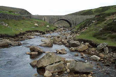
The start is Surrender Bridge (grid ref. SD989999) on the road from Feetham in Swaledale to Langthwaite in Arkengarthdale. After parking walk north along the road for about 600 metres. Just after the road levels off turn left along a signed track. This track curves northwest and climbs steadily for a short way before levelling off the cross the wild moorland.
Stay on the track, gaining height easily, to pass a sheepfold on your right. Shortly afterwards you reach an untidy area of spoil tips, some of which have cairns! Leave the main track and head due north across heather (looking out for mineshafts!) to reach a wall. The summit of Great Pinseat is marked by a standard concrete trig point. Although the summit's immediate surroundings are exceptionally boring, there is a wide view especially north into upper Arkengarthdale and beyond.
Return to the main track and follow it west as it descends to a gate. Go through the gate and stay with the track as it follows Flincher Gill to reach Level House Bridge. Flincher Gill becomes Hard Level Gill and this remains on your right as you descend gently to the remains of Old Gang Smelting Mills where the stream changes name again to become Old Gang Beck. This leads down to Surrender Bridge.
Rather then return directly to your transport, it is worth continuing downstream for a few hundred metres to have a look at the last mining remains of the walk - a further smelting mill. Today it is hard to imagine the level of activity in this area although the many spoil heaps, scars on the landscape and the remaining buildings do give some impression of how important this area was to the local economy.
Other walks nearby
| Walk 1253 | Booze & Slei Gill from Langthwaite | easy | 2.5 miles |
| Walk 3478 | Cringley Hill & Scar House from Langthwaite | easy/mod | 4.8 miles |
| Walk 2190 | Calver Hill & Reeth Low Moor | easy/mod | 6.0 miles |
| Walk 1056 | Gunnerside & Surrender Bridge | moderate | 10.3 miles |
| Walk 1197 | Gunnerside & Swinner Gills | moderate | 8.5 miles |
| Walk 3093 | Bunton Hush, Blakethwaite & Gunnerside Gill | easy/mod | 5.5 miles |
| Walk 1694 | Nappa Hall & Whitfield Gill Force | easy/mod | 6.0 miles |
| Walk 2822 | Aysgarth & Castle Bolton | mod/hard | 14.5 miles |
| Walk 1340 | Muker & Upper Swaledale from Keld | easy/mod | 6.5 miles |
| Walk 1053 | Swinner Gill and Muker | mod/hard | 8.5 miles |
Recommended Books & eBooks
Walking in the Yorkshire Dales: North and East
 This guidebook contains 43 circular day walks in the north and east Yorkshire Dales. It explores the dales, hills and moors between Kirkby Stephen and Pateley Bridge. Walking ranges from gentle 3 mile strolls to more strenuous day-long rambles across the Howgills, Wensleydale, Swaledale, Nidderdale, Mallerstang and Coverdale.
More information
Trail and Fell Running in the Yorkshire Dales
 Guidebook to 40 of the best trail and fell runs in the Yorkshire Dales National Park. Ranging from 5 to 24 miles, the graded runs start from bases such as Ribblehead, Dent, Sedbergh, Malham and Grassington and take in the region's diverse delights, from castles and waterfalls to iconic mountains such as Whernside, Ingleborough and Pen Y Ghent.
More information
Messaging & Social Media
Message Walking Britain and follow the latest news.

Mountain Weather
Stay safe on the mountains with detailed weather forecasts - for iOS devices or for Android devices.