Arncliffe & Kettlewell Circular
Yorkshire Dales Walk
Nat Park - Yorkshire Dales - Upper Wharfedale
County/Area - North Yorkshire
Author - Lou Johnson
Length - 7.0 miles / 11.4 km Ascent - 1500 feet / 455 metres
Time - 5 hours 0 minutes Grade - moderate
Maps 

| Ordnance Survey Explorer OL30 | Sheet Map | 1:25k | BUY |
| Anquet OS Explorer OL30 | Digital Map | 1:25k | BUY |
| Ordnance Survey Landranger 98 | Sheet Map | 1:50k | BUY |
| Anquet OS Landranger 98 | Digital Map | 1:50k | BUY |
Walk Route Description
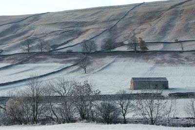
Click image to visit gallery of 6 images.
Kettlewell is a popular starting point for walks in Wharfedale with cafes, pubs and shops. This Yorkshire Dales walk uses a path linking Wharfedale with Littondale and includes another picturesque village at Arncliffe where there is a solitary pub.
There is a pay and display car park in Kettlewell (Grid ref. SD968723) with alternative parking nearby. Leave the car park and cross the River Wharfe. Ignore the riverside path leading to Starbotton and take the next path. Almost immediately turn left on a rising path that can be seen heading uphill to a limestone outcrop. This path is signed Arncliffe. The climb, although steep, offers excellent views of Kettlewell and Wharfedale.
The path is easily to follow and once through the 'slit' in the limestone outcrop the gradient eases to reach Old Cote Moor. With few navigational problems you can enjoy the views with Littondale appearing ahead with Arncliffe village clustered around its church. The descent is easy until you reach Byre Bank Wood where the going is considerably more difficult.
Reaching a tarmac road go straight across to a stile and take the shortcut to the bridge over the River Skirfare. Go over the bridge and turn left past the Church where you will find the signed path that leads downstream to Hawkswick. Note if you have the time then it is worthwhile to spend a few minutes exploring the village.
The path continues alongside the River Skirfare to reach a footbridge after nearly two miles. Cross the bridge to reach a road. Turn right along the road to Hawkswick village taking care not to miss the footpath on the left (Grid ref. SD 955 706). This continues as a wide path leading you gently uphill to reach a point above Knipe Scar from where you can see the confluence of the Wharfe and Skirfare rivers.
The path descends through pastures to reach a wood. Continue through the wood to reach the main valley road. Turn left along this taking care especially when traffic is heavy to reach the start.
Other walks nearby
| Walk 2332 | Mastilles Lane & Bordley from Kilnsey | easy/mod | 6.8 miles |
| Walk 3301 | Conistone to Grassington via the Dib | easy | 5.0 miles |
| Walk 3262 | Copplestone Gate and Conistone Pie from Conistone | easy/mod | 7.0 miles |
| Walk 2423 | Capplestone Gate & Conistone Pie | easy/mod | 6.8 miles |
| Walk 1254 | Yockenthwaite & Hubberholme | moderate | 8.0 miles |
| Walk 1281 | Buckden Pike | moderate | 10.5 miles |
| Walk 2132 | Buckden Pike and Hubberholme | moderate | 8.4 miles |
| Walk 1926 | Pen-y-ghent & Littondale | hard | 16.0 miles |
| Walk 1145 | Grassington, Mastilles Lane & Conistone Dib | moderate | 11.3 miles |
| Walk 1645 | Grassington, Mastilles Lane & Conistone Dib | moderate | 12.0 miles |
Recommended Books & eBooks
Walking in the Yorkshire Dales: South and West
 Part of a two-book set, this guidebook describes 44 walks in the southern and western Yorkshire Dales, including the famous 23 mile Three Peaks circuit over Pen-y-Ghent, Whernside and Ingleborough. The other, mostly circular routes of 3½ to 13 miles cover the scenic region between Sedbergh, Kirkby Lonsdale, Settle, Skipton and Grassington.
More information
Walking in the Yorkshire Dales: North and East
 This guidebook contains 43 circular day walks in the north and east Yorkshire Dales. It explores the dales, hills and moors between Kirkby Stephen and Pateley Bridge. Walking ranges from gentle 3 mile strolls to more strenuous day-long rambles across the Howgills, Wensleydale, Swaledale, Nidderdale, Mallerstang and Coverdale.
More information
Messaging & Social Media
Message Walking Britain and follow the latest news.

Mountain Weather
Stay safe on the mountains with detailed weather forecasts - for iOS devices or for Android devices.