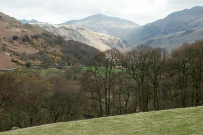
Green Crag from Eskdale
Lake District Walk
Nat Park - Lake District - Lake District Southern Fells
Wainwrights - Green Crag
County/Area - Cumbria
Author - Lou Johnson
Length - 6.5 miles / 10.6 km Ascent - 1900 feet / 576 metres
Time - 5 hours 10 minutes Grade - moderate
Maps 

| Ordnance Survey Explorer OL6 | Sheet Map | 1:25k | BUY |
| Anquet OS Explorer OL6 | Digital Map | 1:25k | BUY |
| Ordnance Survey Landranger 90 | Sheet Map | 1:50k | BUY |
| Anquet OS Landranger 90 | Digital Map | 1:50k | BUY |
Walk Route Description
Click image to visit gallery of 9 images.
Green Crag is one of those fells that is perhaps only visited if you are doing the "Wainwrights". Located south of Eskdale it occupies an area of rough moorland fell with few paths and the potential to be wet underfoot!
This Lake District walk starts from the small car park on the north side of the road from Eskdale to Hardknott Pass at Wha House Farm (Grid ref. NY201009). After parking walk east towards the River Esk. Cross the bridge and take the signed footpath on your right. This follows the river for a short way before entering woodland. Keep right at the junction (Grid ref. NY 203005) and continue past Penny Hill Farm to reach a road (Grid ref. NY 190007). Turn left and follow the track up to Low Birker staying with the rising right of way, a former peat road, as it climbs up hill using zigzags to ease the grade.
Continue on the peat road to pass a ruined stone hut. Shortly after passing this hut the track turns south with Birker Force waterfall below on your right. Stay on the track to reach Low Birker Tarn. Care is needed in this area as the moorland is wet underfoot. Staying with the path is probably advisable as it is likely to be even wetter away from the trodden route.
The path, always clear underfoot, passes beneath Tarn Crag on your left with Green Crag in view ahead. The path does not take a direct approach but uses the contours to avoid the wettest heathery swamps to reach a col between Crook Crag and Green Crag (Grid ref. NY 200985). From here turn right and climb the remaining 200 feet to the summit.
After enjoying and extensive view with the Scafells, Bowfell, Esk Pike and other peaks in view to the north. A less familiar fell is Black Combe to the south east, which is generally ignored by many walkers. Having taken in the view descend to the col and continue straight ahead and follow the path over Crook Crag. The path is at times indistinct and you need to follow your instincts heading roughly north across what is confusing ground to reach the path on the western flank of Kepple Crag (Grid ref. NY 197997). This path soon improves and looks more like its peat road origins as it descends to Penny Hill Farm. Turn right here and retrace your steps along the outward route to the road and car park.
Other walks nearby
| Walk 2226 | The Scafells | very hard | 12.0 miles |
| Walk 1916 | Harter Fell and Low Birker Tarn from Hardknott Pass | moderate | 6.5 miles |
| Walk 3419 | Scafell Pike an Eskdale circular | very hard | 12.5 miles |
| Walk 2467 | Green Crag & Harter Fell | moderate | 7.9 miles |
| Walk 2355 | Blea Tarn & Eskdale Green | easy/mod | 6.5 miles |
| Walk 1668 | Silver Knott & Muncaster Fell from Irton Road | easy/mod | 5.0 miles |
| Walk 3485 | High Birkhow & Low Wood from Wast Water | easy | 4.2 miles |
| Walk 1176 | Yewbarrow | moderate | 4.5 miles |
| Walk 2341 | Circuit of Nether Beck and Over Beck from Wasdale | hard | 11.3 miles |
| Walk 1690 | Netherbeck Horseshoe - Middle Fell, Steeple & Red Pike from Wasdale Head | mod/hard | 12.5 miles |
Recommended Books & eBooks
Hadrian's Wall Path
 Hadrians Wall Path guidebook to walk the 84 mile National Trail. Described in both directions, the main description is west to east between Bowness-on-Solway and Wallsend, Newcastle, with extensions to Maryport and South Shields. With extensive historical information related to this World Heritage site and separate 1:25,000 OS map booklet included.
More information
Walking the Lake District Fells - Wasdale
 Part of the Walking the Lake District Fells series, this guidebook covers a wide range of routes to 25 Lakeland summits that can be climbed from the Wasdale, Eskdale and Ennerdale valleys, with highlights including Scafell Pike, Great Gable and Pillar. Suggestions for longer ridge routes are also included.
More information
Messaging & Social Media
Message Walking Britain and follow the latest news.

Mountain Weather
Stay safe on the mountains with detailed weather forecasts - for iOS devices or for Android devices.