Nine Standards Rigg from Birk Dale
Yorkshire Dales Walk
Nat Park - Yorkshire Dales - Swaledale
County/Area - North Yorkshire
Author - Lou Johnson
Length - 6.0 miles / 9.8 km Ascent - 700 feet / 212 metres
Time - 3 hours 40 minutes Grade - moderate
Maps 

| Ordnance Survey Explorer OL19 | Sheet Map | 1:25k | BUY |
| Anquet OS Explorer OL19 | Digital Map | 1:25k | BUY |
| Ordnance Survey Landranger 91 | Sheet Map | 1:50k | BUY |
| Anquet OS Landranger 91 | Digital Map | 1:50k | BUY |
Walk Route Description
Click image to visit gallery of 6 images.
Nine Standards Rigg is a collection of large roughly built cairns that offer a commanding view across the Vale of Eden. Technically the summit is not within the boundaries of the Yorkshire Dales National Park although most of the approach route is. The path also forms part of the "Coast to Coast" route and thus sees busy periods. It should be noted that this walk crosses wild and desolate moorland that can be very wet underfoot after rain. It also should not be attempted unless you are familiar with this type of terrain and have suitable navigation skills should visibility worsen during the walk.
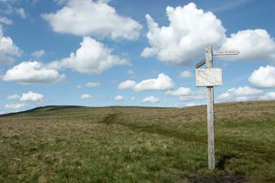
The start is a small lay-by (Grid ref. NY832027) on the B6270 road from Nateby (near Kirkby Stephen) to Keld (Swaledale) road. It can be hard to locate this spot as there are very few obvious landmarks but there is a footpath fingerpost to help its location.
The path from the fingerpost is hard to locate on the ground. An easier way is to walk along the road in the direction of Keld for approximately 200 metres and take the clear track that heads over the moor on your left. Stay on this for just over 0.5 km to reach another fingerpost with an access map. Turn left along this path heading for a large cairn that is visible from this point. Generally the path is distinct although near some of the wetter patches it is easy to loose the route.
You are now crossing wild moorland and when researching this walk I was amazed at the quiet solitude of this area. Reaching the cairn there is a nice retrospective view with Birkdale Tarn to the south-east. Continue following the path across a section that is wetter underfoot to reach a 'pile of stones'. Turning north the path continues climbing very steadily to cross the almost flat summit of White Mossy Hill. Its name should give you some idea that it is likely to be very squelchy after rain!
Descending, the path continues to another fingerpost in a broad and boggy col before ascending again to reach the trig point (662 m.). The Nine Standards are another 250 metres further north from where excellent views across the Vale of Eden can be enjoyed.
To return to the start all that you need to do is retrace your steps. However do be careful on the section from White Mossy Hill to the 'pile of stones' as the latter are hard to see from this direction and the path does fade in the wetter areas.
Other walks nearby
| Walk 1383 | Pendragon Castle | easy | 2.3 miles |
| Walk 3573 | Wild Boar Fell from Pendragon Castle | moderate | 8.3 miles |
| Walk 1386 | Hartley Birkett & Nine Standards Rigg | easy/mod | 4.5 miles |
| Walk 1340 | Muker & Upper Swaledale from Keld | easy/mod | 6.5 miles |
| Walk 1382 | Mallerstang circular | easy/mod | 7.0 miles |
| Walk 1053 | Swinner Gill and Muker | mod/hard | 8.5 miles |
| Walk 1768 | Thomas Gill and Ravenseat from Tan Hill | moderate | 8.7 miles |
| Walk 1160 | Wild Boar Fell & Swarth Fell | moderate | 7.0 miles |
| Walk 1388 | Kirkby Stephen & Hartley Circular | easy/mod | 5.0 miles |
| Walk 2538 | Nateby & Waitby Common from Kirkby Stephen | easy/mod | 6.2 miles |
Recommended Books & eBooks
Walking in the Yorkshire Dales: South and West
 Part of a two-book set, this guidebook describes 44 walks in the southern and western Yorkshire Dales, including the famous 23 mile Three Peaks circuit over Pen-y-Ghent, Whernside and Ingleborough. The other, mostly circular routes of 3½ to 13 miles cover the scenic region between Sedbergh, Kirkby Lonsdale, Settle, Skipton and Grassington.
More information
Walking in the Yorkshire Dales: North and East
 This guidebook contains 43 circular day walks in the north and east Yorkshire Dales. It explores the dales, hills and moors between Kirkby Stephen and Pateley Bridge. Walking ranges from gentle 3 mile strolls to more strenuous day-long rambles across the Howgills, Wensleydale, Swaledale, Nidderdale, Mallerstang and Coverdale.
More information
Messaging & Social Media
Message Walking Britain and follow the latest news.

Mountain Weather
Stay safe on the mountains with detailed weather forecasts - for iOS devices or for Android devices.