Strata Florida to Tregaron
Cambrian Mountains Walk
Region - Cambrian Mountains
County/Area - Ceredigion
Author - Dafydd Wyn Morgan
Length - 9.5 miles / 15.4 km Ascent - 1200 feet / 364 metres
Time - 6 hours 0 minutes Grade - moderate
Maps 

| Ordnance Survey Explorer 187 | Sheet Map | 1:25k | BUY |
| Anquet OS Explorer 187 | Digital Map | 1:25k | BUY |
| Ordnance Survey Explorer 199 | Sheet Map | 1:25k | BUY |
| Anquet OS Explorer 199 | Digital Map | 1:25k | BUY |
| Ordnance Survey Landranger 147 | Sheet Map | 1:50k | BUY |
| Anquet OS Landranger 147 | Digital Map | 1:50k | BUY |
Walk Route Description
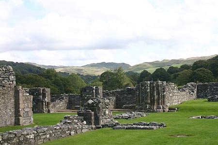
Click image to see photo description.
This linear walk follows rough paths and trackless moorland. There is a long stretch on a country lane at the end. Navigation would be difficult in poor visibility. The suggestion is you park in Tregaron and catch a bus to Pontrhydfendigaid and walk the short distance to the start at Strata Florida. Alternatively you can park at Strata Florida, complete the walk, and catch a pre-arranged taxi back to the car. The section of walk passing through the Bryneithinog forest managed by UPM Tilhill may be closed due to forest operations. All warning signs must be obeyed for your own safety.
1 - With the Abbey on your left and the car park on your right, walk down the lane and as it bends left go straight ahead through a gate. Follow the track ahead alongside a stream and through a gate. Now cross the footbridge and keep straight ahead to follow a sunken track up through the wood. Wooden posts then lead to a gate. Go through this and keep straight ahead for a few paces before bearing right at a waymark, and continuing to a gate that leads into woodland. Keep straight ahead into the wood and when you meet a main forest track, turn left.
2 - Continue for a short distance and then turn right onto another narrow path that leads up through the wood to another main track. Bear left onto this and then, as it bends sharp left, keep straight ahead on a rough track that leads to a gate. Go through and bear half left to cross the top of the field, where a barn comes into sight. Head to a gate next to the barn and go through this, and then follow left down a good track into a dip and up the other side. Continue through Bryneithinog farm yard and then turn left onto another good track.
3 - Follow this to the corner of a wood and then bear half right to cut down through the field to a gate at the bottom. This leads into open ground. Go through and bear left to keep alongside the fence as far as a stile. Don't cross this but bear right to drop to the stream. Now follow easy ground alongside the stream until it's possible to cross. Once over, follow the other bank upstream, staying with it until your reach a major confluence beneath a steep hillside.
4 - Continue over stream aiming uphill to cross the boggy plateau and then bear right to contour around the dryer grassy banks of the hill. Keep your eyes open for a faint path that drops to cross the stream again and now follow a clear but narrow path up the side of the valley with steeper ground to your right and forestry to your left. Continue to level ground, with a fence ahead, and then bear right to climb the steep hillside to the cairn and trip point Garn Gron.
5 - Make your way back towards the wood and the path you just left. Turn right onto this and follow it easily down to a fork. Bear left to stay next to the fence and continue down to a large cairn. Here bear sharp right onto a faint path that leads down into a valley.
6 - Cross a stream and contour around to a gate. Go through and keep ahead to join another track and now stay on this for two kilometres to a road. Bear left and follow this down to a t-junction, where you turn left again. Now continue all the way down into Tregaron, where you turn left and then left again to the Tregaron Square.
Other walks nearby
| Walk 2736 | Teifi Pools from near Strata Florida | easy/mod | 6.2 miles |
| Walk 1363 | The Elephant Walk from Tregaron | easy/mod | 5.5 miles |
| Walk 1362 | Tregaron & Cors Caron circular | easy | 4.0 miles |
| Walk 1361 | Tregaron & Twm Town circular | easy | 3.5 miles |
| Walk 1364 | Tregaron & Llandewi Brefi circular | easy/mod | 4.5 miles |
| Walk 1367 | Cwm Berwyn from Tregaron | moderate | 11.0 miles |
| Walk 3086 | Pen y Garn from near Devil's Bridge | easy/mod | 6.8 miles |
| Walk 1366 | Pentre Bach circular | easy/mod | 9.5 miles |
| Walk 3674 | Claerwen Valley & Dam from Dolymynach Reservoir | moderate | 7.4 miles |
| Walk 2498 | Gorllwyn circuit, Elan Valley | easy/mod | 6.8 miles |
Recommended Books & eBooks
The Wales Coast Path
 A single guidebook to walking the whole Wales Coast Path - 1400km (870 miles) the length of Wales from Chester to Chepstow, including Anglesey, described in 57 stages. The route passes through the Snowdonia and Pembrokeshire National Parks and many AONBs and can be linked with the Offa's Dyke Path for a complete circuit of Wales.
More information
Messaging & Social Media
Message Walking Britain and follow the latest news.

Mountain Weather
Stay safe on the mountains with detailed weather forecasts - for iOS devices or for Android devices.