Pendragon Castle from Outhgill
Cumbria Walk
County/Area - Cumbria - Eden Valley Mallerstang
Author - Lou Johnson
Length - 2.3 miles / 3.7 km Ascent - 100 feet / 30 metres
Time - 1 hours 10 minutes Grade - easy
Maps 

| Ordnance Survey Explorer OL19 | Sheet Map | 1:25k | BUY |
| Anquet OS Explorer OL19 | Digital Map | 1:25k | BUY |
| Ordnance Survey Landranger 98 | Sheet Map | 1:50k | BUY |
| Anquet OS Landranger 98 | Digital Map | 1:50k | BUY |
Walk Route Description
Click image to see photo description.
This short walk captures some of the flavour of Mallerstang and the upper stretches of the River Eden. To the west lies the familiar shape of Wild Boar Fell with Mallerstang Edge to the east. The landscape in the immediate area is typical of the valley with hamlets and farms dotted across lush fields enclosed by dry stone walls.
The start is the hamlet of Outhgill (grid ref NY783015) where limited parking is available. Please be considerate of local residents and park with care. After parking return to the main B6259 and walk north along this road. Generally traffic is light but still care is needed. After about 450 yards take the signed footpath on the right (grid ref. NY783020). The path indistinct in paces follows a steam uphill before turning left behind Ing Hill towards Castlethwaite. After crossing two fields you reach a group of cottages. From here take the drive left down to the main road (NY782025).
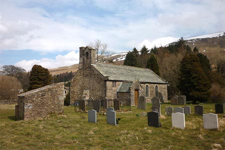
Turn right along the road. The ruin of Pendragon Castle is on your left. Fork left down a narrow lane and continue downhill and over the River Eden. Take the signed footpath on the left just over the bridge and walk through a number of fields to reach a walled track just before Shoregill (grid ref. NY779014). Continue through Shoregill and cross the River Eden. Once across the bridge take the footpath on the left following the river downstream. This leads through fields to St Mary's Church and the main road (grid ref. NY782014). Turn left down the main road and you are back at the start.
Other walks nearby
| Walk 3573 | Wild Boar Fell from Pendragon Castle | moderate | 8.3 miles |
| Walk 1160 | Wild Boar Fell & Swarth Fell | moderate | 7.0 miles |
| Walk 1341 | Nine Standards Rigg | moderate | 6.0 miles |
| Walk 1389 | Fell End Clouds | easy | 3.0 miles |
| Walk 1382 | Mallerstang circular | easy/mod | 7.0 miles |
| Walk 1384 | Mallerstang Edge | moderate | 8.8 miles |
| Walk 1386 | Hartley Birkett & Nine Standards Rigg | easy/mod | 4.5 miles |
| Walk 1388 | Kirkby Stephen & Hartley Circular | easy/mod | 5.0 miles |
| Walk 2538 | Nateby & Waitby Common from Kirkby Stephen | easy/mod | 6.2 miles |
| Walk 2253 | Uldale Falls & Wandale | moderate | 8.5 miles |
Recommended Books & eBooks
Walking the Lake District Fells - Mardale and the Far East
 Part of the Walking the Lake District Fells series, this guidebook covers a wide range of routes to 36 Lakeland summits that can be climbed from the Ullswater, Haweswater, Troutbeck, Kentmere and Longsleddale valleys, with highlights including High Street, Place Fell and the Kentmere fells. Suggestions for longer ridge routes are also included.
More information
Walking the Lake District Fells - Wasdale
 Part of the Walking the Lake District Fells series, this guidebook covers a wide range of routes to 25 Lakeland summits that can be climbed from the Wasdale, Eskdale and Ennerdale valleys, with highlights including Scafell Pike, Great Gable and Pillar. Suggestions for longer ridge routes are also included.
More information
Messaging & Social Media
Message Walking Britain and follow the latest news.

Mountain Weather
Stay safe on the mountains with detailed weather forecasts - for iOS devices or for Android devices.