Hartley Birkett & Nine Standards Rigg
Cumbria Walk
County/Area - Cumbria - Eden Valley Mallerstang
Author - Lou Johnson
Length - 4.5 miles / 7.3 km Ascent - 1000 feet / 303 metres
Time - 3 hours 20 minutes Grade - easy/mod
Maps 

| Ordnance Survey Explorer OL19 | Sheet Map | 1:25k | BUY |
| Anquet OS Explorer OL19 | Digital Map | 1:25k | BUY |
| Ordnance Survey Landranger 98 | Sheet Map | 1:50k | BUY |
| Anquet OS Landranger 98 | Digital Map | 1:50k | BUY |
Walk Route Description
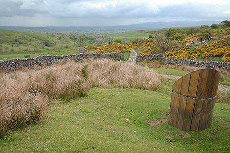
Click image to visit gallery of 3 images.
The large cairns at Nine Standards Rigg occupy a wonderful position offering expansive views across the Eden Valley and the surrounding moorland and hills. The Coast to Coast National Trail crosses this area although diversions to reduce erosion mean that at certain times of the year walkers on this trail as requested to take a bypass route. The surrounding area of moorland can be challenging with peat making the going far from easy.
This route starts above Hartley Quarry on a minor road from Kirkby Stephen, the last section of which is gated. After parking at grid ref. NY799075 go through a metal gate and walk along a track signed Coast to Coast path initially in a south-easterly direction. The track undulates for a while generally following a wall on your right. Reaching a path junction at grid ref. NY810067 bear left leaving the track to follow a clear path across the moor. Initially Faraday Gill is to your left but as height is gained the stream is crossed.
Nine Standards disappear from sight on this section and feel further away than they really are. Nowhere is the climbing steep but the path is somewhat tedious across the moor. Eventually the Nine Standards come into sight and your objective is close at hand. The large cairns offer a fine viewpoint and it's a perfect place to rest. If you wish to reach the true summit then this is marked by a trig point some 500 metres to the south. However the view is not so good.
To return to the start simply retrace your steps. Do remember that this area can be quite wild in bad weather so check the forecast before starting the walk. After heavy rain don't expect dry feet either!
Other walks nearby
| Walk 1382 | Mallerstang circular | easy/mod | 7.0 miles |
| Walk 1388 | Kirkby Stephen & Hartley Circular | easy/mod | 5.0 miles |
| Walk 2538 | Nateby & Waitby Common from Kirkby Stephen | easy/mod | 6.2 miles |
| Walk 1341 | Nine Standards Rigg | moderate | 6.0 miles |
| Walk 3573 | Wild Boar Fell from Pendragon Castle | moderate | 8.3 miles |
| Walk 1383 | Pendragon Castle | easy | 2.3 miles |
| Walk 1389 | Fell End Clouds | easy | 3.0 miles |
| Walk 1768 | Thomas Gill and Ravenseat from Tan Hill | moderate | 8.7 miles |
| Walk 1160 | Wild Boar Fell & Swarth Fell | moderate | 7.0 miles |
| Walk 1342 | Randygill Top from Weasdale | moderate | 6.0 miles |
Recommended Books & eBooks
Hadrian's Wall Path
 Hadrians Wall Path guidebook to walk the 84 mile National Trail. Described in both directions, the main description is west to east between Bowness-on-Solway and Wallsend, Newcastle, with extensions to Maryport and South Shields. With extensive historical information related to this World Heritage site and separate 1:25,000 OS map booklet included.
More information
Walking the Lake District Fells - Mardale and the Far East
 Part of the Walking the Lake District Fells series, this guidebook covers a wide range of routes to 36 Lakeland summits that can be climbed from the Ullswater, Haweswater, Troutbeck, Kentmere and Longsleddale valleys, with highlights including High Street, Place Fell and the Kentmere fells. Suggestions for longer ridge routes are also included.
More information
Messaging & Social Media
Message Walking Britain and follow the latest news.

Mountain Weather
Stay safe on the mountains with detailed weather forecasts - for iOS devices or for Android devices.