Snowdon and Y Lliwedd from Pen-y-pass
Snowdonia/Eryri Walk
Nat Park - Snowdonia - Snowdon Crib Goch
County/Area - Gwynedd
Author - Peter Smyly
Length - 7.5 miles / 12.2 km Ascent - 3020 feet / 915 metres
Time - 6 hours 50 minutes Grade - mod/hard
Maps 

| Ordnance Survey Explorer OL17 | Sheet Map | 1:25k | BUY |
| Anquet OS Explorer OL17 | Digital Map | 1:25k | BUY |
| Ordnance Survey Landranger 115 | Sheet Map | 1:50k | BUY |
| Anquet OS Landranger 115 | Digital Map | 1:50k | BUY |
Walk Route Description
Click image to visit gallery of 8 images.
The Snowdon Horseshoe is one of the best known walks in Snowdonia (Eryri), so the only originality I can bring to a walk description of such a well-known walking route is to offer my own personal perspective on it. This is a variation on the Snowdon Horseshoe, omitting Crib Goch for vertigo sufferers to give the narrow ridge a miss, or else a common sense option should adverse weather conditions mean that Crib Goch is not a realistic option.
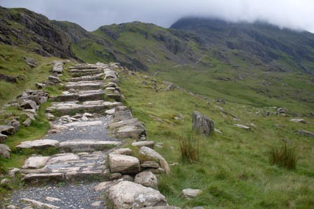
This classic Snowdonia (Eryri) walk starts at the car park at Pen-y-Pass and follows the Pyg Track with Crib Goch looming ahead. There is only one path as far as Bwlch y Moch, where it divides. To the right is the route up Crib Goch but this route takes the path to the left which drops down for a while before regaining height later. From the top of Bwlch Moch, Crib Goch appears starkly ahead, showing its north face in a way that suggests there could not possibly be a way up there for walkers rather than rock climbers, yet of course there is, as you will know from having read about it, if not from personal experience of having gone up that way.
The downwards trajectory does not last for long before it is a case of onwards and upwards, though with the Pyg Track, height is gained more gradually than with the Miners' Track. At least, you are spared anything remotely as steep as the bit of the Miners' Track after it leaves Glaslyn when it heads up a very steep slope of jumbled rocks and stones before it joins the Pyg Track higher up.
Glaslyn (Blue/green lake) comes into view below Snowdon, towering a thousand feet above it. There is also a fine view at this stage of the walk of the cliffs of Y Lliwedd, to be climbed later in the walk. At the top of the Pyg Track you reach Bwlch Glas where Garnedd Ugain, the second highest mountain in Wales, is an optional extra on this route, to the right while the main path turns left to lead you to the summit of Snowdon, the highest point in Wales.
Descending from Snowdon, navigational care is required to ensure that you come down the Watkin Path rather than the Rhyd Ddu path. The Watkin Path is very step in descent but the prospect of the next mountain looms ahead, the impressive Y Lliwedd with its cliffs to the left. But before you descend to Bwlch Ciliau, look out for a spectacular view to the left looking down and along the full length of Llyn Llydaw (Brittany Lake) with the much smaller Llyn Teyrn (Tyrant Lake) beyond.
Anybody who suffers from vertigo need not worry when it comes to Y Lliwedd as there is no obligation to go near the edge of the cliffs off to the left. Instead, rather than one single path up it from the bwlch, there are a series of steep stony paths which tend to meet up with each other further up until finally the top is reached. As it turns out, Y Lliwedd has three tops, the west and east peaks and Lliwedd Bach. There are spacious views from each across to Yr Aran (looking more Matterhorn-like than Cnicht from this angle), Snowdon and Crib Goch as well as the Moelwyns to the south east across the Nantgwynant valley. Descend from the third top to reach the south shore of Llyn Llydaw near the causeway and then follow the route back to Pen-y-Pass via the Miners' Track.
Other walks nearby
| Walk 2650 | Tryfan, the Glyders & Y Garn | very hard | 8.0 miles |
| Walk 1088 | Glyder Ridge traverse | hard | 5.5 miles |
| Walk 1186 | Y Garn | mod/hard | 4.5 miles |
| Walk 3019 | Y Garn & Carnedd y Filiast Ogwen Cottage | hard | 8.5 miles |
| Walk 3062 | Pen yr Ole Wen | moderate | 5.0 miles |
| Walk 2417 | Glyder Fach, Glyder Fawr and Tryfan from Idwal Cottage | mod/hard | 6.5 miles |
| Walk 1137 | Y Garn (Route 2) from Ogwen Cottage | mod/hard | 4.5 miles |
| Walk 2680 | Circuit of Llyn Idwal | easy | 2.8 miles |
| Walk 1192 | Yr Aran | mod/hard | 6.5 miles |
| Walk 1103 | Snowdon & Cwm Llan horseshoe | very hard | 13.0 miles |
Recommended Books & eBooks
Great Mountain Days in Snowdonia
 Inspirational guidebook to 40 great mountain day walks and scrambles in Snowdonia. Inspirational routes for all abilities across the National Park with routes up Snowdon and Moel Eilio, the Glyderau, the Carneddau, Eifionydd, Siabod and the Moelwynion, Rhinogydd (the Harlech Dome), Migneint and the Arans and Cadair Idris and the Tarrens.
More information
Snowdonia: 30 Low-level and easy walks - North
 Guidebook describing 30 walks in Snowdonia, Wales. Routes are mostly low level and on clear paths and showcase the region's beautiful scenery and rich history and culture. Part of a 2-volume set, this northern volume includes the Snowdon area, the Ogwen and Conwy Valleys, Betws-y-Coed, Beddgelert, Ffestiniog and the coast.
More information
Messaging & Social Media
Message Walking Britain and follow the latest news.

Mountain Weather
Stay safe on the mountains with detailed weather forecasts - for iOS devices or for Android devices.