Midhurst Way - Petworth to Midhurst
South Downs Walk
Nat Park - South Downs
County/Area - West Sussex
Author - John Trueman
Length - 5.5 miles / 8.9 km Ascent - 750 feet / 227 metres
Time - 3 hours 30 minutes Grade - easy/mod
Maps 

| Ordnance Survey Explorer OL33 | Sheet Map | 1:25k | BUY |
| Anquet OS Explorer OL33 | Digital Map | 1:25k | BUY |
| Ordnance Survey Landranger 197 | Sheet Map | 1:50k | BUY |
| Anquet OS Landranger 197 | Digital Map | 1:50k | BUY |
Walk Route Description
Click image to see photo description.
This linear East Sussex walk follows the recently created "Midhurst Way" from the village of Tillington to Midhurst. A regular bus service operates between Midhurst and Tillington and this offers a useful way of reaching the start from Midhurst and enables you to enjoy the walk without the need to retrace your steps. The route in the South Downs National Park includes much of interest so it is not a walk to rush. Take your time and enjoy the West Sussex countryside.
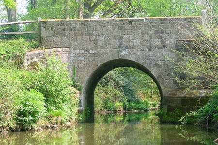
From the Midhurst to Petworth main road (grid ref. SU962218) walk into Tillington village, following the lane to a churchyard entrance on the left after about 100 yards. Follow the path though the churchyard, turning sharp right at the avenue of trees, pass through the gate - see picture - cross the lane, and go up steps into a field. Continue across this field into the vineyard, across a deep, hidden old lane to Upperton Farm and thence up into more vineyards owned by Nyetimber.
Cross New Road and follow the lane opposite - going north-west - to River via Dene Dip. Take the footpath left after the right hand bend down a tunnel of shrubs and trees to Eel Bridge over the River Lod. Cross Lodsworth Common (not marked) to St Peter's Well, taking Vicarage Lane - to the right of the big house - up into the village. Turn right into The Street, after 100 yards turn left past the Hollist Arms in the direction of the Village Hall. Adjoining The Hollist Arms is the Lodsworth Larder, the village shop, crafted from local forest timber and stocked with local produce and run by volunteers.
Continue down the lane to a sharp left hand bend at Heath End Farm, take the footpath ahead down the edge of the wood - Heathend Copse - round the field edge, across a broken style and into Cowdray Park, with views in every direction, through the Jubilee Avenue of 60 recently planted lime-trees celebrating the Queen's Diamond Jubilee thence downhill to Steward's Pond. The 1000 year old Queen Elizabeth Oak is to the right of the pond, surrounded by other ancient trees covering the hillside.
Continue past Steward's Pond on its southern edge, to the fence 50 yards ahead, pass through the swing gate, into a broad grassy way, bearing right, continue through the trees up the slope to where it breaks out on the fairway of Cowdray Golf Course. Cross over the golf course and down into another sunken pathway, finally crossing fields to The Race, an avenue of ancient chestnut trees.
Turn left before The Race and follow the field margin to the main road at Easebourne - Midhurst to Petworth Road ; or follow The Race itself which is rougher going. Cross the main road and continue on a broad track, at first metalled, through Cowdray Park - the Cowdray Farm Shop & Café (Food Emporium) is on your right - to Cowdray Castle. Turn right through the gates over the River Rother and follow the Causeway to North Street Car Park, your finishing point. The South Downs National Park Authority new HQ, Capron House, is across the road (North Street) opposite the Bus Station.
Other walks nearby
| Walk 2232 | Midhurst and Woolbeding | easy/mod | 6.0 miles |
| Walk 1872 | Charlton, Singleton & Goodwood Circular | easy/mod | 6.5 miles |
| Walk 1917 | Rackham Hill from Amberley | easy/mod | 6.5 miles |
| Walk 1615 | Amberley & East Dean Circular | mod/hard | 21.0 miles |
| Walk 1466 | Amberley and Arundel Circular | moderate | 13.0 miles |
| Walk 1628 | Bignor Hill and The Denture from Amberley | moderate | 8.7 miles |
| Walk 1629 | The River Arun & South Stoke | easy | 4.6 miles |
| Walk 3406 | The Wey & Arun Canal, Loxwood | easy | 4.5 miles |
| Walk 3228 | Black Down from Haslemere | easy/mod | 10.0 miles |
| Walk 1424 | Midhurst Way - Haslemere Stn to Midhurst Bus Stn | moderate | 9.5 miles |
Recommended Books & eBooks
Walks in the South Downs National Park
 Guidebook with 40 circular walks throughout the South Downs National Park, exploring the beautiful chalk hills between Eastbourne and Winchester. The walks range from under 5 miles to 11 miles, including Beachy Head and the Seven Sisters, Ditchling Beacon and hundreds of prehistoric sites. Accessible all year, but wild flowers best in spring.
More information
Messaging & Social Media
Message Walking Britain and follow the latest news.

Mountain Weather
Stay safe on the mountains with detailed weather forecasts - for iOS devices or for Android devices.