South Rauceby and Rauceby Hall
Lincolnshire Walk
County/Area - Lincolnshire
Author - North Kesteven Council
Length - 4.0 miles / 6.5 km Ascent - 150 feet / 45 metres
Time - 2 hours 10 minutes Grade - easy
Maps 

| Ordnance Survey Explorer 272 | Sheet Map | 1:25k | BUY |
| Anquet OS Explorer 272 | Digital Map | 1:25k | BUY |
| Ordnance Survey Landranger 130 | Sheet Map | 1:50k | BUY |
| Anquet OS Landranger 130 | Digital Map | 1:50k | BUY |
Walk Route Description
Click image to see photo description.
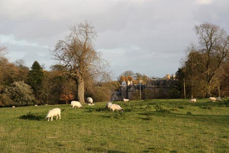
North and South Rauceby lie on the Southern Lincolnshire Edge at one of North Kesteven's highest points. Antiquarians even used the name 'Rauceby Altera' and looking east on a clear day Boston Stump can be seen from the hill above Heath Farm. Anciently known as Rosbi and listed in Domesday as Roscebi, the name derives from the Old Scandanavian for Rauthr+by, or 'Rauthr's village'. Rauceby Hall was built by Anthony Peacock, between 1841 - 1846, at a cost of £ 24,000 (about £ 1M today).
The Bustard Inn was constructed in 1860, its name allegedly commemorates the last Great Bustard shot in Lincolnshire. The Bustard cost just over £ 800 to build, replacing the older 'Robin Hood', demolished to accommodate the south gate of Rauceby Park.
1 - From the Bustard Inn car park (please use the top car park), step onto Tom Lane and turn left walking down the hill for a few yards onto Main Street. Turn left onto Main Street and pass through South Rauceby with parkland on your left until you reach Pinfold Lane.
2 - Turn left into Pinfold Lane and follow for 400 metres until the lane turns right and you see a track forking left, through the park.
3 - Follow this track which leads towards the stone buildings of Hall Farm. Ignore the Steeping Out waymarker leading off into woodland on your right.
4 - Once you reach Hall Farm the track forks. Take the right fork, keeping the farm buildings to your left and head into open countryside. Continue along this track as it turns left towards a copse.
5 - The track takes you through the copse and then heads right around the edge of the copse. Look out for the carved Boggart's Bench for a rest or a coffee break!
6 - Continue along this track for approximately 1 km until you can see Sumner's Plantation across the field to your left and Field Farm to your right. Follow the waymarkers left, keeping the plantation on your left up a gentle rise, past the plantation, and follow the track across Field Beck stream to the farm buildings at Holdingham Anna.
7 - To continue the circular route, follow the waymarkers left, keeping the farm buildings to your right and join a farm track. This leads right along the field edge. Keep an eye out for a waymarker indicating the route of a cross field path.
8 - Turn left onto this path and cross the field to gain a second field ahead, Turn right here and follow the field edge up the hill towards Drove Lane.
9 - Turn right onto Drove Lane for approximately 1,7 km, heading back westwards towards North and South Rauceby.
10 - When Drove Lane joins Tom Lane, turn left, passing the village school on your right and Rauceby Hall on your left. This road will take you back to the Bustard In and back to your car.
This route is from the Stepping Out series of walks produced by North Kesteven Council.
Other walks nearby
| Walk 1436 | High Wood and North Rauceby | easy | 4.8 miles |
| Walk 1429 | Sleaford riverside circular | easy | 6.4 miles |
| Walk 2312 | Culverthorpe | easy | 4.0 miles |
| Walk 1026 | Ropsley, Scotland & the Humbys | easy/mod | 8.5 miles |
| Walk 2379 | Sempringham Circular from Folkingham | easy | 6.0 miles |
| Walk 3512 | Scopwick, Kirkby Green & Blankney | easy | 7.3 miles |
| Walk 1428 | Blankney Circular | easy | 3.8 miles |
| Walk 2224 | Dunston & Nocton | easy | 5.0 miles |
| Walk 1430 | Aubourn Country Circular | easy | 4.5 miles |
| Walk 1431 | Haddington - Story of Two Churches | easy | 2.9 miles |
Recommended Books & eBooks
No suggestions for this area.Messaging & Social Media
Message Walking Britain and follow the latest news.

Mountain Weather
Stay safe on the mountains with detailed weather forecasts - for iOS devices or for Android devices.