Fulbrook & Widford from Burford
Cotswolds Walk
Region - Cotswolds
County/Area - Oxfordshire
Author - Lou Johnson
Length - 6.0 miles / 9.8 km Ascent - 300 feet / 91 metres
Time - 3 hours 20 minutes Grade - easy
Maps 

| Ordnance Survey Explorer OL45 | Sheet Map | 1:25k | BUY |
| Anquet OS Explorer OL45 | Digital Map | 1:25k | BUY |
| Ordnance Survey Landranger 163 | Sheet Map | 1:50k | BUY |
| Anquet OS Landranger 163 | Digital Map | 1:50k | BUY |
Walk Route Description
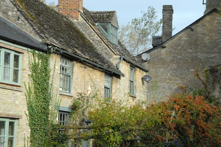
Click image to visit gallery of 15 images.
This pleasant circular walk starts from the attractive market town of Burford. The route includes some sections of road walking, footpaths and bridleways with the final section a pleasant walk along the banks of the River Windrush. At busy times of the year parking in Burfard is in short supply and this walk description assumes you have parked close to the large parish church (grid ref. SP253123) where there is a large pay and display parking area. However you could park anywhere in the town where space is available.
From the car park walk back to the High Street and turn right (north). Cross the bridge over the River Windrush. Turn right at the next road junction onto the A361 towards Fulbrook. Sadly this a busy road but once through the village of Fulbrook you can enjoy the peace and quiet of the countryside. At the road junction in the centre of the village bear left and continue along the A361. After 100 yards or so take the signed footpath on the right that leads through fields to an enclosed track (grid ref. SP273138). Go right along this track passing Payne's Farm to reach a junction of tracks (grid ref. SP282131). Turn left and continue along the track ignoring the track veering off left. This leads you to a lane (grid ref. SP274128).
Turn right along the lane and take the first footpath on the left (grid ref. SP271127). Follow this path down into a dell (Dean Bottom) which leads you to a junction of paths by the River Windrush (grid ref. SP274120), Turn right here and continue a short way to Widford. This was a substantial village in the Middle Ages. Today the 16th-century manor house, a few houses and St Olswald's chapel are all that remain. The chapel is worth a visit and this is a pleasant place for a break.
Continue along the path to a lane. Turn left, cross the River Windrush and reach a T-junction. Turn left in front of Mill Farm to briefly follow a lane west. A footpath on the left (grid ref. SP271116) is then taken. This follows the River Windrush for some way before reaching a road. Turn right along this road to return to Burford.
Other walks nearby
| Walk 2283 | Church Westcote & Icomb Circular | easy/mod | 5.1 miles |
| Walk 2076 | Kingham to Charlbury | easy/mod | 10.5 miles |
| Walk 1360 | Naunton & the Slaughters | moderate | 11.0 miles |
| Walk 2484 | Icomb & Wyck Rissington Circular | easy/mod | 5.2 miles |
| Walk 2454 | Farmington & Clapton-on-the-Hill | easy/mod | 6.4 miles |
| Walk 2186 | Adlestrop & Chastleton | easy | 3.8 miles |
| Walk 1848 | Turkdean & Notgrove from Cold Aston | easy/mod | 6.5 miles |
| Walk 3636 | Bibury & Ablington Circular | easy | 4.1 miles |
| Walk 3635 | Barnsley Park | moderate | 11.0 miles |
| Walk 1062 | Pusey & Buckland circular | easy | 3.5 miles |
Recommended Books & eBooks
The Cotswold Way Map Booklet
 Map of the 102 mile (163km) Cotswold Way National Trail, between Chipping Camden and Bath. This booklet is included with the Cicerone guidebook to the trail, and shows the full route on OS 1:25,000 maps. The trail typically takes two weeks to walk, and is suitable for walkers at all levels of experience.
More information
The Cotswold Way
 Guidebook to walking the Cotswold Way National Trail. Between Chipping Campden and Bath, the 102 mile route explores the Cotswolds AONB. Described in both directions over 13 stages, the Cotswold Way can be walked year round and is suitable for beginner trekkers. Includes separate OS 1:25,000 map booklet of the route.
More information
Messaging & Social Media
Message Walking Britain and follow the latest news.

Mountain Weather
Stay safe on the mountains with detailed weather forecasts - for iOS devices or for Android devices.