Sileby, Barrow on Soar and Walton from Seagrave
Leicestershire Walk
County/Area - Leicestershire
Author - David McMahon
Length - 12.5 miles / 20.3 km Ascent - 500 feet / 152 metres
Time - 6 hours 50 minutes Grade - easy/mod
Maps 

| Ordnance Survey Explorer 246 | Sheet Map | 1:25k | BUY |
| Anquet OS Explorer 246 | Digital Map | 1:25k | BUY |
Walk Route Description
Click image to see photo description.
Seagrave is a neat little village to the east of Loughborough. It is easily accessible by road off the A46 north of Leicester. Roberts Bus Service route no.27 from Loughborough is the bus service (for timetable see their website). Alternatively the walk can be started from Barrow-on-Soar in which case Kinchbus route no. 2, from Leicester to Loughborough can be used (again see the company's website for timetables).
The walk starts from Green Lane in Seagrave up by the village green and to the west of the village (grid ref. SK616180). From the start head along The Banks and almost immediately turn right onto a footpath. Continue along the alleyway into a field, onto the next field and then turn right over a stile into another field. Continue into another alleyway and you will come out onto a road. Walk straight on down with the All Saints church and the White Horse pub on your left. At the next junction turn left and you will see a footpath sign indicating Sileby 2 miles distant (grid ref SK617177).
Turn right onto the footpath and follow a well marked path until you are on the outskirts of Sileby where the path underfoot turns into tarmac. Continue past the Memorial Park and when you reach a side road turn right (grid ref SK603154). A short walk to the main road and then turn left. Cross the road and after another short distance turn right onto a footpath which will take you across the railway line. Carry on until you reach the junction with the main Barrow Road (grid ref. SK600153).
Cross the road and turn right. Turn left onto a bridleway when you reach it (grid ref SK598154). Follow this bridleway straight through for several fields bearing right at grid ref. SK594152 to reach a road. Cross over and take the footpath almost immediately opposite. Ignore the footpath going straight ahead and go diagonally right until you reach the banks of the River Soar.
Go right along the river and cross the weir footbridge. Carry on following the river bank until you come to the Waterside Restaurant. Immediately after it you cross the Mountsorrel Lane (grid ref. SK581152). Continue to follow the river bank on the other side of the road. Ahead you will see what looks like a road/rail bridge, but in fact it is the support structure for a conveyor belt from Mountsorrel Quarry.
Continue along the bank until you reach a footbridge (grid ref. SK578156). Cross the bridge and continue along the river which is now to your right. Soon you will cross a stile and see a road bridge (A6) in front of you. Before the bridge go diagonally to the left, walk along the hedgerow, through the gate, through the road tunnel, along another short stretch of footpath and another road tunnel. After the next stile head diagonally to the left. Carry on along the rough track, cross the footbridge over the River Soar, and carry on until you come out onto a minor road by Meadows Farm (grid ref. SK576167).
Turn right along this minor road. You will see the Navigation Inn, Barrow. Before crossing the bridge turn left and walk along the canal tow path until you reach another road (grid ref. SK572172). Turn right and you will see the Boathouse pub and after another right turn, the Soar Bridge Inn will be in your sights. Continue to the left, past the roundabout and over the railway bridge bringing you into Barrow's shopping centre, where you will find an excellent cafe. This would be the recommended point to start the walk if using public transport.
To continue walk in a northerly direction, through the town centre, and then turn right immediately after the Blacksmiths Arms. Go along the narrow alleyway, which will bring you out to the left of Holy Trinity church. Opposite it is a single-story hexagon building which was at one-time the local prison, but more recently a blacksmiths. On the opposite corner there are what were almshouses.
Bear left and follow the alleyway to the left of the school (grid ref. SK576175). This takes you onto a cul-de-sac. Continue ahead along the cul-de-sac to reach a road junction (grid ref. SK580173). Off to your right you will see a footpath sign to Seagrave. Follow it and when you reach a road junction turn left and then continue on the footpath on your right. Follow it round to the left and then straight across the first field. Go diagonally to the left in the second field and into the corner. Follow the hedge line in the next field and when you reach the stile at its end you will cross over and follow the right-hand side of several fields.
At the end of this stretch (grid ref. SK592177) go diagonally to your right and through a gate. At the end of that field climb the stile to your right and turn immediately left and over a second stile. Head off diagonally right. Eventually, you will see a yellow post by the farm enclosure; head for it, but when you get nearer you will see another yellow post off to your right. Head for that one instead; go through the gate and at the end of the field you will see a stile in front of you and an alleyway off to your left (grid ref. SK598180). This stile provides an option for a shorter route to Seagrave.
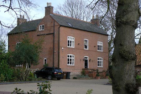
Walk along the alleyway to a road. Cross over to the bridleway on the opposite side and continue along. At first it is downhill and then the way starts to rise. When you reach the brow of the hill you will see a yellow post. At that point the path goes off to the right and gradually converges with the hedgerow on the right-hand side. When you see the beginnings of a lane look out for a stile on your right (grid ref. SK591194). Climb the stile and you are into the grounds of the Manor House, Walton. Go straight to the first fence then walk diagonally to our left onto the driveway and through the gates to a road. Turn right and walk past St Mary's Church. On reaching the road junction go left and then pick up the footpath to the right which leads to the village green.
Continue eastwards along Six Hills Road. After a road walk of approximately half a mile there is a right-hand bend. Leave the road here and take the footpath continuing eastwards. Walk on through several fields and then you will see a yellow post prominent from the hedgerow (grid ref. SK606201). Turn right here and carry on along the hedge row. On reaching a road, turn right and then turn left onto another footpath (grid ref. SK606199).
Carry on along this footpath as it goes downhill to a stream (note there is one gate you will need to climb over) and up the other side. When you are near to the brow of the slope, you go through a gap and then diagonally to your right across a field. When you reach the road (Paudy Lane) at grid ref. SK610187) go right and then turn left onto the bridleway Muckle Gate Lane. Follow it through and you will come out on Green Lane close to where you started in Seagrave.
NB - Every October Seagrave hosts the extremely popular 'The Seagrave Challenge' - check the website for actual date and details.
Other walks nearby
| Walk 1537 | Frisby on the Wreake & Brooksby from Rearsby | moderate | 12.3 miles |
| Walk 2463 | Hoby & Gaddesby Circular | easy/mod | 8.6 miles |
| Walk 2187 | Bradgate Country Park from Hallgates | easy | 3.4 miles |
| Walk 2941 | Out Wood & Beacon Hill from Loughborough | easy/mod | 6.8 miles |
| Walk 1540 | Nanpantan Reservoir, Wood Brook and Buck Hill | easy | 2.5 miles |
| Walk 2315 | Old John & Beacon Hill | easy/mod | 8.8 miles |
| Walk 2175 | Bradgate Park from Newtown Linford | easy | 4.8 miles |
| Walk 1443 | Burrough Hill & Somerby from Twyford | moderate | 11.0 miles |
| Walk 1708 | Lowesby and South Croxton | easy/mod | 7.0 miles |
| Walk 1391 | Colston Bassett & Cropwell Bishop from Kinoulton | easy/mod | 8.5 miles |
Recommended Books & eBooks
No suggestions for this area.Messaging & Social Media
Message Walking Britain and follow the latest news.

Mountain Weather
Stay safe on the mountains with detailed weather forecasts - for iOS devices or for Android devices.