Cold Kirby, Rievaulx Bridge & Wass
North York Moors Walk
Nat Park - North York Moors - North York Moors West
County/Area - North Yorkshire
Author - Andy Chaplin
Length - 12.5 miles / 20.3 km Ascent - 1750 feet / 530 metres
Time - 8 hours 0 minutes Grade - moderate
Maps 

| Ordnance Survey Explorer OL26 | Sheet Map | 1:25k | BUY |
| Anquet OS Explorer OL26 | Digital Map | 1:25k | BUY |
| Ordnance Survey Landranger 100 | Sheet Map | 1:50k | BUY |
| Anquet OS Landranger 100 | Digital Map | 1:50k | BUY |
Walk Route Description
Click image to see photo description.
A further stage on the series of circular walks on the theme of the Cleveland Way, this takes in a short section of the Cleveland Way between Cold Kirby and Rievaulx Bridge but it then comes back on the "southern brow" or bank that the CW has been following southwards from Roseberry Topping and that continues in this walk from Sutton Bank towards Oswaldkirk and features some of the scenic highlights within the North York Moors National Park
There is space to park on the roads in Cold Kirby (Grid ref. SE532845) - but avoid blocking any of the farm or house entrances. It is an interesting village that seems to be made up of a series of farms laid out as a village.
Follow the CW sign along the road then down the bank to the right of the church. Go up to the right then turn left on to Low Field Lane. When this peters out continue straight ahead, through a gate and down a gulley - still signposted as the CW. At the meeting with a track, in front of Callister Wood, turn left and then right at the next junction of paths.
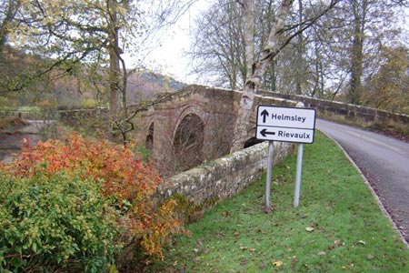
When the track turns to the right go off to the left to cross the stepping stones over the stream then walk along Bridge Road with the Nettle Dale ponds on your left. Turn left at the road and continue on to Rievaulx Bridge - which will be the start for the final section of CW walks.
Go back along the road past Ashberry Farm then turn off left on a public bridleway heading up towards Hags Wood. Looking back there is a good view of Rievaulx. Just before Scrawton Croft take the path on the right which is signposted as a public bridleway. After climbing steeply uphill the track splits into two parallel tracks - one through the edge of the wood on the right and the other at the edge of the fields on your right. Take either as they join up again at the top of Seamer Howl.
A well defined track goes off to the right - don't take it - keep to the top of the Claythwaite Rigg and bridleway markers and gates will be apparent in the next two field fences. Eventually you pick up the farm track that goes past High Lodge Deer Farm and come out onto the A170.
Turn right along the road then off left at the mile-marker into Byland Moor Plantation. The bridleway bends round to the right then continues straight on at a crossroads. The better path is the forestry track on the right which meets another, where you bear left, then continue back down to the bridleway just before you come out on the Wass Bank Road.
Turn right on the road and continue downhill into Wass. Turn right at the junction, away from the Wombwell Arms, and up the road towards Lund Farm. At the end of the track take the footpath straight ahead signposted to Cam Farm and the Observatory. After skirting the wood on your left, go over the stile at Blind Side Gill and follow the footpath on the left towards Cam Farm. When you meet the second forestry track the footpath is signposted up a bank - you can ignore that and just turn right on the track.
At the next forestry track go left downhill, pass the other end of the footpath, the ruins of a house in the woods then turn back on yourself to the right as the forestry track makes its way through Snever Wood. The Kilburn White Horse is visible in front of you. Pass paths off right to the Observatory and left to Oldstead Mill and continue on the track until you come to a junction with another track. Turn left and go through the barrier onto the road that leads down towards Oldstead.
Before getting to Oldstead Road turn right on the track - unsuitable for motor vehicles - that climbs up towards Scotch Corner. Here there is the John Bunting War Memorial Chapel - at the site where the Scots beat the English at the Battle of Byland in 1322. Carry on up to Shaw's Gate then left onto the road and right up to Hambleton.
At this point you are back on the CW. Continue past Hambleton House and along Cote Moor Road until you arrive back at Cold Kirby.
Other walks nearby
| Walk 3581 | Gormire Lake from Sutton Bank National Park Centre | easy/mod | 3.4 miles |
| Walk 1498 | Kilburn White Horse, Cold Kirby, Murton, & Sutton Bank | moderate | 14.0 miles |
| Walk 2566 | Rievaulx Abbey from Kilburn, near Thirsk | mod/hard | 15.0 miles |
| Walk 1622 | Hawnby, Bilsdale West and Wetherhouse Moors | moderate | 8.3 miles |
| Walk 1525 | Beck Dale & Rievaulx from Helmsley | moderate | 9.8 miles |
| Walk 2702 | Ampleforth, Shallow Dale, Yearsley Moor & Wilderness | moderate | 9.5 miles |
| Walk 1920 | Rievaulx Moor from Cowhouse Bank | moderate | 9.5 miles |
| Walk 1704 | Oswaldkirk, Nunnington & Harome circular | moderate | 11.5 miles |
| Walk 1473 | Hollin Hill to Square Corner by the Cleveland Way | moderate | 9.5 miles |
| Walk 1497 | High Paradise around Arden Great Moor from Square Corner | moderate | 14.3 miles |
Recommended Books & eBooks
Trail and Fell Running in the Yorkshire Dales
 Guidebook to 40 of the best trail and fell runs in the Yorkshire Dales National Park. Ranging from 5 to 24 miles, the graded runs start from bases such as Ribblehead, Dent, Sedbergh, Malham and Grassington and take in the region's diverse delights, from castles and waterfalls to iconic mountains such as Whernside, Ingleborough and Pen Y Ghent.
More information
The Cleveland Way Map Booklet
 Map booklet of the Cleveland Way National Trail, a 177km (110 mile) walk around the North York Moors National Park. This booklet is included with the Cicerone guidebook to the Cleveland Way and the Yorkshire Wolds Way, and shows the full route of the Cleveland Way on Ordnance Survey 1:25,000 maps.
More information
Messaging & Social Media
Message Walking Britain and follow the latest news.

Mountain Weather
Stay safe on the mountains with detailed weather forecasts - for iOS devices or for Android devices.