Frisby on the Wreake & Brooksby from Rearsby
Leicestershire Walk
County/Area - Leicestershire
Author - David McMahon
Length - 12.3 miles / 19.9 km Ascent - 500 feet / 152 metres
Time - 6 hours 40 minutes Grade - moderate
Maps 

| Ordnance Survey Explorer 246 | Sheet Map | 1:25k | BUY |
| Anquet OS Explorer 246 | Digital Map | 1:25k | BUY |
Walk Route Description
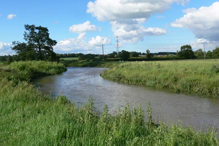
Click image to see photo description.
Rearsby is an attractive village midway between Leicester and Melton Mowbray on the A607. Parking is on Brookside and the 5A bus from Leicester to Melton(see timetable) provides a frequent service. The walk itself could be described as a series of straight lines making a circular route.
The walk starts from the stone bridge which leads to St Michael and All Angels Church. Carry on past Brook St and pick up the footpath to the right just past it. Follow it for a short distance until you reach the old A607. Carry on straight across and walk up the side of the sports field and then continue onto the next field. At the end of it turn left and then very shortly right onto the new A607 Rearsby Bypass.
Cross over and carry on along this well-marked footpath until you reach Topfield Farm. Pass it to the right and onto a track. Eventually, this reverts back to footpath and then you reach the top end of Gaddesby Village. Carry on along Pasture Lane until, after Rose Cottage, you can pick up, to the left, a section of The Leicestershire Round. Carry along it until you once more reach the A607.
Continue straight over and after that you are into Frisby on the Wreake. Follow the main road around to the right and then you have a choice of routes. You can reduce the distance stated by 2.5 miles by walking down to the Stone Cross on the left hand side of the road and picking up the footpath to Rotherby just beyond it to the left. Otherwise you take the footpath to the right. You go through an awkward farm gate, walk slightly diagonal to the left and through another gate. Carry straight on, ignoring the footpath to the left and eventually you will reach the road. This is the limit of the walk as designated. However, if you carry on through the next field you will reach Kirby Bellars proper. You can also, by going to the left, road walk into the same destination.
By turning right you will arrive on the A607 once more and quite handily is the Flying Childers pub; to the right on the opposite side of the road. To restart the walk, retrace your route to Frisby and continue along the aforementioned footpath to Brooksby. When you come to a road junction cross the road and take the left-hand path. When you reach an enclosure made of seemingly redundant motorway crash barriers, go through the gate and through the chicane on the opposite side onto the road.
Road walk right the way through Rotherby until you reach a 'T' junction and opposite you is Brooksby Agricultural College. Walk up the driveway and then follow the waymarks until you arrive on a tarmac road and follow it through until a right-hand turn, followed quickly by a left-hand turn will bring you back onto a proper footpath. When you reach the outskirts of Rearsby continue along Church Leys Avenue and at the end of it take the alleyway off to the left and this will bring you past the church and out by the stone bridge.
Hope you have enjoyed it!
Other walks nearby
| Walk 2463 | Hoby & Gaddesby Circular | easy/mod | 8.6 miles |
| Walk 1465 | Sileby, Barrow on Soar and Walton from Seagrave | easy/mod | 12.5 miles |
| Walk 1443 | Burrough Hill & Somerby from Twyford | moderate | 11.0 miles |
| Walk 1708 | Lowesby and South Croxton | easy/mod | 7.0 miles |
| Walk 2187 | Bradgate Country Park from Hallgates | easy | 3.4 miles |
| Walk 3425 | Rolleston from Billesdon | easy | 5.3 miles |
| Walk 3351 | Rolleston, Skeffington & Tilton from Billesdon | moderate | 12.3 miles |
| Walk 2830 | Circular from Billesdon via Frisby Dairy Farm | easy | 4.0 miles |
| Walk 2829 | Rolleston, & Skeffington from Billesdon | easy | 4.5 miles |
| Walk 3088 | Sludge Hall & Cold Newton Grange | easy | 5.5 miles |
Recommended Books & eBooks
No suggestions for this area.Messaging & Social Media
Message Walking Britain and follow the latest news.

Mountain Weather
Stay safe on the mountains with detailed weather forecasts - for iOS devices or for Android devices.