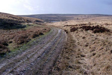
Flask Edge and Bar Brook Moor from Shillito Wood
Peak District Walk
Nat Park - Peak District - Derwent Edge Sheffield
County/Area - Derbyshire
Author - Andy Chaplin
Length - 9.4 miles / 15.3 km Ascent - 1000 feet / 303 metres
Time - 5 hours 40 minutes Grade - moderate
Maps 

| Ordnance Survey Explorer OL1 | Sheet Map | 1:25k | BUY |
| Anquet OS Explorer OL1 | Digital Map | 1:25k | BUY |
| Ordnance Survey Landranger 110 | Sheet Map | 1:50k | BUY |
| Anquet OS Landranger 110 | Digital Map | 1:50k | BUY |
Walk Route Description
Click image to see photo description.
This Peak District walk crosses Ramsley Moor, Big Moor and Flask Edge in the Derbyshire moorland to the west of Holmesfield. There are fine views into Derbyshire to the west and towards Sheffield to the east from Flask Edge. It is accessible by bus for anyone who wants to start at Owler Bar.
For those travelling by car then park at Shillito Woods (grid ref. SK296750) and either walk south on Fox Lane or cross over the road from the car park onto the path opposite and continue down to the junction with Far Lane then westwards to the entrance to the old Ramsley Reservoir. This is one of two disused reservoirs. Ramsley was built in 1880 and decommissioned in 2003. Walk along the southern edge of the old reservoir, down and up the breach in the embankment then follow the track to the A621.
Cross the road and follow the track at the side of Bar Brook, past the small dam and on to the site of the old Barbrook Reservoir. This was also decommissioned in 2003, with the outlet tower and walkway being dismantled, the embankment breached and the area within the old dam area left as a nature reserve.
After Barbrook Cottage, on your left, continue straight over the road then go through the gate and walk on the track between the old dam bank on your left and the new fence on your right. The track follows the site of the reservoir round to the right and then heads north to the B6054. It can get boggy as you head towards the road but you will eventually see a white gate in front of you. Unfortunately there is no stile here so you either have to go slightly west to Barbrook Bridge - or climb the gate.
Back at the gate, cross the road and take the path towards Flask Edge trig point. As you get to the top there are great views back into Derbyshire and eastwards towards Totley and Sheffield. The path now seems to go south of the trig point so when you reach the track near it then turn north and continue to the Moss Road which is marked as the Sheffield Country Walk.
Head eastwards until the track starts to descend downhill and there is a path off to the right which skirts Brown Edge towards Moor Edge Farm. A new path takes you down to the A621 before Moorwood Lane then you need to take the roadside pavement past Owler Bar and off on Horsleygate Road. At this point - you are passing very close to the Moorlands and the Peacock - those tempted by coffee or beers have been warned.
After a kilometre of down Horsleygate Road you reach a wooden gate and fingerpost on the right (grid ref. SK300770). Turn right through the gate and follow the path through woodland for just over 300 metres to reach a path junction (grid ref. SK301767). Turn right and continue along the path to reach Car Road after a further 450 metres. Bear right up Car Road and in 200 metres take the path on the left which follows Blake Brook beneath Hewetts Bank all the way back to the parking.
Other walks nearby
| Walk 1169 | Baslow Edge & Wellington's Monument | easy | 3.5 miles |
| Walk 1240 | Curbar, Froggatt & White Edges | easy/mod | 8.0 miles |
| Walk 1273 | Burbage Rocks & Padley Gorge from Hay Wood | moderate | 11.0 miles |
| Walk 2515 | The River Derwent, Curbar, Baslow & Froggatt Edges | easy/mod | 7.5 miles |
| Walk 2520 | Higger Tor & the Longshaw Estate | moderate | 9.0 miles |
| Walk 2456 | Flask Edge from Dronfield Woodhouse | moderate | 10.0 miles |
| Walk 1014 | Coombs Dale, Longstone Edge & Pilsley from Calver | moderate | 10.0 miles |
| Walk 1093 | Higger Tor & Burbage Rocks | easy/mod | 5.3 miles |
| Walk 3557 | Chatsworth Park from Calton Lees | easy/mod | 6.5 miles |
| Walk 1479 | Burbage Moor & Redmires from near Ringinglow | easy/mod | 9.8 miles |
Recommended Books & eBooks
Walking in Derbyshire
 Walking guidebook to 60 circular day walks in Derbyshire and the Peak District. Includes the Derwent, Wye and Trent river valleys, near Derby, Matlock, Glossop, Bakewell and Ripley. Routes range from easy to moderate and are between 4 and 14km (2 to 10 miles). Walks focus on places of interest, from Stone Age forts to castles to grand estates.
More information
Dark Peak Walks
 Guidebook to 40 walks in the Dark Peak area of the Peak District National Park. 35 circular routes for most abilities, from 8km to 19km, around Edale, Marsden, Fairholmes, Baslow and Castleton, including Kinder Scout and Mam Tor, and 5 longer (25km to 45km) routes highlighting the best of the Gritstone Edges, High Moorland and Deep Valleys.
More information
Messaging & Social Media
Message Walking Britain and follow the latest news.

Mountain Weather
Stay safe on the mountains with detailed weather forecasts - for iOS devices or for Android devices.