Wortley circular including Wharncliffe Crags
South Yorkshire Walk
County/Area - South Yorkshire - Barnsley
Author - Andy Chaplin
Length - 8.1 miles / 13.2 km Ascent - 830 feet / 252 metres
Time - 4 hours 50 minutes Grade - easy/mod
Maps 

| Ordnance Survey Explorer OL1 | Sheet Map | 1:25k | BUY |
| Anquet OS Explorer OL1 | Digital Map | 1:25k | BUY |
| Ordnance Survey Landranger 110 | Sheet Map | 1:50k | BUY |
| Anquet OS Landranger 110 | Digital Map | 1:50k | BUY |
| Ordnance Survey Landranger 111 | Sheet Map | 1:50k | BUY |
| Anquet OS Landranger 111 | Digital Map | 1:50k | BUY |
Walk Route Description
Click image to visit gallery of 2 images.
This is another walk based on a route described in 'Stocksbridge Walkers Are Welcome' although continuing on to Wharncliffe Crags adds some great views into the Don valley - as well as an additional half a mile.
From car parking opposite the church (grid ref. SK307993) in the centre of Wortley, walk down Park Avenue then bear right down The Flats lane. Continue on the track after going through the wrought iron gates into the Wharncliffe Estate. Carry on for a mile until you reach Westwood Lodge at the junction with Carr Lane and Westwood Lane. It is a very pleasant walk through Wortley Park.
Cross the road at the information board and take the path leading off on your right through the trees parallel to Westwood Lane. The path comes onto the lane in order to pass under the A616 then take the lane on the left up towards the woods. Bear right into the woods and follow the tracks through it (which can become confused as they seem to be used for moto-cross) until you come to the A61.
Cross the road taking the path opposite down the steps and into Westwood Wood and take path southwards until you come out on Greaves Lane at Westwood Bridge. Go back, initially on the same path back up towards the A61 again. The next 2.5 miles is on the Barnsley Boundary Walk - marked with a B.
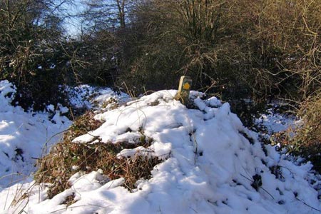
Cross the A61 - the BBW continues some 50 m up the road - then descend down to the fields and at the left of Storrs Dike. Take the path to your right through the hedge, marked with a B sign but can be easy to miss (see the photo), come out into a field and head towards the tree in the middle of the field and the buildings at Carr House Court further behind it.
Go left at the junction down Bromley Carr Road to Howbrook. At the crossroads go straight across onto Berry Lane then after 50 m, take the signed footpath to the right up the track to West Side. At the top of the track take the footpath between the house and the barn then follow the field boundary, keeping the hedge to your right. The markers are not clear at this point so aim for the nearest corner of Booth Wood then follow the south east edge of the wood until, as you come downhill, there are handrails which indicate the path down towards the How Brook then back up to the A629.
Cross the road and take the signed path opposite and at the junction of paths bear left then follow the field boundaries to Bank Lane. Turn right, left at the road junction then off right on the farm track, Rough Lane. When this bends to the right, go left and climb up the field to the gate in front of another path where you turn right and keep the trees on your right.
When you come to the paths that enter Wharncliffe Woods bear left picking tracks that keep the wall between the Woods and the Moor just to your left. After a quarter of a mile you will come to the path that runs northwards along Wharncliffe Crags. As you get closer to Plank Gate, below you on the left, follow the crag path right and then left, passing a small pond on your right and finally onto the Plank Gate track as it descends down to the A616.
Immediately after going under the road in the tunnel go through the stile on your left taking the "Upper Don Trail", Pass the Mallard House Riding School on your right and the old Wortley Station. Go over the Finkle Street bridge, pass the farm buildings then about 20 m before the next road bridge turn off right and back down the lane towards Finkle Street. Just before the junction bear off left over a stone stile and follow the footpaths which are clearly seen as they head off across the fields towards Wortley church.
Come out on the A629 by the church and cross over back to the parking.
Other walks nearby
| Walk 2086 | Stainborough Castle, Wentworth Castle & Worsbrough | easy/mod | 8.9 miles |
| Walk 2238 | Thurgoland Boundary Walk Oxspring | easy/mod | 8.6 miles |
| Walk 1582 | More Hall Reservoir | easy | 3.4 miles |
| Walk 1935 | Birley Edge & Wharncliffe Wood | easy/mod | 9.4 miles |
| Walk 3439 | High Bradfield from Glen Howe | moderate | 8.3 miles |
| Walk 2825 | Silkstone Circular & Cannon Hall Country Park | moderate | 10.4 miles |
| Walk 2328 | Penistone to Shepley linear | easy/mod | 8.0 miles |
| Walk 1523 | Broomhead Moor & Ewden Beck | easy/mod | 6.0 miles |
| Walk 1522 | Back Tor, Bradfield Moors and Reservoirs | moderate | 11.0 miles |
| Walk 1687 | Broomhead & Howden Moors | moderate | 12.4 miles |
Recommended Books & eBooks
No suggestions for this area.Messaging & Social Media
Message Walking Britain and follow the latest news.

Mountain Weather
Stay safe on the mountains with detailed weather forecasts - for iOS devices or for Android devices.