Monyash & Lathkill Dale from Back Lane
Peak District Walk
Nat Park - Peak District - Lathkill Dale High Peak
County/Area - Derbyshire
Author - Lou Johnson
Length - 8.2 miles / 13.3 km Ascent - 800 feet / 242 metres
Time - 4 hours 50 minutes Grade - easy/mod
Maps 

| Ordnance Survey Explorer OL24 | Sheet Map | 1:25k | BUY |
| Anquet OS Explorer OL24 | Digital Map | 1:25k | BUY |
| Ordnance Survey Landranger 119 | Sheet Map | 1:50k | BUY |
| Anquet OS Landranger 119 | Digital Map | 1:50k | BUY |
Walk Route Description
Click image to see photo description.
This interesting Peak District walk traverses the upper section of Lathkill Dale, and offers the chance to see the wonderful Limestone scenery at the top end of the Dale as well as taking you through a delightful wooded section. Walking is generally easy and the route is mostly well signed. Opportunities for refreshment are limited to Monyash.
Roadside parking is available on Back Lane at grid ref. SK192644 or the small car park a short distance away at SK194644. Having parked follow the well-trodden Limestone Way west towards Monyash. The path is clear and crosses a number of fields to reach Low Moor Plantation. The onward route takes you past Calling Low, where the path deviates to the north of this farm. Shortly afterwards the views open out ahead and you get your first look at Lathkill Dale across to your right.
The path descends steps to the bottom of Cales Dale (grid ref. SK172653), Following the Limestone Way follow the path out of Cales Dale to One Ash Grange Farm. Continue through the farm keeping straight ahead. Cross Fern Dale and continue to the road at Monyash (grid ref. SK151662). Bear right along the road to reach the mian crossroads in the village.
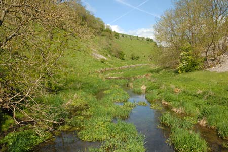
Turn right, passing the church on your right. Just past the public toilets take the signed footpath on your right (grid ref. SK157664) that leads you down Lathkill Dale. The way ahead is never in doubt and the early stages of the Dale are typical of Limestone country.
Continue following this path down the dale, entering Palmerston Wood. The dale loses its open character and you have a pleasant walk through woodland. Alongside is the River Lathkill, which after very dry weather can dry up. Stay on the main path. There is no need to worry about navigation. It is a simple case of following your nose! You reach a bridge below Over Haddon (grid ref. SK202661).
Turn right over the bridge. The path climbs out of Lathkill Dale turning sharply right after the initial ascent. Continue uphill to the rim of the Dale. With open pastures ahead take the path to Meadow Place Grange. Ignore the track going off to your left and walk straight ahead. At grid ref. SK201657, the path forks and you should bear right. This leads across fields to Back Lane (grid ref. SK197647). Turn right along the lane and you are soon back at the parking.
Other walks nearby
| Walk 1945 | Lathkill Dale & Over Haddon circular | easy/mod | 5.7 miles |
| Walk 2503 | Robin Hood's Stride & Stanton Moor | moderate | 11.0 miles |
| Walk 2798 | Bakewell to Edale | mod/hard | 18.0 miles |
| Walk 1146 | Bradford & Lathkill Dales | moderate | 11.3 miles |
| Walk 3046 | Lathkill Dale & Monyash | easy | 4.0 miles |
| Walk 1827 | Ashford-in-the Water,Magpie Mine & Over Haddon | easy/mod | 7.1 miles |
| Walk 1369 | Tissington Trail - Hartington to Parsley Hey | easy | 4.0 miles |
| Walk 3018 | Cracknowl and the Monsal Trail | easy | 3.5 miles |
| Walk 1410 | Minninglow Hill, Roystone Grange and Cardlemere Lane from Gotham | easy/mod | 5.5 miles |
| Walk 1892 | Minninglow & Roystone Rocks | easy/mod | 5.8 miles |
Recommended Books & eBooks
Walking in the Peak District - White Peak East
 Guidebook describing 42 half-day and day walks in the limestone landscapes of Derbyshire's White Peak, part of the Peak District National Park. One of two volumes, this book covers the east of the region, with potential bases including Bakewell, Eyam, Castleton, Birchover, Matlock and Wirksworth.
More information
Great Mountain Days in the Pennines
 An inspirational guidebook to 50 classic walks on the rolling Pennine landscape. The graded routes, between 6 and 13 miles in length, cover classic Pennine fells and moorland such as Whernside, Ilkley Moor and Pendle Hill; exploring the North and South Pennines, Yorkshire Dales, Howgills and Dark Peak. Many routes are also suited to fell running.
More information
Messaging & Social Media
Message Walking Britain and follow the latest news.

Mountain Weather
Stay safe on the mountains with detailed weather forecasts - for iOS devices or for Android devices.