Beresford, Wolfscote & Biggin Dales from Hartington
Peak District Walk
Nat Park - Peak District - Dovedale Manifold Valley
County/Area - Derbyshire
Author - Lou Johnson
Length - 6.2 miles / 10.1 km Ascent - 500 feet / 152 metres
Time - 3 hours 40 minutes Grade - easy/mod
Maps 

| Ordnance Survey Explorer OL24 | Sheet Map | 1:25k | BUY |
| Anquet OS Explorer OL24 | Digital Map | 1:25k | BUY |
| Ordnance Survey Landranger 119 | Sheet Map | 1:50k | BUY |
| Anquet OS Landranger 119 | Digital Map | 1:50k | BUY |
Walk Route Description
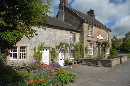
Click image to visit gallery of 12 images.
This Peak District walk starts from the village of Hartington, which is a good centre for walkers. The village, with its green and duck pond, has a range of places to eat and usually has ample parking. On busy days you may have to use the pay and display car park on the B5054 a short way from the centre in the direction of Hulme End. This walk explores Wolfscote Dale, through which the River Dove flows and the adjoining Biggin Dale, which for most of the year is a dry valley. The landscape is typical of the 'White Peak' with limestone outcrops common in this area.
To start the walk, follow the B5054 south from the village centre. Close to the public toilets on the left hand side you will locate the signed path into Wolfscote Dale. The path is well used and easy to follow and initially crosses open pastures before entering woodland. You are now in Beresford Dale. The path soon reaches the River Dove and you follow this well-known river south to reach a footbridge (grid ref. SK128588). Cross this to the other side of the river and continue south to a second footbridge at the end of Beresford Lane (grid ref. SK128586). Cross the river here and continue alongside the river through an open field to enter Wolfscote Dale. There is a dramatic change in scenery as you enter a steep sided valley.
The onward route is clear and the path good and you can make excellent progress down the Dale. After a mile and a half you reach the point where Biggin Dale comes in from the left (grid ref. SK142569). Turn left here and make your way up steep sided Biggin Dale. The path is easy to follow but is quite rough underfoot in places. In very wet weather there may be a stream but normally the valley is dry - a typical feature of limestone country.
Eventually you reach an open area (grid ref. SK145587) where a smaller dale comes in from the right. Careful navigation is required here. Do not bear right, instead go left and follow the path a short distance to a junction of paths (grid ref. SK144588). Veer right here and follow the Dale, which becomes quite shallow up to a road (grid ref. SK147595). Turn left onto the road and take the unsurfaced lane on your left. This is Highfield Lane. Follow this track until you reach a footpath sign on your left (grid ref. SK139599). Follow this footpath across fields to a walled track (grid ref. SK132599). Turn right up this track to reach a road. Turn left, walk past Hartington Hall on your right and descend into Hartington. Reaching the main road, turn left and you will soon be back in the centre of the village.
Other walks nearby
| Walk 1369 | Tissington Trail - Hartington to Parsley Hey | easy | 4.0 miles |
| Walk 2455 | Lum Edge & Revidge Moor | easy/mod | 6.5 miles |
| Walk 1021 | Milldale & Hall Dale | easy/mod | 5.0 miles |
| Walk 1257 | Wolfscote Dale | easy/mod | 7.5 miles |
| Walk 1709 | Milldale and Wolfscote Dale | easy/mod | 6.5 miles |
| Walk 3597 | Manifold Valley, Thor's Cave, Ecton & Wetton Hills from Alstonefield | moderate | 10.0 miles |
| Walk 3601 | Dove & Manifold Valleys | moderate | 10.0 miles |
| Walk 3709 | Sparklow, Crowdicote & Pilsbury Circular | easy/mod | 9.0 miles |
| Walk 1181 | Wetton Hill & the Manifold Valley | easy/mod | 6.5 miles |
| Walk 1653 | The Manifold Valley from Wetton | easy/mod | 7.8 miles |
Recommended Books & eBooks
Walking in the Peak District - White Peak East
 Guidebook describing 42 half-day and day walks in the limestone landscapes of Derbyshire's White Peak, part of the Peak District National Park. One of two volumes, this book covers the east of the region, with potential bases including Bakewell, Eyam, Castleton, Birchover, Matlock and Wirksworth.
More information
Walking in Derbyshire
 Walking guidebook to 60 circular day walks in Derbyshire and the Peak District. Includes the Derwent, Wye and Trent river valleys, near Derby, Matlock, Glossop, Bakewell and Ripley. Routes range from easy to moderate and are between 4 and 14km (2 to 10 miles). Walks focus on places of interest, from Stone Age forts to castles to grand estates.
More information
Messaging & Social Media
Message Walking Britain and follow the latest news.

Mountain Weather
Stay safe on the mountains with detailed weather forecasts - for iOS devices or for Android devices.