Ben Cruachan and Meall Cuanail Walk
Walk 1606 - Route Maps
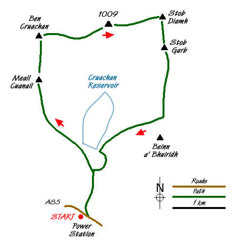
Sketch Map
Suggested Maps 

| Ordnance Survey Explorer 377 | Sheet Map | 1:25k | BUY |
| Anquet OS Explorer 377 | Digital Map | 1:25k | BUY |
| Ordnance Survey Landranger 50 | Sheet Map | 1:50k | BUY |
| Anquet OS Landranger 50 | Digital Map | 1:50k | BUY |
It is recommended you take a map. The preferred scale is 1:25k.
Start Point Details
Ordnance Survey Grid Ref NN079267
Latitude 56.393396 Longitude -5.113897
Postcode PA33 1AN
what3words start runners.indoor.schooling
Walk description may contain detailed information on the start point for this walk.
Further Information
Walk grading - Learn how each walk is assessed and select a walk to suit your ability and experience by going to Walk Grading Details.
Messaging & Social Media
Message Walking Britain and follow the latest news.

Mountain Weather
Stay safe on the mountains with detailed weather forecasts - for iOS devices or for Android devices.