Amberley & East Dean Circular
South Downs Walk
Nat Park - South Downs
County/Area - West Sussex
Author - Peter Smyly
Length - 21.0 miles / 34.1 km Ascent - 2000 feet / 606 metres
Time - 12 hours 30 minutes Grade - mod/hard
Maps 

| Ordnance Survey Explorer OL10 | Sheet Map | 1:25k | BUY |
| Anquet OS Explorer OL10 | Digital Map | 1:25k | BUY |
| Ordnance Survey Landranger 197 | Sheet Map | 1:50k | BUY |
| Anquet OS Landranger 197 | Digital Map | 1:50k | BUY |
Walk Route Description
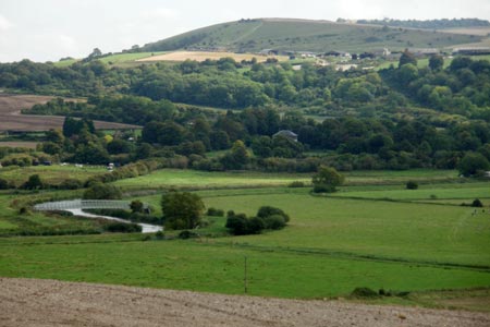
Click image to visit gallery of 6 images.
Although the South Downs provide easy walking in terms of terrain and gradients, the sheer length of this particular walk (21 miles) makes it a bit of a marathon in walking terms. The route also includes part of both the South Downs Way and the Monarch's Way and passes through the small West Sussex village of East Dean. Although the South Downs may conjure up an image of a broad grassy ridge with short grass and a fairly steep slope off to the north, this walk does not fit that image. Instead, there is a mixture of fields, woodland, a few hills up and down and the occasional busy road to cross with care. Paths can be wet and muddy in places so a pair of boots is advisable.
The start and finish point is Amberley station. After crossing the busy main road and going left under the railway bridge, the first turning on the right leads over a wooden stile to the River Arun. Cross the footbridge over the river on the left and then follow the waymarked signs for the South Downs Way. Once the path gains some height, there is a view looking back towards the River Arun and the footbridge and a stretch of the South Downs ridge to the east of Amberley. After crossing the busy A29 there are no more roads to cross for a few miles as the route heads north-west between fields. The next dip marks a crossroads of paths near to Westburton Hill and then the next stretch is quite steep going up south west before turning north-west on the way towards Bignor Hill with its two radio stations. Looking back, you can see the path you have just come along across the valley to the east. The path does not go to the top of Bignor Hill but skirts round to the left of it and leads to a car park. Passing Sutton Down and Littleton End on the left, the path starts to lose quite a bit of height as it goes down through woodland as it heads north-west towards the A285.
At the A285, a sign pointing back the way you have just walked down the hill indicates that the River Arun is six miles away. After crossing the road, the path goes past Littleton Farm and regains the height lost going down the previous hill as you go uphill and cross a cultivated field to enter woodland at the top heading north west. Shortly after this, the route emerges partly in the open to the right and a set of signposts indicate that the next left turning leads to East Dean, the next objective by heading south west. This is only one of a number of forest trails in the vicinity. The path through the woods follows a more or less straight course for the next couple of miles, going straight ahead at a crossroads, before it starts to lose height and the houses of East Dean appear between trees. A right turn along the main road leads to a pub on the left and whether stopping here or not for a break, the route continues by following the first road on the left past the pub which shortly turns into a track between trees.
Look out for a turning off to the right that follows the edge of a field up a hill and leads to woodland where the route joins up with the Monarch's Way. East Dean can be seen in retrospect with hillside beyond. The Monarch's Way is followed most of the way back to Amberley, still another nine miles or so distant. For long stretches the path goes through woodland with few, if any, views of open countryside, though at one point the path emerges into the open to cross fields going south then east before the route crosses the A285 again and continues into Eartham Wood. The Monarch's Way route continues through Houghton Forest. Once the path emerges back on to the main road (B2139) it crosses alongside a field with a view overlooking Amberley. To go back to the railway station, rather than taking a direct approach, it is better to avoid going this way due to the narrowness of the road. Instead, a safer though slightly longer option is to take the next road on the left via Houghton which rejoins a point passed in the early stages of the walk, bring you briefly back to the South Downs Way. A footpath to the right leads back to the bridge over the river and then back to Amberley railway station.
Other walks nearby
| Walk 3305 | Amberley Mount and Wepham Down | easy/mod | 8.0 miles |
| Walk 1667 | Blackpatch Hill & Harrow Hill from near Storrington | easy/mod | 7.2 miles |
| Walk 3464 | Rackham Hill & Kithurst Hill Circular | easy/mod | 6.7 miles |
| Walk 3080 | Arundel Park and the River Arun | easy/mod | 7.2 miles |
| Walk 2835 | Arundel to Amberley | easy | 6.2 miles |
| Walk 1423 | Midhurst Way - Arundel to Midhurst | mod/hard | 19.0 miles |
| Walk 3310 | Washington to Littleton Farm by the South Downs Way | moderate | 13.0 miles |
| Walk 3078 | Cissbury Ring & Chanctonbury Ring from Washington | easy/mod | 8.3 miles |
| Walk 2487 | Littlehampton to Climping | easy | 5.0 miles |
| Walk 1425 | Midhurst Way - Petworth to Midhurst | easy/mod | 5.5 miles |
Recommended Books & eBooks
The South Downs Way
 Guidebook to walking the South Downs Way National Trail, a 100 mile (160km) route between Winchester and Eastbourne through the South Downs National Park, described in both directions over 12 stages. Easy walking on ancient and historical tracks, taking in wooded areas, delightful river valleys and pretty villages. With 1:25K OS map booklet.
More information
Walks in the South Downs National Park
 Guidebook with 40 circular walks throughout the South Downs National Park, exploring the beautiful chalk hills between Eastbourne and Winchester. The walks range from under 5 miles to 11 miles, including Beachy Head and the Seven Sisters, Ditchling Beacon and hundreds of prehistoric sites. Accessible all year, but wild flowers best in spring.
More information
Messaging & Social Media
Message Walking Britain and follow the latest news.

Mountain Weather
Stay safe on the mountains with detailed weather forecasts - for iOS devices or for Android devices.