Bowderdale and the Calf
Howgills Walk
Nat Park - Yorkshire Dales - Howgill Fells
Region - Howgills
County/Area - Cumbria
Author - Lou Johnson
Length - 10.0 miles / 16.3 km Ascent - 2050 feet / 621 metres
Time - 7 hours 0 minutes Grade - moderate
Maps 

| Ordnance Survey Explorer OL19 | Sheet Map | 1:25k | BUY |
| Anquet OS Explorer OL19 | Digital Map | 1:25k | BUY |
| Ordnance Survey Landranger 97 | Sheet Map | 1:50k | BUY |
| Anquet OS Landranger 97 | Digital Map | 1:50k | BUY |
| Ordnance Survey Landranger 98 | Sheet Map | 1:50k | BUY |
| Anquet OS Landranger 98 | Digital Map | 1:50k | BUY |
Walk Route Description
Click image to visit gallery of 12 images.
This walk into the Howgill Fells offers some fine scenery and excellent walking. However do not underestimate the Howgills as in poor visibility they offer considerable navigational challenges with a complex series of interconnecting ridges and deep valleys. This route has been described with the outward valley section completed first followed by a descent along the ridge. This was chosen because strong southerly winds would have made the ridge ascent hard going. In good still conditions the route is probably best undertaken in reverse by first doing the ascent up the ridge and then returning down the valley.
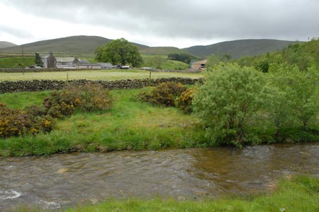
The start is the hamlet of Bowderdale which lies a few miles along the A685 east of Tebay (M6 Junction 38). Turn onto the lane and follow to the hamlet. There is limited parking (grid ref. NY677046) just over the bridge on the right hand side. Please note there is a sign requesting you not to park beyond a certain point. Please respect this request.
After parking walk west up the lane to reach a signed bridleway on your left. Follow this rough track soon getting great views ahead into the mouth of Bowderdale. The ridge used for the return lies to the right of the valley. The track continues past through two gates and continues in open country with a wall on your left. Follow this wall and where it curves left leave the track (grid ref. NY669035) and follow the path which starts to descend. It is likely that you will see few people and you will have this beautiful place to yourself.
Little description is required and all you need to do is follow the clear path up Bowderdale. After the initial descent, the path levels out before gently climbing into the hills. Ahead the view is dominated by the steep slopes of Yarlside. Reaching an indistinct path junction at grid reference SD678988, the climb starts in earnest. Don't worry if you miss this junction as it is quite indistinct but lies almost alongside the summit of Yarlside. From this point the path climbs more steeply across the fellside.
Height is soon gained and the view improves dramatically with Whernside and Baugh Fell amongst the many summits that come into view towards the southeast. The ascent starts to ease and you reach small tarn (grid ref. SD671974). Take note as this is the key to the descent route. It will have become apparent by this stage the complex network of ridges and valleys that make up the Howgills and should the cloud come down this small tarn provides an essential landmark in what can be a featureless landscape.
To reach the summit of the Calf, continue on the main path as it turns southwest to reach the trig point. The view is good with a grand panorama of hills through 360 degrees although the flattish nature of the summit area does detract a little from the view. Having enjoyed the summit, return to the small tarn noted on the outward route. Bear half left off the main path used for the ascent and follow a broad grassy track. Do check you are on the right ridge before committing yourself to the descent.
The track descends quite steeply for a short section with the onward ridge laid out before you. You also have a superb view ranging from the Lakeland Fells to the left through Cross Fell to the high ground east of Kirkby Stephen to your right. The first un-named summit has a spot height of 556 metres and this is quickly followed by an easy ascent of Hazelgill Knott. Down to another col, and then along the undulating ridge of West Fell. Where there is a choice of tracks then use the one to the right. In poor weather another check of your position needs to be made on the summit of West Fell where there is a danger of following the wrong track heading northwest over Langdale Knott. The final descent starts here and trends generally in a northerly direction. The track leads you back to the wall where you started the valley section of the route. All that remains is to retrace your steps back to the start.
Other walks nearby
| Walk 1342 | Randygill Top from Weasdale | moderate | 6.0 miles |
| Walk 1839 | Blease Fell & Hare Shaw from Tebay | easy/mod | 5.7 miles |
| Walk 1389 | Fell End Clouds | easy | 3.0 miles |
| Walk 3385 | Carlingill Beck, Black Force & Whin's End | mod/hard | 6.5 miles |
| Walk 2253 | Uldale Falls & Wandale | moderate | 8.5 miles |
| Walk 3006 | Cautley Spout & The Calf | moderate | 5.5 miles |
| Walk 1393 | Yarlside | moderate | 4.0 miles |
| Walk 1387 | Cautley Spout | easy | 2.0 miles |
| Walk 3007 | Fell Head & The Calf from Howgill | moderate | 7.5 miles |
| Walk 1382 | Mallerstang circular | easy/mod | 7.0 miles |
Recommended Books & eBooks
Walking in the Yorkshire Dales: South and West
 Part of a two-book set, this guidebook describes 44 walks in the southern and western Yorkshire Dales, including the famous 23 mile Three Peaks circuit over Pen-y-Ghent, Whernside and Ingleborough. The other, mostly circular routes of 3½ to 13 miles cover the scenic region between Sedbergh, Kirkby Lonsdale, Settle, Skipton and Grassington.
More information
Walking the Lake District Fells - Mardale and the Far East
 Part of the Walking the Lake District Fells series, this guidebook covers a wide range of routes to 36 Lakeland summits that can be climbed from the Ullswater, Haweswater, Troutbeck, Kentmere and Longsleddale valleys, with highlights including High Street, Place Fell and the Kentmere fells. Suggestions for longer ridge routes are also included.
More information
Messaging & Social Media
Message Walking Britain and follow the latest news.

Mountain Weather
Stay safe on the mountains with detailed weather forecasts - for iOS devices or for Android devices.