The River Arun & South Stoke from Amberley
South Downs Walk
Nat Park - South Downs
County/Area - West Sussex
Author - Lou Johnson
Length - 4.6 miles / 7.5 km Ascent - 250 feet / 76 metres
Time - 2 hours 30 minutes Grade - easy
Maps 

| Ordnance Survey Explorer OL10 | Sheet Map | 1:25k | BUY |
| Anquet OS Explorer OL10 | Digital Map | 1:25k | BUY |
| Ordnance Survey Landranger 197 | Sheet Map | 1:50k | BUY |
| Anquet OS Landranger 197 | Digital Map | 1:50k | BUY |
Walk Route Description
Click image to see photo description.
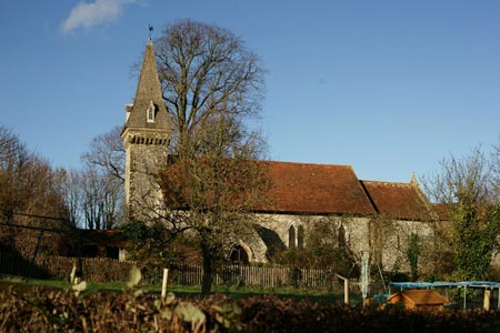
This short walk explores a section of the River Arun and visits the attractive church at South Stoke.
Exit Amberley station and walk down to the main road. Turn left to Houghton Bridge over the River Arun. Half way across the bridge take the footpath on the left. This leads you alongside the River Arun on the east bank of the river. Reaching a footbridge (grid ref TQ021113) cross the dyke and stile, and turn left away from the river. The path leads to Stoke Road (grid ref. TQ024109). Turn right along the road into the village of North Stoke. Reaching a T-junction turn left to take a path on the right within a few yards.
This path crosses a small suspension bridge continuing to reach the River Arun and a road bridge close to South Stoke (grid ref. TQ026101). Walk up past St Leonard's church to take the bridleway on the right just after South Stoke Farm. This bridleway then follows the west bank of the River all the way back to Houghton. At grid ref. TQ014103 the Monarch's way comes in from the left. Leave the riverside path and climb into Houghton. Reaching the main road through the village turn right and then almost immediately along a lane. Follow this north to reach the South Downs Way which crosses this lane at grid ref. TQ016118. Turn right onto the SDW, cross the footbridge over the River Arun and then follow the north bank back to Amberley station.
Other walks nearby
| Walk 3305 | Amberley Mount and Wepham Down | easy/mod | 8.0 miles |
| Walk 1667 | Blackpatch Hill & Harrow Hill from near Storrington | easy/mod | 7.2 miles |
| Walk 3464 | Rackham Hill & Kithurst Hill Circular | easy/mod | 6.7 miles |
| Walk 3080 | Arundel Park and the River Arun | easy/mod | 7.2 miles |
| Walk 2835 | Arundel to Amberley | easy | 6.2 miles |
| Walk 1423 | Midhurst Way - Arundel to Midhurst | mod/hard | 19.0 miles |
| Walk 3310 | Washington to Littleton Farm by the South Downs Way | moderate | 13.0 miles |
| Walk 3078 | Cissbury Ring & Chanctonbury Ring from Washington | easy/mod | 8.3 miles |
| Walk 2487 | Littlehampton to Climping | easy | 5.0 miles |
| Walk 1425 | Midhurst Way - Petworth to Midhurst | easy/mod | 5.5 miles |
Recommended Books & eBooks
The South Downs Way
 Guidebook to walking the South Downs Way National Trail, a 100 mile (160km) route between Winchester and Eastbourne through the South Downs National Park, described in both directions over 12 stages. Easy walking on ancient and historical tracks, taking in wooded areas, delightful river valleys and pretty villages. With 1:25K OS map booklet.
More information
Walks in the South Downs National Park
 Guidebook with 40 circular walks throughout the South Downs National Park, exploring the beautiful chalk hills between Eastbourne and Winchester. The walks range from under 5 miles to 11 miles, including Beachy Head and the Seven Sisters, Ditchling Beacon and hundreds of prehistoric sites. Accessible all year, but wild flowers best in spring.
More information
Messaging & Social Media
Message Walking Britain and follow the latest news.

Mountain Weather
Stay safe on the mountains with detailed weather forecasts - for iOS devices or for Android devices.