Bankhouses via the Lancashire Coastal Way from Glasson
Lancashire Walk
County/Area - Lancashire
Author - Lou Johnson
Length - 7.0 miles / 11.4 km Ascent - 200 feet / 61 metres
Time - 3 hours 40 minutes Grade - easy/mod
Maps 

| Ordnance Survey Explorer 296 | Sheet Map | 1:25k | BUY |
| Anquet OS Explorer 296 | Digital Map | 1:25k | BUY |
| Ordnance Survey Landranger 102 | Sheet Map | 1:50k | BUY |
| Anquet OS Landranger 102 | Digital Map | 1:50k | BUY |
Walk Route Description
Click image to see photo description.
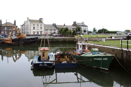
This Lancashire walk starts from Glasson Dock which at one time had high hopes as being a port serving Lancaster. The route follows a section of the Lancashire Coastal Way passing close the ruins of Cockersand Abbey before continuing east. The return uses footpaths through rural Lancashire back to the start.
The start is Glasson Dock carpark (grid ref. SD446561) from where you walk west along Tithebarn Hill through the village. Reaching a road junction, turn south. Close to here is one of the highest points on the route from where you have a good view across the River Lune Estuary. At the next junction (grid ref. SD442556), turn right along Marsh Lane. You have now joined the Lancashire Coastal Way. Follow this track west towards the coast at Crook Farm turning south, with the Estuary to your right, to Plover Hill at 7 metres above sea level! The path turns south and you have the option of taking a footpath on your left (grid ref. SD426537) to visit the ruins of Cockersand Abbey.
The main route continues along the coast to reach Bank Houses where you briefly join a road before continuing along a track to pass Bank End. The track improves to a tarmac lane. At the end of straight section the Lancashire Coastal Way goes right but for this route we keep on the road and turn left following the lane to reach Hillam. Here take the footpath on the left by Hillam Farm and walk north to Norbreck Farm (which will be on your right). Continue north passing the high spot on the route - a trig point at 23 metres above sea level.
As you descend from this 'hill', the path doglegs before reaching a T-junction (grid ref. SD450540). Turn left here and continue to the next crossroads of paths. Turn right here and walk to Moss Lane. Cross this lane and continue north to meet a track (grid ref. SD446550). Go left here and follow the road round to the right into Dobs Lane. This leads you into Old Glasson and on to rejoin the outward route. All that remains is to retrace your steps back to Glasson Dock.
Other walks nearby
| Walk 1994 | Cockerham, Glasson & Conder Green | easy/mod | 6.6 miles |
| Walk 2257 | Clougha Pike from Quernmore | easy/mod | 4.8 miles |
| Walk 1742 | Grit Fell from the Jubilee Tower near Quernmore | moderate | 7.7 miles |
| Walk 2164 | Clougha Pike from the Jubilee Tower | easy/mod | 4.7 miles |
| Walk 2137 | Clougha & Goldsworthy's Installation Circular | moderate | 5.2 miles |
| Walk 2278 | Ward's Stone from Stoops Bridge | mod/hard | 13.0 miles |
| Walk 3459 | Abbeystead Reservoir Circular | easy | 1.6 miles |
| Walk 3457 | Wyre Valley Circular | easy/mod | 6.4 miles |
| Walk 1670 | Hazelhurst Fell, Fair Snape Fell and Parlick | moderate | 11.0 miles |
| Walk 3038 | Wolfhole Crag from Tower Lodge | moderate | 9.0 miles |
Recommended Books & eBooks
Walking on the West Pennine Moors
 This guidebook describes 30 walks on the West Pennine Moors, around Blackburn, Darwen, Chorley and Bolton, home to some of the most inspiring and exhilarating walking country. The walks range from short, easy rambles to more challenging hikes covering a variety of terrain, all of it easily accessible for day walking.
More information
Messaging & Social Media
Message Walking Britain and follow the latest news.

Mountain Weather
Stay safe on the mountains with detailed weather forecasts - for iOS devices or for Android devices.