Hazelhurst Fell, Fair Snape Fell and Parlick from Delph Lane
Forest of Bowland Walk
Region - Forest of Bowland
County/Area - Lancashire
Author - Lou Johnson
Length - 11.0 miles / 17.9 km Ascent - 1100 feet / 333 metres
Time - 6 hours 40 minutes Grade - moderate
Maps 

| Ordnance Survey Explorer OL41 | Sheet Map | 1:25k | BUY |
| Anquet OS Explorer OL41 | Digital Map | 1:25k | BUY |
Walk Route Description
Click image to see photo description.
The Forest of Bowland offers many opportunities for walking and this circuit of the high ground at the western end of the area provides many excellent views, some moorland walking and the interesting hamlet of Bleasdale with its fine church. A good sense of directions is required for some sections of this walk and you need to take along the relevant OS 1:25000 Explorer series map. It is not a route recommended for inexperienced walkers. Ample food and water is also needed as there are no opportunities for refreshment during the walk.
The start is the small car park on Delph Lane (grid ref. SD546455). After parking exit the car park and turn left along Delph Lane for just over half a mile to reach a track on the right hand side leading to Stang Yule (grid ref. SD545465). Turn up this track and in a short way turn left at a junction. This leads to open country. Turn right onto a track heading ENE rising across the moorland. The track eventually peters out and becomes a feint path. If you lose the path then follow sheep tracks maintaining the same general direction roughly walking parallel to the northern boundary of Fell Plantation on your right aiming for the northern corner of the plantation at grid ref. SD556472).
Join the track at this corner and follow it for a short way before veering off north-east to the summit of Hazelhurst Fell (grid ref. SD563480). From the summit, head just north of east to follow Calder Dyke (grid ref. SD572482) east to join a track. Stay with this track across the northern side of Winny Bank. The track continues east towards Fiensdale Head (grid ref SD589485) where you meet a path trending northeast down into Fiensdale. Cross this path maintaining an easterly direction to meet with a clearer path heading south-east. Turn right onto this and continue to a cairn at grid ref. SD597472). The path swings southwest shortly afterwards and makes a beeline for the summit of Fair Snape Fell (grid ref. SD591468). The views from here include much of the return route which crosses the countryside far below.
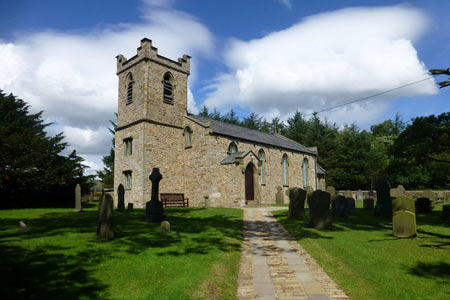
The navigational problems are now behind you and route finding becomes much easier. From Fair Snape Fell follow the clear path along the edge in a south-easterly direction. The path swings round to head south and you soon reach the final summit of the route - Parlick (grid ref. SD595450). From this summit you have a steep descent over grass following the fence (which should be on your left) in a south-westerly direction. At the bottom of the fell, take the lower path west to Blindhurst, continuing along a track and then paths to Bleasdale School (grid ref. SD573452). Turn right up the lane to Bleasdale Church. Follow the track on the left opposite the church passing Admarsh Barn to Brooks. Continue north-west on an improving track to reach a junction (grid ref. SD561462). Keep left here and continue through Broadgate Wood to Broadgate Farm and onto Delph Lane near High Moor. Turn right up Delph Lane and the car park is a short way along on the left hand side.
Other walks nearby
| Walk 2596 | The River Brock & Beacon Fell | easy/mod | 9.0 miles |
| Walk 2505 | Fair Snape Fell from Fell Foot, Forest of Bowland | moderate | 6.0 miles |
| Walk 1902 | Saddle Fell, Fair Snape Fell & Parlick from Chipping | moderate | 8.0 miles |
| Walk 2278 | Ward's Stone from Stoops Bridge | mod/hard | 13.0 miles |
| Walk 3459 | Abbeystead Reservoir Circular | easy | 1.6 miles |
| Walk 3457 | Wyre Valley Circular | easy/mod | 6.4 miles |
| Walk 3038 | Wolfhole Crag from Tower Lodge | moderate | 9.0 miles |
| Walk 1218 | Fiensdale Head & Bleasdale Water | moderate | 10.0 miles |
| Walk 2594 | Totridge Fell & Fiendsdale Head, Forest of Bowland | moderate | 11.0 miles |
| Walk 2384 | Hodder Valley from Whitewell | easy/mod | 6.8 miles |
Recommended Books & eBooks
Walking on the West Pennine Moors
 This guidebook describes 30 walks on the West Pennine Moors, around Blackburn, Darwen, Chorley and Bolton, home to some of the most inspiring and exhilarating walking country. The walks range from short, easy rambles to more challenging hikes covering a variety of terrain, all of it easily accessible for day walking.
More information
Walking in the Forest of Bowland and Pendle
 A guidebook to 40 diverse circular day walks suitable for walkers with navigational skills. The Forest of Bowland and Pendle are two of north west England's upland AONBs, perfect for walkers who enjoy exploring rough hilly, sometimes pathless terrain. The routes include Ward's Stone, Pendle Hill, Longridge Fell and Fair Snape Fell.
More information
Messaging & Social Media
Message Walking Britain and follow the latest news.

Mountain Weather
Stay safe on the mountains with detailed weather forecasts - for iOS devices or for Android devices.