The Esk Valley & Egton High Moor
North York Moors Walk
Nat Park - North York Moors - North York Moors East
County/Area - North Yorkshire
Author - Andy Chaplin
Length - 10.5 miles / 17.1 km Ascent - 1270 feet / 385 metres
Time - 6 hours 30 minutes Grade - moderate
Maps 

| Ordnance Survey Explorer OL27 | Sheet Map | 1:25k | BUY |
| Anquet OS Explorer OL27 | Digital Map | 1:25k | BUY |
| Ordnance Survey Landranger 94 | Sheet Map | 1:50k | BUY |
| Anquet OS Landranger 94 | Digital Map | 1:50k | BUY |
Walk Route Description
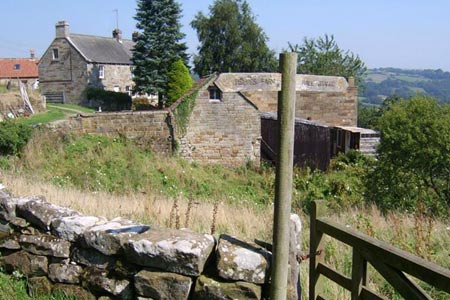
Click image to visit gallery of 2 images.
Although a fair amount of this North York Moors walk is on roads, they are not busy, even in August, and they are mainly un-fenced so it makes for easy walking. It also seems to be that many of the best places to walk above the Esk Valley seem to be on the roads.
Park just after the cattle grid at grid ref. NZ778036. Walk down the road towards Delves and take the first footpath off on the right across open country and then across fields to Lodge Hill. Pick up the farm track through Butter Park Farm and follow it down to Delves coming out opposite the thatched cottage. At the same bend in the road take the overgrown path off on the right and follow it downhill. Cross the track at The Delves and take the path signed to Hall Grange. Go over field to the footbridge then angle slightly right and cross into the next field keeping the trees on your left.
Over the stile at the end and turn left down Hall Grange farm road and go back down to Delves Road. Follow it into Egton Bridge (grid ref. NZ804051). You may have to take the footbridge over the ford (but most likely won't) and can either take the stepping stones or the road bridge to end up on the road out to Egton - just past Egton Manor.
Take the Barnard's Road track past the manor and keep on until Beckside Farm (just before the old Toll House) then take the path down to the Esk and cross on the footbridge. Head uphill past the house then up the track to Lease Rigg Lane. Take the footpath opposite past Low Burrows then out on the track to come out on the road opposite High Burrows Farm.
Follow the road to Moss Brow then cross onto the gated road signposted to the Roman (Wheeldale) Road. Keep heading south west towards Murk Mire Moor passing Castle Hill on your left. At grid ref. NZ799029 you can take the track/path on your right - but it peters out in the heather - and it's probably better to carry on then take the moors track off on the right at grid ref. NZ795023.
It is easy walking with good views into the Butter Beck valley as you cross Egton High Moor before coming out on Smiths Lane opposite the Wintergill Plantation. Turn right on the road then off on the bridleway on your left around the east of the plantation. The bridleway starts off fine but disappears into the heather and bracken as you approach the wall at grid ref. NZ760030. When you find the wall turn right - the good news is that the bracken is slightly more trodden down for the next mile.
The views over the wall into Glaisdale are very pleasant and eventually the ferns give way as the path crosses through Bank House Brow Plantation and comes back out at the parking.
Other walks nearby
| Walk 1012 | Glaisdale, Great Fryup Dale and Eskdale | moderate | 7.5 miles |
| Walk 2077 | Glaisdale Moor circular | moderate | 11.9 miles |
| Walk 2563 | Egton Bridge & Grosmont from Goathland | moderate | 12.5 miles |
| Walk 3533 | Mallyan Spout and Beck Hole from Goathland | easy | 3.0 miles |
| Walk 2262 | Goathland & Grosmont | easy/mod | 7.7 miles |
| Walk 1450 | Little & Great Fryup Dales | moderate | 8.3 miles |
| Walk 1930 | Wheeldale Moor circular | moderate | 11.3 miles |
| Walk 1758 | Newton House Plantation & Stony Leas | moderate | 10.3 miles |
| Walk 3737 | Commondale & Esk Valley | easy/mod | 8.2 miles |
| Walk 1922 | Goathland & Howl Moors | moderate | 11.2 miles |
Recommended Books & eBooks
Trail and Fell Running in the Yorkshire Dales
 Guidebook to 40 of the best trail and fell runs in the Yorkshire Dales National Park. Ranging from 5 to 24 miles, the graded runs start from bases such as Ribblehead, Dent, Sedbergh, Malham and Grassington and take in the region's diverse delights, from castles and waterfalls to iconic mountains such as Whernside, Ingleborough and Pen Y Ghent.
More information
Messaging & Social Media
Message Walking Britain and follow the latest news.

Mountain Weather
Stay safe on the mountains with detailed weather forecasts - for iOS devices or for Android devices.