Bont-goch Circular from near Aberystwyth
Cambrian Mountains Walk
Region - Cambrian Mountains
County/Area - Ceredigion
Author - Donald Morton
Length - 4.5 miles / 7.3 km Ascent - 900 feet / 273 metres
Time - 3 hours 10 minutes Grade - easy/mod
Maps 

| Ordnance Survey Landranger 136 | Sheet Map | 1:50k | BUY |
| Anquet OS Landranger 136 | Digital Map | 1:50k | BUY |
Walk Route Description
Click image to visit gallery of 6 images.
The most direct way to Bont-goch from where the walk starts is to take the country lane which goes up to the right of the Black Lion and White Lion pubs on the village green in Tal-y-bont on the A487 between Aberystwyth to Machynlleth, keeping to the right at each junction. This is a picturesque ride (to be appreciated by passengers only since it is on a very narrow road) up the Afon Leri. An alternative route on wider roads is from the A4159 linking Bow Street, also on the A487, to the A44: go past the University of Wales Plant Breeding Centre, forking left in Penrhyn-coch and then turning right at a cross roads signed Bont-goch (Elerch). Once in Bont-goch turn up the lane, past the church, and, where the lane appears to terminate at a gate, park on the verge (room for two cars) to the left taking care to block neither the gate - the road actually continues after the gate - nor the private access drive also to the left (Grid ref. SN689868).
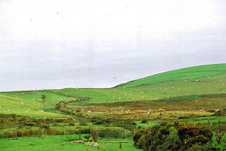
To start the walk, go through the gate which apparently ends the road and turn right up the bridleway. Follow the fence on the right climbing up between Afon Leri on the right and Nant Lwyd on the left. At the third gateway turn left down hill following the fence on the left. This goes down to Nant Lwyd, at this point a mere stream and easily crossed (even in the wet year of 2008). Once over, go through the gate and bear right to the next gate. Follow a bank of furze on the left and where this ends curve right and then left round a hill with a wireless mast. The track goes up to a gate and then descends before resuming the climb; this part of the walk can be full of water - the drainage channels which were cut some years back are becoming gradually less effective - but the deepest water can be avoided by walking above the track. Now follow the clear track to the saddle which is the highest point of the walk (Spot Height 395). The route at this point turns left but before you leave, detour over the saddle to enjoy the panorama looking over the empty landscape beyond Nant-y-moch and Llyn Craigpistyll. (There is also a rock providing a resting place for two.)
Returning over the saddle there is a view towards Cardigan Bay and the 1998 wind farm above Tal-y-bont and the return route, straight ahead. It is not a right of way but is shown as "a route with public access" on the OS Landranger and there are no barriers to its use; indeed its use seems to be expected since gates carry requests to close after passing through. From the saddle it can be seen clearly for some way descending before rounding a hill to disappear before descending further. A little way from the saddle an older track can be seen descending to the left to rejoin the newer track further down: the comparatively newer track is becoming rapidly eroded by water and it may well be that it will soon be sensible to revert to the older track. Where the track levels out before rounding the hill it can again be somewhat waterlogged, but again the water can be avoided by walking above the path. There are views to the right over Afon Cyneiniog. After passing a distant farmhouse on the left the path descends to a ford. There is a bridge, but since 2006 it has been festooned with duck tape to deter use: on inspection one of the plank supports appears rotted. The ford is at a confluence so by going slightly upstream the two tributaries can be crossed separately, hitherto quite easily. This was still true of the first even in 2008, the second in this very wet year was, despite some rudimentary stepping stones, more of a challenge: a walking pole was a help.
Once over the ford it is an easy walk following the track down to a road at the apex of a sharp bend. Turn left to walk back to the gate at the start of the walk- the lane is very quiet since it serves one dwelling and it does mean that if done as an evening walk the last ½ mile can be safely completed in the dusk.
Other walks nearby
| Walk 2048 | Craig-y-Pistyll, Cambrian Mountains | moderate | 10.0 miles |
| Walk 1420 | Borth to Aberystwyth coast | easy/mod | 6.5 miles |
| Walk 1102 | Plynlimon & Nant-y-Moch Reservoir | hard | 11.0 miles |
| Walk 1304 | Plynlimon | moderate | 5.0 miles |
| Walk 2138 | Plynlimon Circular | moderate | 5.0 miles |
| Walk 1767 | Allt Wen & Wales Coast Path from Trefechan | easy/mod | 6.0 miles |
| Walk 3317 | Happy Valley Circular | easy | 4.2 miles |
| Walk 3086 | Pen y Garn from near Devil's Bridge | easy/mod | 6.8 miles |
| Walk 3230 | Tarrenhendre from Abergynolwyn | easy/mod | 5.0 miles |
| Walk 1309 | Tarren y Gesail | moderate | 8.0 miles |
Recommended Books & eBooks
The Wales Coast Path
 A single guidebook to walking the whole Wales Coast Path - 1400km (870 miles) the length of Wales from Chester to Chepstow, including Anglesey, described in 57 stages. The route passes through the Snowdonia and Pembrokeshire National Parks and many AONBs and can be linked with the Offa's Dyke Path for a complete circuit of Wales.
More information
Messaging & Social Media
Message Walking Britain and follow the latest news.

Mountain Weather
Stay safe on the mountains with detailed weather forecasts - for iOS devices or for Android devices.