Bont-goch Circular from near Aberystwyth Walk
Walk 1705 - Route Maps
Route Map
Digital Maps - Copyright © 2011-2024. All rights reserved.
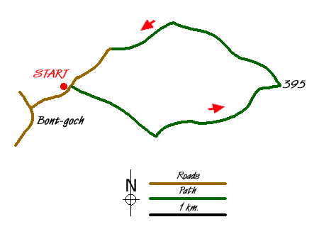
Sketch Map
Suggested Maps 

| Ordnance Survey Landranger 136 | Sheet Map | 1:50k | BUY |
| Anquet OS Landranger 136 | Digital Map | 1:50k | BUY |
It is recommended you take a map. The preferred scale is 1:25k.
Start Point Details
Ordnance Survey Grid Ref SN689868
Latitude 52.463358 Longitude -3.931123
Postcode SY24 5DP
what3words start flagged.flopping.fishery
Walk description may contain detailed information on the start point for this walk.
Further Information
Cambrian Mountains
The Cambrian Mountains are a wild and empty plateau lying between the Snowdonia and Brecon Beacons National Parks. They are Wales' fourth national park in-waiting; designated in 1972, the Park was later cheated of recognition and protection, by an unholy alliance of landowners and politicians. Cambrian Mountains Walking Guide
Ceredigion
Ceredigion is a coastal county in mid-Wales. The Cambrian Mountains covering much of the east of the county and offer excellent walking. The highest point is Plynlimon at 2,467 feet (752 m). In complete contrast to the wilds of the mountains, Ceredigion's 50 miles (80 km) of coastline has sandy beaches and, in places, high cliffs. Several attractive seaside resorts provide excellent bases for exploration. The Wales Coast Path follows the full length of the coast.
Walk grading - Learn how each walk is assessed and select a walk to suit your ability and experience by going to Walk Grading Details.
Messaging & Social Media
Message Walking Britain and follow the latest news.

Mountain Weather
Stay safe on the mountains with detailed weather forecasts - for iOS devices or for Android devices.