Draycott in the Clay circular from Hanbury
Staffordshire Walk
County/Area - Staffordshire - Mid Staffordshire
Author - Lou Johnson
Length - 3.0 miles / 4.9 km Ascent - 200 feet / 61 metres
Time - 1 hours 40 minutes Grade - easy
Maps 

| Ordnance Survey Explorer 245 | Sheet Map | 1:25k | BUY |
| Anquet OS Explorer 245 | Digital Map | 1:25k | BUY |
| Ordnance Survey Landranger 128 | Sheet Map | 1:50k | BUY |
| Anquet OS Landranger 128 | Digital Map | 1:50k | BUY |
Walk Route Description
Click image to visit gallery of 5 images.
This walk explores some pleasant countryside above the Dove Valley and provides some excellent views north towards the Peak District National Park. This route can be combined with Walk 1327 visiting the Fauld Crater.
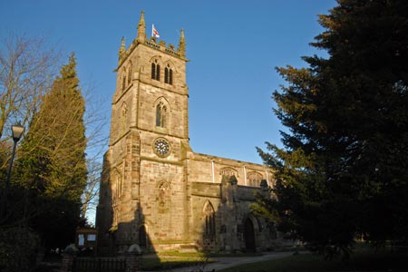
The start for this walk is the car park of Cock Inn at Hanbury (grid ref. SK173278). Please note that you should only park with the publican's permission and perhaps obtain refreshments at the end of the walk. After parking turn left out of the car park and follow the road to the first junction. Turn right and where the road turns sharp left walk straight on to pass the Parish Church on your right.
At the end of this lane take the signed footpath on the right (you will return using the footpath on the left). At the first field boundary some care with navigation is required as the path makes a three way spilt. Do not gain height but head straight across this large field keeping the ridge of hills to your right. If you have a compass walk roughly northwest, maintaining this direction through a number of fields to reach a lane (grid ref. SK158287).
Turn left down the lane and walk into the village of Draycott in the Clay. Go past the school on your right to reach a T-junction. Go left and continue along this lane towards Foxholes. Where the lane bears sharp right (grid ref. SK163276) continue ahead on the signed footpath. The route leads through fields and climbs up to a strip of woodland on your left. Continue on the clear path, going left at a junction. This leads back towards the lane used earlier.
Walk past the church. Turn left at the first junction and then left again. The Cock Inn is a short way along this road.
Other walks nearby
| Walk 3405 | Abbots Bromley Circular | easy | 6.0 miles |
| Walk 1375 | Blithfield Estate Circular | easy | 2.5 miles |
| Walk 1608 | Calke Abbey & Robin Wood from Ticknall | easy/mod | 8.0 miles |
| Walk 1843 | Haywood Slade & Sherbrook from Seven Springs | easy | 4.0 miles |
| Walk 1753 | Abraham's Valley & Haywood Warren from Seven Springs | easy | 3.0 miles |
| Walk 3562 | The Weaver Hills from Wootton | easy | 3.2 miles |
| Walk 1370 | Sherbrook Valley from Punch Bowl, Milford | easy | 4.0 miles |
| Walk 1802 | Shugborough Park from Milford | easy | 4.5 miles |
| Walk 1731 | Highlights of Cannock Chase from Marquis Drive | easy/mod | 10.0 miles |
| Walk 1189 | Cannock Chase Circular | easy | 6.5 miles |
Recommended Books & eBooks
Walking in the Peak District - White Peak East
 Guidebook describing 42 half-day and day walks in the limestone landscapes of Derbyshire's White Peak, part of the Peak District National Park. One of two volumes, this book covers the east of the region, with potential bases including Bakewell, Eyam, Castleton, Birchover, Matlock and Wirksworth.
More information
Messaging & Social Media
Message Walking Britain and follow the latest news.

Mountain Weather
Stay safe on the mountains with detailed weather forecasts - for iOS devices or for Android devices.