Highlights of Cannock Chase from Marquis Drive
Cannock Chase Walk
Region - Cannock Chase
County/Area - Staffordshire - Cannock Chase
Author - Lou Johnson
Length - 10.0 miles / 16.3 km Ascent - 800 feet / 242 metres
Time - 5 hours 50 minutes Grade - easy/mod
Maps 

| Ordnance Survey Explorer 244 | Sheet Map | 1:25k | BUY |
| Anquet OS Explorer 244 | Digital Map | 1:25k | BUY |
Walk Route Description
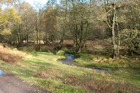
Click image to see photo description.
This Staffordshire walk explores many of the highlights of Cannock Chase and include two War Cemeteries, a War Memorial, a glacial boulder as well as typical landscapes of this Area of Outstanding Natural Beauty. Like many such heathland areas there are many footpaths crossing the landscape some of which are not marked on OS maps. The route does require a good sense of direction and the relevant OS 1;25000 map should be used to confirm the route on the ground. There are some areas of conifer plantations. Many of these have recently being cleared so OS maps can be quite dated in this respect.
The start is the access driveway parking close to the Marquis Drive Visitor Centre. My usual parking spot is at grid ref. SK002153 just to the west of the Adventure Playground. After parking walk south past the visitor centre (on your left) and follow the tarmac access road to join Brindley Heath Road. Turn left and walk along the grass verge for 400 metres to Duffields Car Park (grid ref. SK003148) on the right-hand side of the road. From take the ascending path (blue way marker) northwest into the Brindley Valley. Follow this until you reach Brindley Bottom car park (grid ref. SJ994154) and a road. Cross the road and pass through two gates to follow a clear path across a cleared plantation. After 350 metres take the track on your right (grid ref. SJ992156) which leads to Penkridge Bank Road. Turn right along the road and continue to the White House (grid ref. SJ994161).
Turn left through the car park opposite and follow the path. Reaching a junction in 300 metres. Turn left and follow path to reach Gospel Oak. Bear left along a clear gravel track and climb steadily to reach the German War Cemetery. After visiting this wonderful location continue along the track to reach the Commonwealth War Cemetery. After visiting this well-kept place of remembrance retrace your steps to just before the German War Cemetery and turn left onto a clear track (grid ref. SJ985156). This leads to an access driveway to a small car park. Turn right along this driveway and then left to the Katyn Memorial (grid ref. SJ980165).
Walk to the right of the Memorial through light woodland and bear left to join a footpath heading north through heathland. Take the third path on the right which initially heads northeast but soon swings north. At grid ref SJ982177 the Staffordshire Way comes in from the left and you follow this long-distance footpath for about 600 metres where you can turn left to visit the Glacial Boulder and adjacent trig point (grid ref. SJ980181). Return to the Staffordshire Way and continue in a northerly direction. After 250 metres the Staffordshire turns right and you follow this path down into the Sherbrook Valley.
Reaching the valley bottom, turn left on a clear path with the stream to your right. Continue on this path for just over a kilometre as far as the Devil's Dumble stepping stones. Cross the stream using the sometimes slippery stones and turn right through the picnic benches. Join the clear track named as Haywood Slade on OS maps continuing as far as the junction with Cherrytree Slade (grid ref. SJ990196). Turn right onto Cherrytree Slade and follow this for just over a kilometre to the junction with Marquis Drive (grid ref. SJ994184).
Turn right along Marquis Drive. Reaching the trig point (grid ref. SJ994180), turn right following clear path descending into the Sherbrook Valley. After 250 metres go left on a narrower path into the plantation to reach a five-way junction on Pepper Slade (grid ref. SJ992175). Take the path heading half right and continue into the valley bottom where you turn left with stream on your right. At the junction with the Heart of England Way (grid ref. SJ989165) turn left. With a plantation on your left and open ground to you right walk for about 400 metres and turn right following the waymarked Hear of England Way (grid ref. SJ993166).
Stay on the Heart of England Way crossing Penkridge Bank Road and follow the path to reach Flints Corner. Keep straight ahead alongside Marquis Drive. You soon reach the access driveway to the Visitor Centre and the start of the walk.
Other walks nearby
| Walk 1801 | Three Memorials of Cannock Chase | easy | 3.5 miles |
| Walk 1348 | Sherbrook Valley & Katyn Memorial | easy | 4.0 miles |
| Walk 1324 | Glacial Boulder & Sherbrook | easy | 3.5 miles |
| Walk 1413 | Sherbrook, Stepping Stones & Freda's Memorial | easy | 6.0 miles |
| Walk 2023 | Cannock Chase War Trail | moderate | 7.5 miles |
| Walk 1843 | Haywood Slade & Sherbrook from Seven Springs | easy | 4.0 miles |
| Walk 1753 | Abraham's Valley & Haywood Warren from Seven Springs | easy | 3.0 miles |
| Walk 1370 | Sherbrook Valley from Punch Bowl, Milford | easy | 4.0 miles |
| Walk 1189 | Cannock Chase Circular | easy | 6.5 miles |
| Walk 2911 | Seven Springs, Little Haywood, Shugborough & Milford | easy | 6.5 miles |
Recommended Books & eBooks
Walking in the Peak District - White Peak East
 Guidebook describing 42 half-day and day walks in the limestone landscapes of Derbyshire's White Peak, part of the Peak District National Park. One of two volumes, this book covers the east of the region, with potential bases including Bakewell, Eyam, Castleton, Birchover, Matlock and Wirksworth.
More information
Messaging & Social Media
Message Walking Britain and follow the latest news.

Mountain Weather
Stay safe on the mountains with detailed weather forecasts - for iOS devices or for Android devices.