Monadh Beag and Meall a' Phubuill from Drumsallie
Highland Walk
County/Area - Highland - Fort William Lochaber
Author - Peter Smyly
Length - 16.5 miles / 26.8 km Ascent - 3220 feet / 976 metres
Time - 11 hours 30 minutes Grade - hard
Maps 

| Ordnance Survey Explorer 398 | Sheet Map | 1:25k | BUY |
| Anquet OS Explorer 398 | Digital Map | 1:25k | BUY |
Walk Route Description
Click image to visit gallery of 8 images.
Monadh Beag (1,732 feet) and Meall a' Phubuill (2,539 feet) are modest heights by Scottish standards. To put them into context, the latter is lower than the Old Man of Coniston in the Lake District south of the border while the former is less than half the height of Ben Nevis, Scotland's highest peak. These peaks are not household names even among seasoned fell walkers. However their lack of height or fame seems immaterial on a fine sunny day when there are splendid views to enjoy and the feeling afterwards of having had a very long day out among the hills including distant views of Ben Nevis and its nearby peaks. One feature that makes the Scottish Highlands different from the Lake District in England and Snowdonia (Eryri) in Wales is the remoteness from roads and civilisation of some of the peaks as illustrated by this walk. It is the kind of walk where even in good weather in summer you might not see another soul all day long. The route does not lend itself to a circular walk so it is an "out and back".
The highest mountains in Scotland do not necessarily present the toughest challenges and here is a case in point. While neither of the two mountains on this walk are Munros, this is a potentially strenuous walk with a walk in and back along a valley, the Gleann Fionlighe, of a few miles each way and some pathless terrain to cross. A full day should be allowed for the walk and a willingness to find a way across rivers as required without bridges. This should not present a difficulty unless there has been a lot of rain recently,
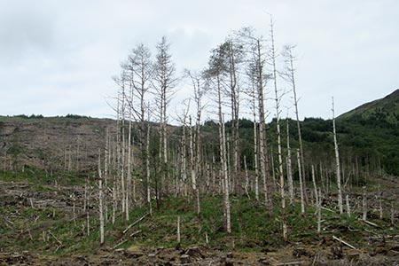
The starting point is Drumsallie to the west of Loch Eil. There is not an official car park so a suitable off road spot will need to be found but competition for a parking space is unlikely in this remote location. Route-finding is easy with a clear bridleway all the way to Na Socachan at the foot of Gulvain where a plank bridge leads across a stream. The path beyond soon peters out and it will be necessary to follow a trackless route over the brow of the hill on the lowers slopes to the right of Gulvain with the river below to your right, the Fionn Ligne. This river needs to be crossed at a suitable point by rock stepping as there is no bridge and then you need to aim for the bealach between Meall Onfhaidh and Meall a' Phubuill. The latter, rounded and dome-shaped dominates the view ahead and this is the next objective. It gets generally steeper the higher up you go and depending on your line of approach you may find yourself needing to hold on to the grassy slopes with hands as well as feet such is the steep gradient in places. Eventually the gradient eases off and it is then an easy stride to reach the highest point of this side of the mountain. Gulvain, a Munro, dominates the view across the glen to the north-west while in the other direction, if it is cloud-free, Ben Nevis can be seen.
Descend to the bealach where there is a small lochan then follow a wall up the ridge to gain the next summit, Monadh Beag which has a diminutive cairn, one of the smallest I have ever seen.
Reverse the outgoing route to return to the start point. By way of slight variation, after crossing the river, a narrow path leads more or less in sync with the river to your left, an idyllic spot on a sunny summer's evening. However, the narrow track eventually peters out and you are faced with either a double river crossing by stone hopping or a trackless route back to the wooden bridge crossed earlier at Na Socachan. At least the bridleway back to the start point poses no such difficulties.
Other walks nearby
| Walk 1163 | Fraoch Bheinn | moderate | 5.0 miles |
| Walk 1813 | Sgurr Dhomhnuill | mod/hard | 8.0 miles |
| Walk 3270 | Ben Nevis | mod/hard | 9.7 miles |
| Walk 2105 | Ben Nevis via Carn Mor Dearg arete | hard | 10.5 miles |
| Walk 1338 | Ben Nevis Tourist Path | mod/hard | 8.7 miles |
| Walk 3066 | Carn Mor Dearg (via Allt a' Mhuilinn trail) | mod/hard | 8.7 miles |
| Walk 1161 | Beinn Resipol | hard | 9.0 miles |
| Walk 2918 | Aonach Mor and Aonach Beag - two of the "Lochaber giants" | mod/hard | 9.0 miles |
| Walk 3303 | Mamores Ridge - Stob Ban, Am Bodach and Sgurr an Iubhair | hard | 9.0 miles |
| Walk 3095 | Stob Ban (Mamores) | mod/hard | 6.0 miles |
Recommended Books & eBooks
Great Mountain Days in Scotland
 Inspirational guidebook to 50 challenging routes for mountaineers, scramblers, hillwalkers and fell runners, many long enough to backpack over 2 days, especially in winter (12 to 25 miles). A mix of classic routes and unsung gems across Scotland from Galloway to the Outer Hebrides in widely differing wild landscapes. With customised OS mapping.
More information
Walking the Munros Vol 2 - Northern Highlands and the Cairngorms
 Guidebook to walking the northern Munros, covering the northern Highlands, the Cairngorms and the Isle of Skye. 70 routes are described, including those up Ben Macdui, Braeriach and Cairn Gorm. Routes range from 7 to 46km, requiring a fair level of fitness. The second of two guidebooks to walking Scotland's Munros: peaks higher than 3000ft.
More information
Messaging & Social Media
Message Walking Britain and follow the latest news.

Mountain Weather
Stay safe on the mountains with detailed weather forecasts - for iOS devices or for Android devices.