Crinkle Crags and Bowfell (Oxendale Horseshoe)
Lake District Walk
Nat Park - Lake District - Lake District Southern Fells
Wainwrights - Bowfell, Crinkle Crags
County/Area - Cumbria
Author - Lou Johnson
Length - 7.8 miles / 12.7 km Ascent - 3200 feet / 970 metres
Time - 7 hours 10 minutes Grade - hard
Maps 

| Ordnance Survey Explorer OL6 | Sheet Map | 1:25k | BUY |
| Anquet OS Explorer OL6 | Digital Map | 1:25k | BUY |
| Ordnance Survey Landranger 90 | Sheet Map | 1:50k | BUY |
| Anquet OS Landranger 90 | Digital Map | 1:50k | BUY |
Walk Route Description
Click image to see photo description.
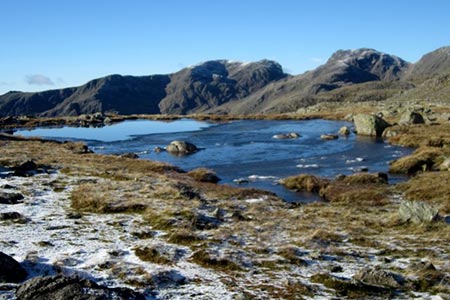
The summits of the Crinkle Crags and Bowfell have always been popular objectives for walkers in the Lake District. This route follows a circuit of rugged Oxendale to reach the summits following the path above Browney Gill to reach the high ground below Cold Pike. From here the route heads west passing the minor top of Great Knott to reach Crinkle Crags with their five craggy tops. The route then descends to Three Tarns before ascending magnificent Bowfell with its superb views. The return route follows the Band offering a wonderful panorama of Great Langdale and its surrounding fells.
The start of this Lake District walk is either the small car park at the Old Dungeon Ghyll Hotel (grid ref. NY286060) or the overflow car park closer to the valley road. Whichever parking option you decide to take, walk west to the valley road and follow the signed path to The Band and Oxendale (grid ref. NY285059). You soon reach Stool End. Follow the signed path through the farmyard. About a hundred metres beyond the farmyard you reach a junction of paths (grid ref. NY275056). Keep straight ahead here keeping the wall to your left (The righthand path leads to the Band and is used for the descent). The path then descends into Oxendale to reach a wooden footbridge on your left over Oxendale Beck (grid ref. NY270052).
Cross the footbridge and follow the rising path. The ascent is steady climbing past Brown Howe. The path continues ahead passing some waterfalls to reach a path junction (grid ref. NY267039) just to the north of Red Tarn. Turn right here and follow the clear but often stony path to pass Great Knott on your right. If you have the energy, then a short detour to the summit offers a fine view into Great Langdale. Continuing ahead the path climbs steadily to reach the start of the Crinkles.
After reaching the top of the First Crinkle descend to a col. The direct route requires a scramble up the Bad Step. As an alternative follow the path to the left around the base of a rock face to take the easier path to the top of the second Crinkle, which is the highest of the five Crinkles. Continue on the well-trodden path across the remaining tops and descend to a col at Three Tarns (grid ref. NY248060). Take the clear path north climbing steeply in places to reach the summit of Bowfell. Do allow time to enjoy the view, which in my opinion is one of the great Lakeland panoramas.
Retrace your steps down to the col at Three Tarns. Just before the tarns, bear left and follow the broad path descending across White Stones and onto the Band. Nearing Stool End you reach a junction (passed on the outward leg of the route) where you turn left. Pass through the farmyard and retrace your steps back to the start.
Other walks nearby
| Walk 1207 | Great & Little Langdales | moderate | 8.5 miles |
| Walk 2042 | The Langdale Pikes with an ascent of Jack's Rake | very hard | 6.3 miles |
| Walk 2073 | Harrison Stickle, Pike o'Stickle & Rosset Pike | moderate | 8.3 miles |
| Walk 1736 | Langdale Pikes and High Raise FROM New Dungeon Ghyll | mod/hard | 6.1 miles |
| Walk 1144 | Lingmoor Fell | moderate | 8.0 miles |
| Walk 1171 | Pike o' Blisco | moderate | 5.0 miles |
| Walk 2582 | Pike o' Stickle, Harrison Stickle & Pavey Ark | moderate | 6.0 miles |
| Walk 3508 | The Crinkle Crags from Wrynose Pass | easy/mod | 5.0 miles |
| Walk 1134 | Wetherlam and The Carrs | mod/hard | 10.8 miles |
| Walk 2270 | Tilberthwaite and Holme Fell Little Langdale | easy/mod | 5.5 miles |
Recommended Books & eBooks
Walking the Lake District Fells - Langdale
 Part of the Walking the Lake District Fells series, this guidebook covers a wide range of routes to 25 Lakeland summits that can be climbed from the Great Langdale valley, Ambleside and Grasmere, with highlights including Scafell Pike, Bowfell, the Langdale Pikes and Helm Crag (the Lion and the Lamb). Includes suggestions for longer ridge routes.
More information
Outdoor Adventures with Children - Lake District
 Guidebook to 40 outdoor adventures in the Lake District with children under 12, including walking, cycling, orienteering, paddling, boating, hostelling and more. Graded activities for varying age ranges or for families with children of different ages.
More information
Messaging & Social Media
Message Walking Britain and follow the latest news.

Mountain Weather
Stay safe on the mountains with detailed weather forecasts - for iOS devices or for Android devices.