Dymock Daffodil Walk
Gloucestershire Walk
County/Area - Gloucestershire
Author - Lou Johnson
Length - 9.0 miles / 14.6 km Ascent - 500 feet / 152 metres
Time - 5 hours 0 minutes Grade - easy/mod
Maps 

| Ordnance Survey Explorer 189 | Sheet Map | 1:25k | BUY |
| Anquet OS Explorer 189 | Digital Map | 1:25k | BUY |
| Ordnance Survey Explorer 190 | Sheet Map | 1:25k | BUY |
| Anquet OS Explorer 190 | Digital Map | 1:25k | BUY |
| Ordnance Survey Explorer OL14 | Sheet Map | 1:25k | BUY |
| Anquet OS Explorer OL14 | Digital Map | 1:25k | BUY |
Walk Route Description
Click image to see photo description.
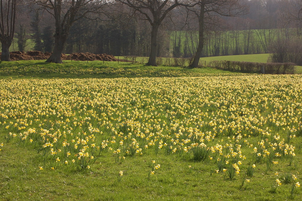
This enchanting walk from Dymock follows a carefully waymarked walk through the countryside south and west of the village. The route includes fields, woodland, and quiet country lanes to enjoy thousands of wild daffodils. In the daffodil season the church of St. Mary at Kempley is decorated in a display of flowers although this requires a diversion from the route given below. Out of the daffodil season, this walk also offers an easy-to-follow exploration of the Gloucestershire countryside.
The start is the Beauchamp Arms (grid ref. SO701302) which lies beside the junction of the B4216 and B4215 in Dymock. Other on-street parking is available elsewhere in the village. After parking walk through the churchyard of St. Mary the Virgin. Bear right and walk past the left-hand end of the church and exit by the graveyard. Bear left and then right through the graveyard to reach a field. The waymarked path continues to reach the B4215 (grid ref. SO696317).
Cross the road (with care) and follow the waymarked track opposite. Where the bends left, continue ahead passing to the right of Allum's Farm. Continue along the path to join a road (grid ref. SO688307). Turn right and continue for 600 metres and turn right over a stile with adjacent fingerpost. After crossing two fields the route enters the woodland of Allum's Grove. Follow the waymarked path through the woods. Leaving the tress follow the path across afield keeping a clump of trees on your right. At the end of this copse the path turns right along the field edge before following a 'zig-zag' route across more fields to reach a stile and tarmac lane (grid ref. SO673316).
Turn left along the lane and continue for 800 metres to a T-junction. Go straight across following the direction indicated by the fingerpost. Continue in a southerly direction beside Kempley Brook across fields for 1.5 kilometres to a stile and a lane. Turn left and follow the lane to reach a junction with a white cottage on the left. Bear right (signed for Upton Bishop) and take the first footpath on the left again with adjacent fingerpost (grid ref. SO666292). The path crosses fields to reach Moor House. Turn left and pass to the left of an adjacent property and continue across fields to reach a road in Kempley Green (grid ref. SO766289).
Turn right along the road and after 100 metres turn left onto a track. Almost immediately turn right onto the next section of the Daffodil Way along a grassy path between houses. The path continues southeast passing to the right of two barns. Before crossing meadows to enter Dymock Wood. Follow the path through the trees to reach a lane (grid ref. SO691286). Turn right, cross the M50 to a T-junction and turn left. Continue along the road past a black and white house on the left. Then turn left onto the Daffodil Way at a metal kissing gate with fingerpost. The follows a hedge on your left, passes under the M50 and then turns right.
Continue ahead passing a farm on your right. Heading north the route continues to pass Boyce Court on your left to reach a track. Turn right and almost immediately left onto the Daffodil Way's last section across fields to reach the reach the start.
Other walks nearby
| Walk 2817 | The Marcle Ridge from Much Marcle | easy/mod | 7.0 miles |
| Walk 2326 | Herefordshire Beacon from Hollybush | easy/mod | 6.5 miles |
| Walk 2380 | The Malverns from the Gullet | moderate | 12.0 miles |
| Walk 2664 | Herefordshire Beacon from British Camp car park | easy | 2.0 miles |
| Walk 2192 | Wye Valley Walk | easy/mod | 6.6 miles |
| Walk 2365 | Mordiford & Hampton Bishop Circular | easy/mod | 7.6 miles |
| Walk 1211 | The Worcestershire Beacon | easy/mod | 4.5 miles |
| Walk 1516 | Pershore Circular | easy/mod | 8.3 miles |
| Walk 2483 | Cradley Circular | easy/mod | 6.0 miles |
| Walk 2445 | Upton-upon-Severn Circular | easy/mod | 6.8 miles |
Recommended Books & eBooks
No suggestions for this area.Messaging & Social Media
Message Walking Britain and follow the latest news.

Mountain Weather
Stay safe on the mountains with detailed weather forecasts - for iOS devices or for Android devices.