Woburn Circular
Bedfordshire Walk
County/Area - Bedfordshire & Buckinghamshire
Author - Donald Morton
Length - 7.5 miles / 12.2 km Ascent - 400 feet / 121 metres
Time - 4 hours 10 minutes Grade - easy/mod
Maps 

| Ordnance Survey Landranger 165 | Sheet Map | 1:50k | BUY |
| Anquet OS Landranger 165 | Digital Map | 1:50k | BUY |
Walk Route Description
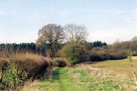
Click image to visit gallery of 5 images.
Woburn is a well maintained, mainly Georgian village with well over 200 listed buildings, adjacent to Woburn Abbey and its parklands. Since the Duke of Bedford is the landlord we should be grateful to him for the free car park (Grid Ref SP950332) from which the walk starts.
On leaving the car park turn left and walk back to the Old Town Hall at the cross roads in the centre of the village. Cross over the A4012 and go straight on down Leighton Street. Keep going for about 3/4 mile (pavement all the way), soon leaving the village and on the way joining the Greensand Ridge Walk, until you reach the road to Little Brickhill on the right. Cross this and continue along Leighton Street but now just inside the bordering field. You soon reach a farm drive. Turn right up this. (Almost immediately look out for the rookery on the left clearly visible when the trees are bare.) After passing the delightful timber and brick Job's Farm the way becomes a green lane which continues straight on into Lowe's Wood.
At a cross path turn left and follow this ancient trackway (the border between Beds and Bucks), initially in the woods and then along the edge, until it comes out on a lane. Here turn right for about 100 yds. Just before a solitary tree in the hedge turn right again through a hedge gap and follow the footpath which runs virtually at right angles to the road across the arable field (it seems it is properly restored after ploughing). Before you reach a hedge gap on the far side there are wide views over to the left. Once through the gap and over a bridge the path goes diagonally right over the next field, again arable and again properly restored.
On the far side, the way descends steps to the A5, the old Roman Watling Street. This must be crossed. (It was not too bad at 10 am on a Friday morning in the school holidays, but at busier times might be difficult since it is not a dual carriageway so a gap in traffic is needed both ways. At any time take CARE.) Having crossed, the path goes up steps and over a stile and starts off across a rather manicured part of Rammamere Heath. Initially it goes along the side of woods but after crossing two more stiles it turns right down the field edge, hedge right. It goes down hill and follows the hedge as it swings left to arrive at Rammamere Farm. After going through two metal kissing gates the path goes diagonally left to gates in the bottom corner of the field. Go through the bridle gate and follow the bridle way until you reach a broad track on the left (it has a display board showing the permissive horse routes in Rammamere and King's Wood).
Leaving the Greensands Ridge Walk, turn up this broad track, a bridleway with a wire fence on the right. Having climbed to the top of a rise it descends to a valley where you turn right with the bridleway along the valley floor with Bragenham Wood on the left and still with a wire fence on the right. Over the wire fence you can see the more natural parts of Rammamere Heath, an SSSI with heathers, gorse, lizards and vipers. You are allowed to walk across it and there are access points - you passed one as you walked uphill on the first part of this leg - so, if you prefer, it is possible to cut across the heathland; it is only necessary to remember that eventually you must descend to one of the access points in the valley to rejoin the bridleway.
This eventually comes to a crossing of four bridleways where you turn left into King's Wood another SSSI and also a National Nature Reserve. There is an information board promising bluebells and lily of the valley in season. In spring as you walk through the woods the bird song is wonderful and varied. Where the bridleway turns right follow it up a steepish short rise and then go straight on until a metal barrier is reached. At this point the bridle path veers right but our way goes straight on past the barrier. The path now becomes much narrower and progressively more overgrown but by maintaining a forward direction you reach a much wider crossing path. Turn left and follow this wide ride, with clumps of primroses in spring, past one broad path on the right (no entry) until it comes to a crossing of four paths at the top of a rise.
There are no waymarks but here you turn right to follow a rather narrower ride past a pond to a road (Grid Ref 934298). Cross the road (CARE!) and go down Sandhouse Lane opposite. This comes to the A5. After meeting the challenge of recrossing this (CARE!) go through the metal kissing gate opposite and diagonally right across the field heading for the furthest utility tower. Here at the corner of the wood go through another kissing gate and along the side of the woods to a lane. On the other side continue straight on up the hill over a field. The target redundant stile in the remains of a wire fence soon appears. After this continue straight on over another field to a metal kissing gate and then along a field edge, hedge left. Before you reach the field corner the path forks right over the field. (Currently a notice on the waymark post helpfully advises aiming halfway between a dead tree on the left and the 'bushy topped' tree on the right.) There is a metal kissing gate and beyond this a clear path descends to a valley and then, as a field break, rises up the opposite hill.
Having crossed a farm track it goes straight on over another field and through a thin strip of woods. From here it goes over a couple of open glades with distant views of Woburn Abbey to the right and finally along an enclosed path to emerge into Leighton Street. Turn right to arrive back at the Old Town Hall and hence the car park.
Other walks nearby
| Walk 1351 | The parkland of Woburn Abbey and Eversholt | easy/mod | 8.0 miles |
| Walk 3225 | Woburn Estates Circular | easy/mod | 9.0 miles |
| Walk 1689 | Woburn Abbey, Eversholt & Milton Bryan | easy/mod | 9.6 miles |
| Walk 1816 | Old Linslade Circular | easy/mod | 9.0 miles |
| Walk 3115 | Ampthill & Steppingley Circular | easy/mod | 9.0 miles |
| Walk 3513 | Ampthill and Clophill Circular | moderate | 12.0 miles |
| Walk 2389 | Wing & Cublington Circular | easy/mod | 8.0 miles |
| Walk 1985 | Houghton Park Circular | easy | 4.0 miles |
| Walk 3409 | The Three Counties Tops | mod/hard | 17.0 miles |
| Walk 2316 | Dunstable Downs Circular | easy | 4.0 miles |
Recommended Books & eBooks
No suggestions for this area.Messaging & Social Media
Message Walking Britain and follow the latest news.

Mountain Weather
Stay safe on the mountains with detailed weather forecasts - for iOS devices or for Android devices.