 Walking Britain
River Ure & Nutwith Common from Masham
Nidderdale NL Walk
Region - Nidderdale NL
County/Area - North Yorkshire - Nidderdale AONB
Author - Lou Johnson
Length - 6.6 miles / 10.7 km Ascent - 700 feet / 212 metres
Time - 3 hours 40 minutes Grade - easy/mod
Walk Route Description
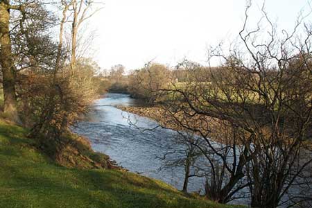
Click image to see photo description.
This walk starts from the small town of Masham which is home to Black Sheep and Theakston breweries. The route includes a section of the Ripon Rowell Walk along the banks of the River Ure before continuing across Nutwith Common to use field paths and lanes to return to the start.
The start is Masham Market Place (grid ref. SE225807). From here follow the signed Ripon Rowell Walk east to reach the River Ure. The path follows the west bank of the River south turning away from the River Ure to follow the River Burn upstream to Low Burn Bridge (grid ref. SE226798). Turn left across the bridge and then left again still following the Ripon Rowell Walk beside the River Burn to re-join the path heading south along the River Ure. Continue for about one and a half miles along the Ure to reach a junction of paths near Limehouse Hill (grid ref. SE235777). Here you turn right leaving the Ripon Rowell Walk, which continues straight ahead, following the path to reach a car park on Thorpe Road (grid ref. SE230774).
Turn left along the road for a short way and then take the signed footpath on your right which heads west through Oak Bank Woods before turning north over Nutwith Common to reach Thorpe Road once again (grid ref. SE223782). Turn left along this road and after 250 metres bear left into Roomer Lane. After just over half a mile take the footpath on your right (grid ref. SE218789). This path leads across fields passing Low Swinton on your left to reach a road (grid ref. SE214797). Turn right along the road and follow it back into Masham and the start of the walk.
Maps 
| Ordnance Survey Explorer 298 | Sheet Map | 1:25k | BUY |
| Ordnance Survey Explorer 302 | Sheet Map | 1:25k | BUY |
| Get Ordnance Survey Digital Map Subscription | |||
| Latest Ordnance Survey Discounts | |||
Other walks nearby
| Walk 2407 | Ripon Rowel Walk Leg 5 - Grewelthorpe to Ripon | moderate | 12.0 miles |
| Walk 2406 | Ripon Rowel Walk Leg 4 - Ilton to Grewelthorpe | moderate | 10.5 miles |
| Walk 3767 | Dallow & Lumley Moor Reservoir Circular | moderate | 8.5 miles |
| Walk 2750 | Fountains Abbey & Studley Park from Ripon | moderate | 9.5 miles |
| Walk 3528 | Fountains Abbey & Markenfield Hall Circular | moderate | 8.7 miles |
Start Point Details
Ordnance Survey Grid Ref SE225807
Latitude 54.2215330 Longitude -1.6564220
Postcode HG4 4DZ
what3words start tables.matchbox.dampen
Walk description may contain detailed information on the start point for this walk.
Further Information
Nidderdale NL Walking
The Nidderdale National Landscape (formerly AONB) is an area of natural beauty in North Yorkshire sharing its western border with the Yorkshire Dales National Park to the east and south. The AONB includes most of Nidderdale itself, part of lower Wharfedale, the Washburn valley and part of lower Wensleydale. The highest land is Great Whernside which rises to 704 metres above sea level on the border with the Yorkshire Dales National Park. Pateley Bridge is the only town with Otley, Ilkley, Masham and Ripon just outside the borders.
Walking GuideAccommodation
Find Accommodation nearby by using the regional accommodation lists
Go to regional accommodation lists
Self Catering & Cottage Holidays
Properties throughout the UK & Europe
Messaging & Social Media
Message Walking Britain and follow the latest news.


Mountain Weather
Stay safe on the mountains with detailed weather forecasts - for iOS devices.