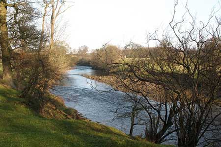
River Ure & Nutwith Common from Masham
Nidderdale AONB Walk
Region - Nidderdale AONB
County/Area - North Yorkshire - Nidderdale AONB
Author - Lou Johnson
Length - 6.6 miles / 10.7 km Ascent - 700 feet / 212 metres
Time - 4 hours 0 minutes Grade - easy/mod
Maps 

| Ordnance Survey Explorer 298 | Sheet Map | 1:25k | BUY |
| Anquet OS Explorer 298 | Digital Map | 1:25k | BUY |
| Ordnance Survey Explorer 302 | Sheet Map | 1:25k | BUY |
| Anquet OS Explorer 302 | Digital Map | 1:25k | BUY |
| Ordnance Survey Landranger 99 | Sheet Map | 1:50k | BUY |
| Anquet OS Landranger 99 | Digital Map | 1:50k | BUY |
Walk Route Description
Click image to see photo description.
This walk starts from the small town of Masham which is home to Black Sheep and Theakston breweries. The route includes a section of the Ripon Rowell Walk along the banks of the River Ure before continuing across Nutwith Common to use field paths and lanes to return to the start.
The start is Masham Market Place (grid ref. SE225807). From here follow the signed Ripon Rowell Walk east to reach the River Ure. The path follows the west bank of the River south turning away from the River Ure to follow the River Burn upstream to Low Burn Bridge (grid ref. SE226798). Turn left across the bridge and then left again still following the Ripon Rowell Walk beside the River Burn to re-join the path heading south along the River Ure. Continue for about one and a half miles along the Ure to reach a junction of paths near Limehouse Hill (grid ref. SE235777). Here you turn right leaving the Ripon Rowell Walk, which continues straight ahead, following the path to reach a car park on Thorpe Road (grid ref. SE230774).
Turn left along the road for a short way and then take the signed footpath on your right which heads west through Oak Bank Woods before turning north over Nutwith Common to reach Thorpe Road once again (grid ref. SE223782). Turn left along this road and after 250 metres bear left into Roomer Lane. After just over half a mile take the footpath on your right (grid ref. SE218789). This path leads across fields passing Low Swinton on your left to reach a road (grid ref. SE214797). Turn right along the road and follow it back into Masham and the start of the walk.
Other walks nearby
| Walk 2407 | Ripon Rowel Walk Leg 5 - Grewelthorpe to Ripon | moderate | 12.0 miles |
| Walk 2406 | Ripon Rowel Walk Leg 4 - Ilton to Grewelthorpe | moderate | 10.5 miles |
| Walk 3528 | Fountains Abbey & Markenfield Hall | moderate | 8.7 miles |
| Walk 2403 | Ripon Rowel Walk Leg 1 - Ripon to South Stainley | easy/mod | 10.0 miles |
| Walk 2405 | Ripon Rowel Walk Leg 3 - Sawley to Ilton | moderate | 11.0 miles |
| Walk 2572 | West Scrafton & Middlesmoor from Lofthouse | mod/hard | 18.0 miles |
| Walk 3659 | Scar House Reservoir, Dale Edge & Middlesmoor | moderate | 9.0 miles |
| Walk 3726 | Brimham Rocks Circular | easy | 4.7 miles |
| Walk 1571 | Scar House & Angram Reservoirs | easy | 4.0 miles |
| Walk 2261 | Pateley Bridge & Nidderdale Way | easy/mod | 7.1 miles |
Recommended Books & eBooks
Trail and Fell Running in the Yorkshire Dales
 Guidebook to 40 of the best trail and fell runs in the Yorkshire Dales National Park. Ranging from 5 to 24 miles, the graded runs start from bases such as Ribblehead, Dent, Sedbergh, Malham and Grassington and take in the region's diverse delights, from castles and waterfalls to iconic mountains such as Whernside, Ingleborough and Pen Y Ghent.
More information
Messaging & Social Media
Message Walking Britain and follow the latest news.

Mountain Weather
Stay safe on the mountains with detailed weather forecasts - for iOS devices or for Android devices.