Slight Side from Whahouse Bridge
Lake District Walk
Nat Park - Lake District - Lake District Southern Fells
Wainwrights - Slight Side
County/Area - Cumbria
Author - Peter Smyly
Length - 5.6 miles / 9.1 km Ascent - 2100 feet / 636 metres
Time - 4 hours 50 minutes Grade - moderate
Maps 

| Ordnance Survey Explorer OL6 | Sheet Map | 1:25k | BUY |
| Anquet OS Explorer OL6 | Digital Map | 1:25k | BUY |
| Ordnance Survey Landranger 89 | Sheet Map | 1:50k | BUY |
| Anquet OS Landranger 89 | Digital Map | 1:50k | BUY |
Walk Route Description
Click image to visit gallery of 8 images.
Slight Side (2,499 feet) is an outlying peak approximately a mile to the south of Scafell, the second highest peak in England. It's profile is that of a distinctive peak when seen from the Eskdale direction though it's the southernmost outpost of the Scafell massif. It's position is rather awkward from the point of view of linking it with other tops (apart from Scafell) unless a not-so-attractive approach is made from the Eskdale direction - as is the case with this route. Among Lakeland's valleys, although I regard Eskdale highly, I have to admit that this is not one of my favourite Lake District walks. Admittedly, weather conditions did not help when I did the walk with a friend in June 2014 - a damp, soggy, dismal day of intermittent rain with cloud on the tops and no summit views. By the afternoon, on the descent, the cloud was tantalisingly showing signs of clearing on the top of Slight Side, looking back up at it, indeed it did clear eventually, whereas when we had been up there in cloud, it had felt like it was settled with no chance of it lifting. Admittedly, a few years earlier I had done the same route in good weather conditions when going on to do the Scafells as well.
On this occasion in 2014 though, the car park opposite Wha House Farm at the start of the walk was deserted and it was still deserted at the end of it. I recall a group of young men with bulky rucksacks walking up the road past the car park before the start of the walk but they headed on up the valley towards Hardknott. And that was the last sign of any other human life for the duration of the walk. Why then is this not a very popular route? On this occasion it was most likely due in part to the uninviting weather conditions, possibly also the lack of a clear path for much of the route. Though I have also done the same route on a clear and sunny day and don't recall seeing any other walkers then either. Additionally, as suggested on the entry for Slight Side on Wikipedia, an approach from Boot via Eel Tarn and Stony Tarn may be more appealing with the bonus of the two tarns being included en route. Of course on a clear day, if also going on to do the bigger draw of Scafell and possibly Scafell Pike too, this walk can be viewed differently. In that case, the tedious, pathless toil up Slight Side might well be considered a burden worth bearing in the hope and expectation of better things to follow, though even then, there are more attractive and more popular routes up the Scafells.
The only other apparent reason for climbing Slight Side is if it is on a "tick box list" of summits (e.g. Wainwrights) still to be done and the Eskdale approach represents a "route one" approach. In fact, when looking at it this way, it does show some merit in doing this route as the alternatives seem rather worse - for instance to try to link it with Lingmell to the north of the two Scafells would entail an awkward and arduous route of descent and re-ascent up and down steep rocky slopes via Mickledore, Foxes Tarn and Scafell, and an "out and back" from Scafell does not appeal much either.
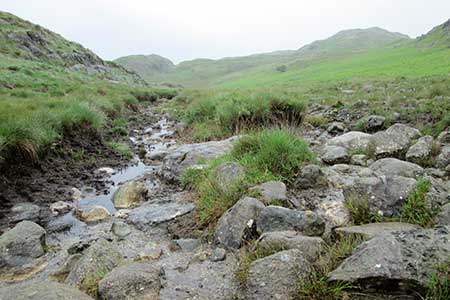
The route for this walk is mostly straightforward. Follow the path where it exists from the car park across a terrain of mud, rock, bog, tussocky grass etc with a wall on the right to begin with, passing Goat Crag and Bull How on the left. When the path peters out, as it frequently does, follow the right general sense of direction, north-east to north and be prepared later for a pathless and energy-sapping, if not also morale-sapping, slog up the shoulder of Slight Side. The summit at least provides some variety in the form of a rocky top that necessitates some simple scrambling to reach the highest point but, on a day when the top is covered in cloud, there is little incentive to linger. The top was highly regarded by the late Alfred Wainwright, considering it to be one of the top six in Lakeland. A few sheep were the only other signs of life on this occasion, appearing through the summit mist.
A group of wet, bedraggled, dismal-looking cows on the way up (and still there on the way back down) the main grassy side of Slight Side seemed to rather sum up the mood of the day. If you are not to be a fair weather walker only, you need to be able to take the rough with the smooth, and days like this are all part of the process.
On the return route, rather than reverse the outgoing route, it is possible to provide an element of variety by heading across pathless grassy slopes due south east to cross a stream and then locate a path that comes down the main valley of the River Esk, emerging at Scale Bridge and reaching the Eskdale road at Whahouse Bridge from where it is a short walk back along the road to the car park. It is actually quite pleasant to be on a proper path again after crossing so much pathless terrain earlier in the walk and there are good views across the Eskdale valley to the peak of the pyramid-like form of Harter Fell with Hard Knott seen to the left.
Other walks nearby
| Walk 2226 | The Scafells | very hard | 12.0 miles |
| Walk 1916 | Harter Fell and Low Birker Tarn from Hardknott Pass | moderate | 6.5 miles |
| Walk 3419 | Scafell Pike an Eskdale circular | very hard | 12.5 miles |
| Walk 2467 | Green Crag & Harter Fell | moderate | 7.9 miles |
| Walk 2355 | Blea Tarn & Eskdale Green | easy/mod | 6.5 miles |
| Walk 1668 | Silver Knott & Muncaster Fell from Irton Road | easy/mod | 5.0 miles |
| Walk 3485 | High Birkhow & Low Wood from Wast Water | easy | 4.2 miles |
| Walk 1176 | Yewbarrow | moderate | 4.5 miles |
| Walk 2341 | Circuit of Nether Beck and Over Beck from Wasdale | hard | 11.3 miles |
| Walk 1690 | Netherbeck Horseshoe - Middle Fell, Steeple & Red Pike from Wasdale Head | mod/hard | 12.5 miles |
Recommended Books & eBooks
Walking the Lake District Fells - Patterdale
 Part of the Walking the Lake District Fells series, this guidebook covers a wide range of routes to 35 Lakeland summits that can be climbed from Ambleside, Grasmere and Patterdale and the Thirlmere and Ullswater valleys, with highlights including Helvellyn and Fairfield. Suggestions for longer ridge routes are also included.
More information
Great Mountain Days in the Lake District
 An inspirational guidebook to 50 challenging walks on the high fells of the Lake District. The graded circular routes, between 4 and 14 miles in length, cover classic Lakeland summits like Fairfield, Scafell Pike, Great Gable and Blencathra, to the lesser-known High Spy, King's How and Brund Fell.
More information
Messaging & Social Media
Message Walking Britain and follow the latest news.

Mountain Weather
Stay safe on the mountains with detailed weather forecasts - for iOS devices or for Android devices.