Morthen & Upper Whiston from Ulley
South Yorkshire Walk
County/Area - South Yorkshire - Doncaster Rotherham
Author - Andy Chaplin
Length - 8.8 miles / 14.3 km Ascent - 600 feet / 182 metres
Time - 5 hours 0 minutes Grade - easy/mod
Maps 

| Ordnance Survey Explorer 278 | Sheet Map | 1:25k | BUY |
| Anquet OS Explorer 278 | Digital Map | 1:25k | BUY |
Walk Route Description
Click image to visit gallery of 3 images.
To complete this walk to the south of Rotherham you are going to need a tolerance of motorways, wind turbines and views into cities to be interested in this route but - if you are still with me - the views towards Sheffield and Rotherham are impressive, Ulley reservoir is picturesque and very few walks will go into the M1 and M18 "triangle" (as this one does).
You can park at the Ulley Reservoir sailing club/cafe car park (grid ref. SK453875) but the gates close at 4pm in winter, so if you set out late and want to make sure you are not locked in you can start on Turnshaw Road in Ulley opposite the Royal Oak pub (grid ref. SK465875).
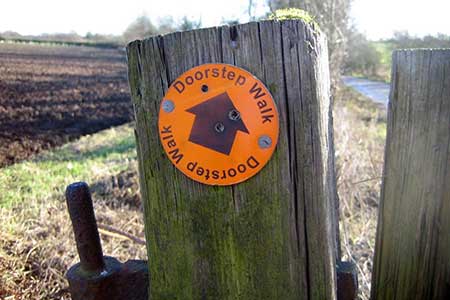
Walk back up to Main street, turn right and then take the first right down the track called Carr Lane. The first part of this track, up to the riding stables, is signed as part of the Doorstep Walk. Keep following the track south then east as it makes its way between fields and around the Penny Hill wind turbines. When you approach the M1 the track heads north alongside the motorway and it is now called High Lane.
After passing the house at Ulley Beeches turn right on Penny Hill lane and go under the M1. On the other side of the road there is a footpath that goes up some steps and then heads north across fields to Brampton en le Morthen. Turn left on Brampton Lane under the M1 again then take the bridleway north into the M1/M18 triangle. If you like urban views, then you are high enough here to get a good view along the motorway towards Rotherham and Sheffield.
Follow the path under the M18 slip-road, turn left and first right into Morthen. Turning left when you come off the footpath will bring you out on York Lane then carry straight on past the Lawns Farm Shop and stay on York Lane while it turns into an overgrown track and finally emerges onto Morthen Lane. Continue straight over on the footpath across the fields to the Pinch Mill Beck. Keep on going across the field on the other side of the beck until you reach the Sandy Flat Lane track coming from Wickersley.
Taking this track to the south west leads to Pinch Mill Farm, stables and fishing ponds. This part of the walk - past Pinch Mill Farm, over Morthen lane, past Royds Moor Farm and back to the M1 - is all part of the Rotherham Round walk. Cross over the M1 on the farm road bridge then carry straight on to Field Lane.
Turn right then left at the junction in Upper Whiston. Take the first path off on the left which goes down to a footbridge over the Ulley Brook. There is a new path just after the bridge which follows the brook off to the right and comes to the top of the reservoir. Take the path along the north and west sides of the reservoir. There are bird hides along the way, a cafe near the car park and carved benches near the dam wall. The reservoir is no longer used for drinking water - but is a nature reserve and used for fishing and sailing.
At the southern end of the reservoir the path comes out on Ulley Lane. Cross over and take the path through the field, parallel to the road, which comes out on the outskirts of Ulley. Continue up through the village to the pub.
Other walks nearby
| Walk 2725 | Chesterfield Canal and Anston Brook from Kiveton | moderate | 10.2 miles |
| Walk 1836 | The Moss Valley from Ford | moderate | 9.3 miles |
| Walk 3436 | Hillsborough to Bradfield & Loxley Valley | moderate | 12.6 miles |
| Walk 3330 | Rivelin Valley from Malin Bridge | easy/mod | 9.7 miles |
| Walk 3440 | Sheffield Round | moderate | 15.2 miles |
| Walk 2717 | Wentworth Woodhouse and its follies | easy/mod | 7.5 miles |
| Walk 2728 | Wadsley and Loxley Commons, Sheffield | easy/mod | 7.9 miles |
| Walk 2456 | Flask Edge from Dronfield Woodhouse | moderate | 10.0 miles |
| Walk 1935 | Birley Edge & Wharncliffe Wood | easy/mod | 9.4 miles |
| Walk 3397 | High Melton & Cusworth Hall | moderate | 12.0 miles |
Recommended Books & eBooks
No suggestions for this area.Messaging & Social Media
Message Walking Britain and follow the latest news.

Mountain Weather
Stay safe on the mountains with detailed weather forecasts - for iOS devices or for Android devices.