Cheddington to Tring via Marsworth Walk
Walk 1943 - Route Maps
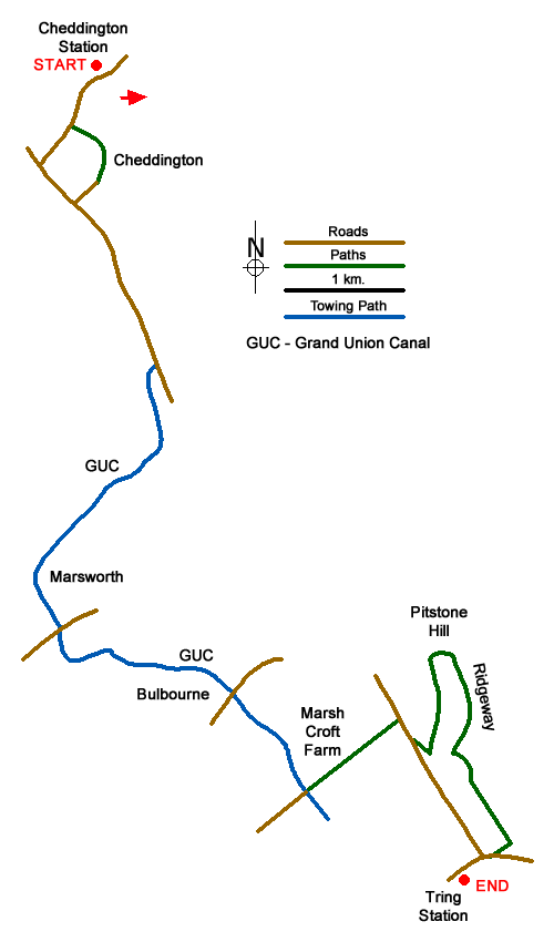
Route Map
Digital Maps - Copyright © 2011-2024. All rights reserved.
Sketch Map
Suggested Maps 

| Ordnance Survey Explorer 181 | Sheet Map | 1:25k | BUY |
| Anquet OS Explorer 181 | Digital Map | 1:25k | BUY |
It is recommended you take a map. The preferred scale is 1:25k.
Start Point Details
Ordnance Survey Grid Ref SP922185
Latitude 51.857481 Longitude -0.662629
Postcode LU7 0SQ
what3words start chicken.envoy.reflect
Walk description may contain detailed information on the start point for this walk.
Further Information
Buckinghamshire
The County of Buckinghamshire is noted for its open countryside and natural features, including the Chiltern Hills Area of Outstanding Natural Beauty which occupy the southern part of the County. Walks along the River Thames, through Wendover Woods and along the Ridgeway long-distance footpath are full of interest. With many attractive towns and villages, walking always offers variety. Walks can also be combined with one of the many historic houses in the area. The highest point in Buckinghamshire is Haddington Hill in Wendover Woods at 267 metres above sea level.
Walk grading - Learn how each walk is assessed and select a walk to suit your ability and experience by going to Walk Grading Details.
Messaging & Social Media
Message Walking Britain and follow the latest news.

Mountain Weather
Stay safe on the mountains with detailed weather forecasts - for iOS devices or for Android devices.