Cowlands, Coombe & Roundwood Quay from Trelissick
Cornwall AONB Walk
Region - Cornwall AONB
County/Area - Cornwall
Author - Hidden Cornwall
Length - 9.0 miles / 14.6 km Ascent - 600 feet / 182 metres
Time - 5 hours 10 minutes Grade - easy/mod
Maps 

| Ordnance Survey Explorer 105 | Sheet Map | 1:25k | BUY |
| Anquet OS Explorer 105 | Digital Map | 1:25k | BUY |
| Ordnance Survey Landranger 204 | Sheet Map | 1:50k | BUY |
| Anquet OS Landranger 204 | Digital Map | 1:50k | BUY |
Walk Route Description
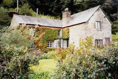
Click image to visit gallery of 3 images.
The River Fal and Carrick Roads make up one of the most attractive and unspoilt estuaries in the country. This Cornwall walk has intriguing glimpses of the river and its heavily tidal creeks with small hamlets which physically have changed little over the last hundred years. The walk starts at Trelissick the impressive National Trust property which has one of Cornwall's premier gardens.
Leave your car in Trelissick car park (grid ref SW837396) and walk westwards through its parkland setting (taking in the view down river to Falmouth) to the Old Lodge. Cross (with care) the B3289 and follow the winding track down through the woods then branch off left and then turn right on to the track/road to the creekside hamlet of Cowlands where oyster fishing still continues.
Just up the hill turn right via a signposted path through ancient oak woods which will lead you to Lower Lanner Farm. Cross the road and the next field turning right on to the downhill Class 3 road to Old Kea church (well worth a visit). Continue up a steep field route past some abandoned lobster pots to Trevean where you turn left at the cottages and make for Halwyn. Just before reaching this property a short detour to the left will reveal large ships moored in this part of the Fal awaiting cargoes, under arrest by the Admiralty Marshal or due for the breakers yard. On the other side of the river is Tolverne, an embarkation point for US troops on D-Day having been visited by General Eisenhower.
Go past Halwyn, being restored by the present tenant, and turn to the left across a field and head for Coombe via a 'green tunnel' walking along the shore back to Cowlands. If you've run out of steam at this point you can retrace your steps to Trelissick otherwise near the top of the hill going south from Cowlands take a left down the old pack-horse route to Roundwood Quay. Here you'll find an Iron Age fort and a granite quay in remarkably good condition built to export tin and copper to South Wales.
Then follow the footpath along the north side of Lamouth Creek and wend your way back to Trelissick. It is worth spending some time here in the gardens, small museum, art gallery and restaurant.
Some of the paths can be a bit boggy in the Spring but the area generally is a mecca for birds- including herons, little egrets, blacktailed godwits and oystercatchers.
Other walks nearby
| Walk 1027 | Nare Head & Portloe | moderate | 7.0 miles |
| Walk 2088 | Rosemullion Head & Mawnan | easy | 4.0 miles |
| Walk 1033 | Dodman Point & Gorran Haven | mod/hard | 11.0 miles |
| Walk 2007 | Helford Passage & Frenchman's Creek | easy/mod | 7.0 miles |
| Walk 2294 | St. Agnes to Porthtowan | easy/mod | 5.0 miles |
| Walk 2009 | Gillan & Nare Point from Porthallow | easy | 4.7 miles |
| Walk 1783 | Gorran Haven & Dodman Point | easy/mod | 5.0 miles |
| Walk 1778 | Maenporth and Helford Passage Circular | easy/mod | 8.0 miles |
| Walk 2001 | Coverack & Lowland Point | easy/mod | 4.2 miles |
| Walk 1104 | Newquay to Porthcothan coast path | moderate | 10.5 miles |
Recommended Books & eBooks
South West Coast Path Map Booklet - Minehead to St Ives
 Map of the northern section of the 630 mile (1014km) South West Coast Path National Trail. Covers the trail from Minehead to St Ives along the north Devon and Cornish coastline. This convenient and compact booklet of Ordnance Survey 1:25,000 maps shows the route, providing all of the mapping you need to walk the trail in either direction.
More information
The South West Coast Path
 Guidebook to walking the entire South West Coast Path National Trail. The route runs for 630 miles from Minehead to Poole along the north Devon, Cornish, south Devon and Dorset coastline. Divided into 45 stages, this long-distance coastal trek could be completed within 4 weeks, or walked in sections. Guide includes maps and essential information.
More information
Messaging & Social Media
Message Walking Britain and follow the latest news.

Mountain Weather
Stay safe on the mountains with detailed weather forecasts - for iOS devices or for Android devices.