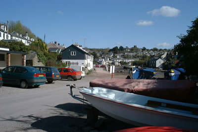
Wembury Bay & St Peter's Church from Noss Mayo
Devon Walk
County/Area - Devon
Author - John Paterson
Length - 6.0 miles / 9.8 km Ascent - 1000 feet / 303 metres
Time - 4 hours 0 minutes Grade - easy/mod
Maps 

| Ordnance Survey Explorer OL20 | Sheet Map | 1:25k | BUY |
| Anquet OS Explorer OL20 | Digital Map | 1:25k | BUY |
| Ordnance Survey Landranger 202 | Sheet Map | 1:50k | BUY |
| Anquet OS Landranger 202 | Digital Map | 1:50k | BUY |
Walk Route Description
Click image to visit gallery of 6 images.
Few walkers have the time or the opportunity to walk the length of the South West Coast Path, yet thousands of people walk stretches of it every day. All too often these short walks are rather unsatisfying as they involve a return by the same route. The way to get the best out of such walks is to get out the OS map and look for a headland or estuary which will give a satisfying circular or triangular walk. This circular walk, less than ten miles from Plymouth, is one of the best, taking in a stretch of one of England's prettiest rivers, dramatic coastal scenery, a ruined church dating back 1000 years and finishing at a pub!
Turn south off the A379 (Plymouth to Yealmpton road) on to the B3186. Proceed to Noss Mayo via the hamlet of Bridgend. The car park (Grid ref. SX547476) lies at the head of a small creek next to the Ship Inn and the Library (which is marked on the OS map). Be careful to park at the upper end of the car park as the lower end is covered at Spring Tides!
Take the lane which goes above the pub and the village houses are soon left behind as the lane passes though the oak woods on the eastern bank of the River Yealm (pronounced Yam by the locals). Just after the foot ferry crossing point (Open May to September) the lane becomes a track and climbs through the woods towards the old coastguard station and cottages above Cellar beach. As the cottages are reached a superb view over Wembury Bay towards the Mew Stone and Cornwall is revealed.
After the coastguard cottages the route circles the east side of Wembury Bay partly though woods until the open coast is reached. The coastal path now turns eastwards along the old "Carriage Drive" created by Revelstoke estate so that lady guests could admire the views without having to walk. The only building on this stretch is Warren Cottage named after the rabbit warren created between the sea and the drive to provide fresh meat for Revelstoke and the surrounding farms. (Just past Warren Cottage it is possible to shorten the walk by striking inland and taking the Devon lanes back to Noss Mayo cutting the walk by perhaps 2 miles).
2 miles of open level walking beyond Warren Cottage brings you to the woods surrounding Revelstoke Caravan Park. Sticking to the main path is the shorter option but taking a smaller path to the right towards the sea will take you into the caravan park and the chance to see the ruined church of "St Peter the Poor Fisherman" which is open to the public and parts of which are Anglo Saxon with later additions in the 14th Cent. From the exit of the caravan park follow country lanes for 1.5 miles back to Noss Mayo, the car park and the pub. The shortest route is well signposted but take an OS map in case you want to explore.
Other walks nearby
| Walk 3276 | Gara Point & Stoke Point from Noss Mayo | easy/mod | 7.0 miles |
| Walk 2018 | Saltram Park & Hardwick Wood, Plymouth | easy | 5.0 miles |
| Walk 2230 | Exploring Plymouth | easy | 6.5 miles |
| Walk 3657 | Bigbury-on-Sea, Arymer Cove & Burgh Island | easy/mod | 5.0 miles |
| Walk 1975 | Erme Mouth | moderate | 9.0 miles |
| Walk 2013 | The Plym Valley | easy | 5.0 miles |
| Walk 3041 | Thurlestone circular | easy | 4.0 miles |
| Walk 2461 | Warren Point & Bolt Tail from Bantham | moderate | 9.0 miles |
| Walk 3387 | Upper Erme Valley & Ugborough Moor | moderate | 9.3 miles |
| Walk 2015 | The Meavy & Plym valleys from Shaugh Bridge | moderate | 6.0 miles |
Recommended Books & eBooks
South West Coast Path Map Booklet - St Ives to Plymouth
 Map of part of the southern section of the 630 mile (1014km) South West Coast Path National Trail. Covers the trail from St Ives to Plymouth along the west Cornwall and Devon coastline. This convenient and compact booklet of Ordnance Survey 1:25,000 maps shows the route, providing all of the mapping you need to walk the trail in either direction.
More information
The South West Coast Path
 Guidebook to walking the entire South West Coast Path National Trail. The route runs for 630 miles from Minehead to Poole along the north Devon, Cornish, south Devon and Dorset coastline. Divided into 45 stages, this long-distance coastal trek could be completed within 4 weeks, or walked in sections. Guide includes maps and essential information.
More information
Messaging & Social Media
Message Walking Britain and follow the latest news.

Mountain Weather
Stay safe on the mountains with detailed weather forecasts - for iOS devices or for Android devices.