Gowbarrow Fell circular
Lake District Walk
Nat Park - Lake District - Lake District Eastern Fells
Wainwrights - Gowbarrow Fell
County/Area - Cumbria
Author - John Paterson
Length - 3.5 miles / 5.7 km Ascent - 1100 feet / 333 metres
Time - 2 hours 50 minutes Grade - moderate
Maps 

| Ordnance Survey Explorer OL5 | Sheet Map | 1:25k | BUY |
| Anquet OS Explorer OL5 | Digital Map | 1:25k | BUY |
| Ordnance Survey Landranger 90 | Sheet Map | 1:50k | BUY |
| Anquet OS Landranger 90 | Digital Map | 1:50k | BUY |
Walk Route Description
Click image to visit gallery of 6 images.
Gowbarrow Fell is less than 1600 feet in height but is very popular with walkers providing an excellent objective for a Lake District walk. Firstly, the views, especially over the head of Ullswater, are excellent. Secondly, it is bounded on the west by the tourist magnets of Aira Beck and Aira Force. Many tourists having viewed the force are tempted to walk at least part of the fell and the section of this route from Green Hill to Aira Force, sees hundreds of visitors a day in the summer holidays. The route described here, is ideal for a summer evening or a half day at any time of the year. It would also be suitable for a party where some of the members did not walk and wanted to explore the force whilst the rest stretched their legs.
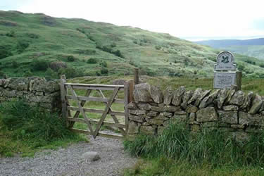
Start at the small car park and quarry (GR NY396211) a quarter of a mile south of Dockray on the A5091 as it drops towards Ullswater. Parking here avoids the crowds but the Aira Force carpark could be used.
Leave the car park by a gate and head east down the slope towards the wooded valley of Aira Beck. This is reached after 400 yards at a famous feature known as the "Strid" - Cumbrian dialect meaning stride. This is a narrowing of the flow of the beck between rocks only a yard wide at times of light water flow. (GR400212) Sounds easy, but because of the very slippery rocks it takes a high degree of confidence to stride across. For those who wish to make the move there is no doubt that a pair of walking poles will make it both safer and more inviting. Those who can't pluck up the courage should head down the beck past waterfalls until a wooden footbridge is reached after about 200 yards. Cross the bridge and walk back up the beck past the "Strid" for a further hundred yards or so. The path then leaves the beck and the woodland behind and heads north east over open moor with rocky outcrops. On the moor the path is often not clear but the going is easy and in clear weather it is simply a question of climbing to the top of a few outcrops to sight the summit with its trig point (GR407218) and views of Ullswater, Sandwick Bay and Hallin Fell.
Leave the summit heading south east for 400 yards to pick up a footpath marked on OS maps. Turn right on to this footpath and follow it south west for a further 400 yards before bearing off to the right and heading due west to the viewpoint of Green Hill (GR410207 ). From Green Hill a well worn path descends to the west, past Bernard Pike, with superb views of the head of Ullswater which have graced a thousand calendars and post cards. The path leads back to Aira Beck and crosses it by a stone footbridge at Aira Force. Walk back up the left (west) bank of the beck to reach the Strid and the short path uphill to the carpark.
Other walks nearby
| Walk 2364 | Clough Head via Great Dodd from near Dockray | moderate | 8.1 miles |
| Walk 1156 | Helvellyn via Striding Edge | hard | 9.5 miles |
| Walk 1235 | Red Tarn & Grisedale | moderate | 7.0 miles |
| Walk 1710 | Glenridding, St. Sunday Crag & Helvellyn | hard | 11.5 miles |
| Walk 3232 | Glenridding Dodd & Sheffield Pike | easy/mod | 4.5 miles |
| Walk 2327 | Red Tarn & Birkhouse Moor from Glenridding | moderate | 6.0 miles |
| Walk 3668 | Catstye Cam from Glenridding | mod/hard | 7.0 miles |
| Walk 1143 | Hallin Fell | easy | 2.0 miles |
| Walk 1241 | Arthur's Pike & Loadpot Hill | moderate | 9.0 miles |
| Walk 1242 | Bannerdale, Boredale & Beda Head | moderate | 9.0 miles |
Recommended Books & eBooks
Walking the Lake District Fells - Wasdale
 Part of the Walking the Lake District Fells series, this guidebook covers a wide range of routes to 25 Lakeland summits that can be climbed from the Wasdale, Eskdale and Ennerdale valleys, with highlights including Scafell Pike, Great Gable and Pillar. Suggestions for longer ridge routes are also included.
More information
Walking the Lake District Fells - Langdale
 Part of the Walking the Lake District Fells series, this guidebook covers a wide range of routes to 25 Lakeland summits that can be climbed from the Great Langdale valley, Ambleside and Grasmere, with highlights including Scafell Pike, Bowfell, the Langdale Pikes and Helm Crag (the Lion and the Lamb). Includes suggestions for longer ridge routes.
More information
Messaging & Social Media
Message Walking Britain and follow the latest news.

Mountain Weather
Stay safe on the mountains with detailed weather forecasts - for iOS devices or for Android devices.