Shanklin to Sandown Walk
Walk 2112 - Route Maps
Route Map
Digital Maps - Copyright © 2011-2024. All rights reserved.
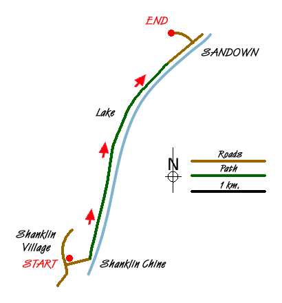
Sketch Map
Suggested Maps 

| Ordnance Survey Explorer OL29 | Sheet Map | 1:25k | BUY |
| Anquet OS Explorer OL29 | Digital Map | 1:25k | BUY |
| Ordnance Survey Landranger 196 | Sheet Map | 1:50k | BUY |
| Anquet OS Landranger 196 | Digital Map | 1:50k | BUY |
It is recommended you take a map. The preferred scale is 1:25k.
Start Point Details
Ordnance Survey Grid Ref SZ581810
Latitude 50.625816 Longitude -1.179975
Postcode PO37 6NR
what3words start trams.plausible.scenes
Walk description may contain detailed information on the start point for this walk.
Further Information
Isle of Wight
The Isle of Wight is a county and the largest island in England. It is known for its coastal scenery, landscape of fields, downs and chines. The Isle of Wight Area of Outstanding Natural Beauty lies in the west. With 57 miles of coastline and diverse landscapes its often referred to as "England in miniature". In the west, dramatic coastlines are dominated by chalk downs which end in the Needles stacks. The island's highest point is St Boniface Down, which at 791 feet (241 m) is a Marilyn. The island is popular with walkers. The 70 miles Isle of Wight Coastal Path follows the coastline as far as possible.
Walk grading - Learn how each walk is assessed and select a walk to suit your ability and experience by going to Walk Grading Details.
Messaging & Social Media
Message Walking Britain and follow the latest news.

Mountain Weather
Stay safe on the mountains with detailed weather forecasts - for iOS devices or for Android devices.