The Avon Dam Reservoir from Shipley Bridge
Dartmoor Walk
Nat Park - Dartmoor
County/Area - Devon
Author - Lou Johnson
Length - 3.5 miles / 5.7 km Ascent - 410 feet / 124 metres
Time - 2 hours 10 minutes Grade - easy
Maps 

| Ordnance Survey Explorer OL20 | Sheet Map | 1:25k | BUY |
| Anquet OS Explorer OL20 | Digital Map | 1:25k | BUY |
| Ordnance Survey Explorer OL28 | Sheet Map | 1:25k | BUY |
| Anquet OS Explorer OL28 | Digital Map | 1:25k | BUY |
| Ordnance Survey Landranger 202 | Sheet Map | 1:50k | BUY |
| Anquet OS Landranger 202 | Digital Map | 1:50k | BUY |
Walk Route Description
Click image to visit gallery of 6 images.
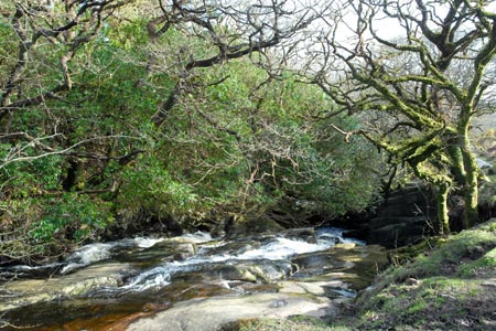
A pleasant valley following the River Avon with a gentle climb up to the shores of the Avon Dam Reservoir make this a relaxing walk that is ideal for pushchairs and the less mobile. The change from woodland to open moorland is quite dramatic and you get the experience of being in wild Dartmoor as you sit beside the reservoir.
This easy walk starts from the car parking area at Shipley Bridge (grid ref. SX680629). To get here you need to use the lanes (narrow in places) that lead from South Brent or the junction of the A38/A385 just to the east of the village.
After parking follow the River Avon upstream on a tarmac road. The walking is pleasant and you soon make good progress. Pass beside a metal gate and shortly after notice the remains of Brent Moor House on your left. After a number of uses since WW2 the building was eventually demolished in 1968. Crossing a bridge the landscape becomes wilder.
After another 600 metres you get your first view of the dam. You will soon see a track veering right off the tarmac lane. This takes you up to the shores of the reservoir. If you want to stay on tarmac then continue ahead to the base of the dam. However for a little more effort the rougher route up the stony track is better. You get a good view across the reservoir and also down into the valley where you have just walked.
To return to the start all you need do is follow the outward route in the opposite direction.
Other walks nearby
| Walk 3387 | Upper Erme Valley & Ugborough Moor | moderate | 9.3 miles |
| Walk 1657 | Huntingdon Warren & Lud Gate from Scorriton | moderate | 7.0 miles |
| Walk 3458 | Sharrah Pool from New Bridge | easy | 3.4 miles |
| Walk 3460 | Dr Blackall's Drive & Ponsworthy | easy/mod | 6.8 miles |
| Walk 3463 | Sharp Tor, Corndon Tor & Yar Tor Circular | easy/mod | 3.4 miles |
| Walk 2912 | Dartington from Totnes | easy | 2.5 miles |
| Walk 1083 | Eylesbarrow & Sheeps Tor | moderate | 8.0 miles |
| Walk 3462 | Corndon Tor & Yar Tor Circular | easy/mod | 4.3 miles |
| Walk 2016 | Cross Gate to Nuns Cross via Leather Tor | moderate | 8.0 miles |
| Walk 3671 | Nun's Cross & Peat Cot from Princetown | easy/mod | 7.0 miles |
Recommended Books & eBooks
No suggestions for this area.Messaging & Social Media
Message Walking Britain and follow the latest news.

Mountain Weather
Stay safe on the mountains with detailed weather forecasts - for iOS devices or for Android devices.