Whin Fell & Ouster Rake from Dunsop Bridge
Forest of Bowland Walk
Region - Forest of Bowland
County/Area - Lancashire
Author - Lou Johnson
Length - 8.3 miles / 13.5 km Ascent - 1400 feet / 424 metres
Time - 5 hours 30 minutes Grade - moderate
Maps 

| Ordnance Survey Explorer OL41 | Sheet Map | 1:25k | BUY |
| Anquet OS Explorer OL41 | Digital Map | 1:25k | BUY |
Walk Route Description
Click image to see photo description.
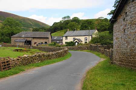
The Forest of Bowland offers many excellent walks in often wild scenery. The village of Dunsop Bridge is the start of this route from the car park located at the eastern end of the village (grid ref. SD661501). After parking exit the car park and turn right. Cross the bridge over the River Dunsop and continue along the road until you reach a stone cross on your right-hand side. Turn right here following the signed bridleway for 800 metres to reach Closes Barn. A few metres after turn left onto a field path leading west.
Continue over a second field to reach a road at a metal gate (grid ref. SD650504). Turn right along the lane and continue for 600 metres to reach the access drive for Hareden Farm on your left (grid ref. SD643506). Walk left over the bridge and take the signed permissive footpath on the right. This leads parallel to Langden Brook, which is on your right. After a kilometre, you reach another bridge. Cross the bridge to a kissing gate and turn left down a track to reach the road (grid ref. SD632511).
Turn left along the road and continue for about a kilometre passing Sykes Farm and a waterworks. Reaching Trough Barn on your right, take the signed bridleway on the right. The track climbs steadily passing Trough House before reaching a stile at a saddle (grid ref. SD643530) with the summit of Whin Fell on your left. If time and energy permits you can make a detour to the summit following the fence. You will be rewarded with some wonderful views over the Forest of Bowland and surrounding areas.
To continue cross the stile and continue steeply down Ouster Rake, which can be a tricky descent in wet and icy conditions. Reaching the bottom of the rake, go through gate and continue to isolated Brennand Farm (grid ref. SD645541). Nearing the farm, aim for the gate at the top of field before the farm. Then follow a farm track across fields to a ladder stile, with the farm on your right onto the farm access road.
Turn right (downhill) passing Lower Brennand on your left. Shortly after (grid ref. SD653535), the track divides. Keep right here and continue down the valley crossing to the west bank of the river before Foot Holme (grid ref. SD652531). After approximately 2 kilometres you reach a footbridge (grid ref. SD656509). Cross this bridge and follow the east ban of the river, ignoring the footpath to Beatrix on your left. This soon becomes a track which leads back to the car park used at the start.
Other walks nearby
| Walk 2594 | Totridge Fell & Fiendsdale Head, Forest of Bowland | moderate | 11.0 miles |
| Walk 1218 | Fiensdale Head & Bleasdale Water | moderate | 10.0 miles |
| Walk 2384 | Hodder Valley from Whitewell | easy/mod | 6.8 miles |
| Walk 2216 | Slaidburn Village Trail - Ribble Valley | easy | 0.8 miles |
| Walk 3329 | Stocks Reservoir from Slaidburn | moderate | 11.5 miles |
| Walk 2452 | Dunsop Head from Slaidburn | easy/mod | 7.0 miles |
| Walk 3038 | Wolfhole Crag from Tower Lodge | moderate | 9.0 miles |
| Walk 1902 | Saddle Fell, Fair Snape Fell & Parlick from Chipping | moderate | 8.0 miles |
| Walk 2505 | Fair Snape Fell from Fell Foot, Forest of Bowland | moderate | 6.0 miles |
| Walk 3730 | Stocks Reservoir Circular | easy/mod | 7.0 miles |
Recommended Books & eBooks
Walking on the West Pennine Moors
 This guidebook describes 30 walks on the West Pennine Moors, around Blackburn, Darwen, Chorley and Bolton, home to some of the most inspiring and exhilarating walking country. The walks range from short, easy rambles to more challenging hikes covering a variety of terrain, all of it easily accessible for day walking.
More information
Walking in the Forest of Bowland and Pendle
 A guidebook to 40 diverse circular day walks suitable for walkers with navigational skills. The Forest of Bowland and Pendle are two of north west England's upland AONBs, perfect for walkers who enjoy exploring rough hilly, sometimes pathless terrain. The routes include Ward's Stone, Pendle Hill, Longridge Fell and Fair Snape Fell.
More information
Messaging & Social Media
Message Walking Britain and follow the latest news.

Mountain Weather
Stay safe on the mountains with detailed weather forecasts - for iOS devices or for Android devices.