Glyder Fach, Glyder Fawr and Tryfan from Idwal Cottage
Snowdonia/Eryri Walk
Nat Park - Snowdonia - Glyders Tryfan
County/Area - Gwynedd & Conwy
Author - Peter Smyly
Length - 6.5 miles / 10.6 km Ascent - 3150 feet / 955 metres
Time - 6 hours 20 minutes Grade - mod/hard
Maps 

| Ordnance Survey Explorer OL17 | Sheet Map | 1:25k | BUY |
| Anquet OS Explorer OL17 | Digital Map | 1:25k | BUY |
| Ordnance Survey Landranger 115 | Sheet Map | 1:50k | BUY |
| Anquet OS Landranger 115 | Digital Map | 1:50k | BUY |
Walk Route Description
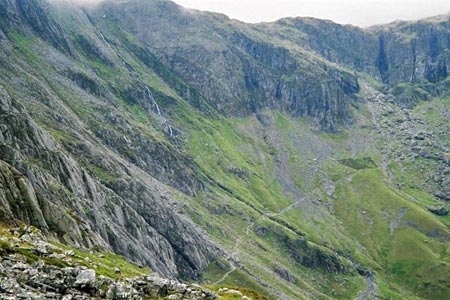
Click image to visit gallery of 8 images.
In my estimation, the weird and wonderful rock formations of Glyder Fach, Glyder Fawr and Tryfan, along with their altitude, make them rank among la creme de la creme of the Welsh mountains. This walk route includes all three, each of them having the Welsh equivalent of Munro status, that is, they top three thousand feet. For those who like scrambling, there are a number of opportunities during the walk.
This Snowdonia (Eryri) walk starts at Idwal Cottage (grid ref. SH649603) where there is a youth hostel at the head of Llyn Ogwen. A well-constructed footpath leads in less than a mile to the mountain lake of Llyn Idwal, a favourite spot for rock climbers because of the Idwal Slabs at the end of the lake. This route branches off left (grid ref. SH646596) before you get to the Idwal Slabs, about half way along the path to the left of the lake, and follows up a steep, pathless stretch of mountainside to reach the crest of the ridge called Y Gribyn where a clearer path can be found. Tryfan now appears as the backdrop to the view to the west on the other side of the ridge with another wildly situated mountain lake, Llyn Bochlwyd, below, also on your left.
Now follow the upwards ridge ahead, which becomes steeper and rockier in places as height is gained. When the top of the ridge is reached (grid ref. SH650582), the going becomes easier. Glyder Fawr is the first summit to be reached on this walk and is now less than a kilometre to the south west, the top being noticeable for its weird spiky rock formations. If visibility allows, Glyder Fach will be seen along the ridge in the distance along with the Snowdon horseshoe to the south west and the Carneddau to the north east.
After reaching Glyder Fawr you need to retrace your steps along the main ridge path towards Glyder Fach passing the point where you exited from the Gribin ridge. An interesting digression shortly before Glyder Fach is the spiky rock formation known as Castell y Gwynt or Castle of the Winds, off the path to the left. Its scrambling opportunities are an optional extra to the main route.
Glyder Fach is one of the few mountains where the use of both hands and feet is required to reach the very top, the highest of the pile of rocks and boulders being a horizontal rock rather like a miniature bridge. It is also advisable to use hands as well as feet on the way up to the top as this makes it easier to move across the gaps between boulders while minimising the risk of an unpleasant loss of footing. The Cantilever Stone is nearby and is a popular photo stop.
The towering, rocky hulk of Tryfan dominates the view to the left (slightly east of north). From here, it appears to some to be insurmountable; but there is a clear enough path to the top which comes later in the walk. The most direct approach to Tryfan from here, Bristly Ridge, is more easily done in ascent than descent and therefore this route takes the easier option of following the main ridge path down to meet up with the Miners' Track which then leads bears left (grid ref. SH667582), down and up again to Bwlch Tryfan (grid ref. SH661588).
From Bwlch Tryfan, the ascent of Tryfan starts in earnest. There is one point near the summit where there is a "bad step" but many walkers do not even notice it. From the top you can look down on Llyn Ogwen and across to the Carneddau as well as back across to the Glyders and Y Garn.
For the descent route, the easiest way is to reverse the route back down to Bwlch Tryfan where a clear path leads down past Llyn Bochlwyd and back down to the start point of the walk.
Other walks nearby
| Walk 2650 | Tryfan, the Glyders & Y Garn | very hard | 8.0 miles |
| Walk 2820 | Carneddau traverse from Llyn Ogwen | mod/hard | 14.0 miles |
| Walk 1150 | The High Carneddau | hard | 10.0 miles |
| Walk 1215 | Tryfan & Llyn Ogwen from Ogwen Valley | mod/hard | 5.5 miles |
| Walk 3001 | Tryfan North Ridge from Ogwen Valley | hard | 3.5 miles |
| Walk 3026 | Tryfan & the Eastern Tops from Ogwen Valley | hard | 5.8 miles |
| Walk 1232 | Carnedd Llewelyn, Llyn Eigiau & Llyn Cowlyd | hard | 16.0 miles |
| Walk 2855 | Gallt yr Ogof & Braich y Ddeugwm | moderate | 4.0 miles |
| Walk 3056 | Pen yr Helgi Du from Ogwen Valley | moderate | 5.5 miles |
| Walk 1074 | The Glyders Traverse | very hard | 12.0 miles |
Recommended Books & eBooks
Snowdonia: 30 Low-level and easy walks - South
 Guidebook describing 30 walks in Snowdonia, Wales. Routes are mostly low level and on clear paths and showcase the region's beautiful scenery and rich history and culture. Part of a 2-volume set, this southern volume includes Trawsfynydd, Bala, Dolgellau, Machynlleth, the Harlech Coast and the valleys of the Mawddach and Dyfi.
More information
Great Mountain Days in Snowdonia
 Inspirational guidebook to 40 great mountain day walks and scrambles in Snowdonia. Inspirational routes for all abilities across the National Park with routes up Snowdon and Moel Eilio, the Glyderau, the Carneddau, Eifionydd, Siabod and the Moelwynion, Rhinogydd (the Harlech Dome), Migneint and the Arans and Cadair Idris and the Tarrens.
More information
Messaging & Social Media
Message Walking Britain and follow the latest news.

Mountain Weather
Stay safe on the mountains with detailed weather forecasts - for iOS devices or for Android devices.